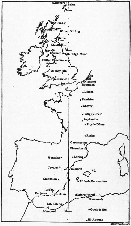

Prime Meridian (Greenwich)
Stand on the brass strip outside the Royal Observatory and check your phone's GPS. It will read 0.0014 degrees east, not zero. The line in the cobblestone, drawn through Sir George Airy's transit circle telescope, is about 102 metres west of where modern satellites place the actual zero meridian. Most tourists never notice. They straddle the strip, one foot in each hemisphere, take the photo, and walk on. The discrepancy is not an error - it is the residue of how Earth's shape was understood in 1851 versus how satellites measure it now. But the older line, the one drawn by Airy, is the one that mattered most. For exactly one hundred years, it was the line from which the world told time.
Forty-One Delegates, Twenty-Five Nations
In October 1884, at the invitation of the President of the United States, forty-one delegates from twenty-six nations gathered in Washington, D.C. for the International Meridian Conference. They had come to settle an awkward question: from which spot on Earth should longitude be measured? For centuries, every maritime nation had drawn its own. Paris had a meridian. So did Berlin, Cadiz, Lisbon, Naples. A British ship's chart and a French ship's chart, both accurate, did not agree about where they were. The conference picked Greenwich. The choice was practical rather than political - by then, most of the world's shipping already used Greenwich-based charts produced by the Royal Observatory. France abstained from the vote. For decades afterwards, French maps continued to count longitude from Paris.
What Made an Observatory Worthy
The Spanish geodesist Carlos Ibáñez e Ibáñez de Ibero had laid out the criteria the year before. To host the world's prime meridian, an observatory needed three things: a first-rate astronomical instrument, direct astronomical links to neighboring observatories, and a network of first-rate triangulation reaching out into the surrounding country. Four places qualified - Greenwich, Paris, Berlin, and Washington. Greenwich won on geography and shipping. It was located on a continent that pushed deep into the world's busiest sea lanes, and the British merchant marine had already standardized its charts there. The conference report noted, with a certain dry diplomatic optimism, that if the world adopted Greenwich, Britain might in return adopt the metric system. Britain did not.
A Line Through Earth
The meridian runs from pole to pole, slicing through eight countries on its way south: the United Kingdom (only England), France, Spain, Algeria, Mali, Burkina Faso, Togo, Ghana. It touches Antarctica only at Queen Maud Land, claimed by Norway. In Accra, Ghana, the line crosses the equator into the Gulf of Guinea, passing through the maritime zone of small Annobón Island. The line that exists physically only as a brass strip in southeast London is also a real and continuous arc through the Earth, defining countries' time zones, organizing global navigation, dividing one half of the planet from the other. Modern GPS uses the IERS Reference Meridian, defined by the International Earth Rotation and Reference Systems Service, which sits about 102 metres east of the Greenwich line - close enough that almost no one notices, distant enough that the difference is real.
Why the Line Drifted
The explanation involves the deflection of the vertical, a concept that sounds esoteric until you think about it. If you hang a plumb line at Greenwich, where does its straight-down direction point? Not exactly toward Earth's center, because Earth is not a sphere - it is an oblate ellipsoid, bulging at the equator, flattened at the poles, with mountains and ocean basins distributing mass unevenly. The plumb line at Greenwich is pulled very slightly off-center by the particular gravitational landscape of southeast England. Airy's transit circle telescope was leveled by such a plumb line in 1851. Modern satellites navigate by a smooth mathematical ellipsoid representing Earth's overall shape. The two definitions disagree by a tiny but measurable amount. The brass strip is the older, terrestrial truth. The GPS reading is the newer, geocentric truth.
Time as Well as Space
The 1884 conference did one more thing. Having agreed on a zero for longitude, it gave the world a zero for time. Greenwich Mean Time became the universal reference, and time zones - those orderly hour-wide bands marching east and west around the globe - were defined relative to it. For travelers, this is what the meridian still means. Whatever your phone says the time is, somewhere in its chain of definitions is this hillside in southeast London. The Greenwich meridian was superseded in 1984 by the IERS Reference Meridian, exactly one hundred years after Washington. The Royal Observatory, the brass strip, and the laser beam projected from the building at night still mark the meridian that mattered when the world agreed.
From the Air
The Prime Meridian sits at 51.4778°N, 0.0015°W on the hill of Greenwich Park, southeast London, at the Royal Observatory. From altitude, the meridian itself is invisible, but Greenwich Park is a clear green square on the south bank of the Thames, with the white domes of the Royal Observatory visible at its summit. Just west, the Old Royal Naval College sits at the river. Nearest major airports: London City (EGLC) 5nm north, Heathrow (EGLL) 17nm west. At night, the green laser beam projected northward from the Observatory along the meridian line is visible across east London.
Nearby Stories
- Battle of Britain, Northfleet 1.1 km away
- Bayham Old Abbey 5.4 km away
- Catharine Macaulay 6.4 km away
- Hatfield rail crash 8.8 km away
- Chequers 8.9 km away
- Chelmsford Cathedral 10 km away
- Queen Victoria Hospital 13 km away
- Fishbourne Roman Palace 36 km away