Ranu Kumbolo: The Lake That Rewards the Climb
The lake appears without warning. After hours of climbing through dense forest from the village of Ranu Pani, legs burning from the relentless uphill grade, hikers emerge onto a grassy ridge and there it is -- an improbable sheet of still water cradled in a volcanic depression at 2,400 meters above sea level. Ranu Kumbolo. In the Tengger language, ranu means lake, and this one has been drawing climbers, campers, and colonial-era explorers since at least 1913, when Dutch visitors posed for photographs on its shores. The water is cold, the air is thin, and the sunrise here -- reflected in perfect symmetry off the lake's glassy surface -- is the reason many trekkers say the six-hour hike was worth every step.
Waypoint on the Path to Java's Roof
Ranu Kumbolo exists because of Semeru. At 3,676 meters, Mount Semeru is the highest peak on Java, an active stratovolcano that erupts with sobering regularity -- its summit often trailing a plume of ash visible from tens of kilometers away. The standard climbing route begins in the Tenggerese village of Ranu Pani at 2,100 meters and ascends through Ranu Kumbolo before continuing upward through alpine savanna toward the peak. The lake sits roughly at the halfway point, both geographically and psychologically. It is where climbers refill water bottles from what is the last reliable freshwater source before the summit push. It is where they pitch tents on the grassy shores and cook meals over portable stoves. And it is where many turn back, content to have reached this far, unwilling to face the loose volcanic scree and sulfurous air that await above.
A Century of Footprints
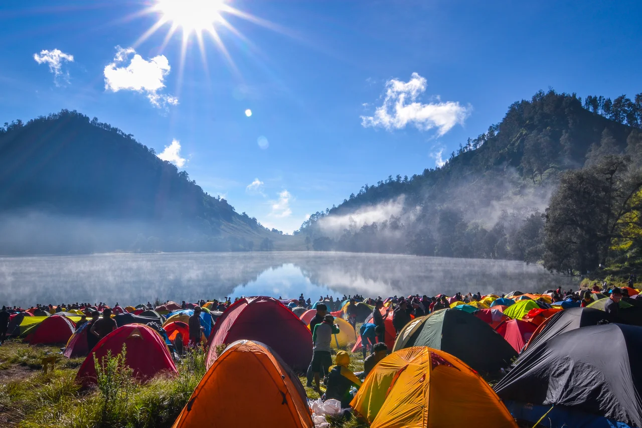
Photographs from the Dutch colonial era, circa 1913, show European visitors gathered near the lake in the shadow of Semeru, their heavy clothing and formal postures incongruous against the raw volcanic landscape. The Tropenmuseum in Amsterdam holds these images -- evidence that Ranu Kumbolo has served as a rest stop and scenic destination for more than a century. The Tenggerese people, Hindu descendants of the Majapahit Empire who have lived in these highlands for generations, knew the lake long before any outsider arrived. For them it was part of the landscape between their villages and the sacred peak, a feature as ordinary and essential as the forests and ridgelines around it. What has changed is the volume. Modern trekking has transformed Ranu Kumbolo from a remote waypoint into one of East Java's most visited natural sites, with strict daily limits now capping visitation at 200 trekkers per day.
Two Hundred Trekkers and a Fragile Shore
The cap exists for good reason. Ranu Kumbolo sits within Bromo Tengger Semeru National Park, a 50,000-hectare protected area declared in 1982, and the lake's ecosystem is vulnerable. The grassy shores that make such inviting campsites erode under heavy foot traffic. Trash accumulation became a serious problem before park authorities tightened regulations, requiring hikers to book permits online through the park's official system at least three days in advance. Camping is limited to two days and one night. The rules reflect a broader tension playing out across Indonesia's wilderness areas: the desire to share extraordinary landscapes with a growing population of outdoor enthusiasts colliding with the fragility of the landscapes themselves. Ranu Kumbolo's water remains clear, its shores still green, its sunrises still reflected in unbroken mirror images -- but maintaining that condition demands constant vigilance.
The Dawn Mirror
Ask any Semeru trekker about Ranu Kumbolo and they will talk about the sunrise. The lake sits in a natural bowl, sheltered from wind on most mornings, and the water goes absolutely flat in the predawn stillness. As the sun rises behind the eastern ridgeline, it illuminates the hills and sky above the lake while the surface captures every detail in perfect reflection -- clouds, light, silhouetted tree lines doubling themselves in the water. Temperatures at this altitude regularly drop below freezing overnight, and on rare occasions frost edges the shoreline. Trekkers emerge from tents into air cold enough to see their breath, wrap themselves in whatever warmth they carried up the mountain, and watch the show. It lasts perhaps twenty minutes before the wind picks up and the mirror fractures into ripples. Then they pack their gear, fill their bottles one last time, and continue upward toward Semeru's summit -- or turn around and descend, carrying the image of that reflected dawn all the way home.
From the Air
Ranu Kumbolo sits at approximately 8.05S, 112.92E at an elevation of 2,400 meters (7,874 ft) on the northern slopes of Mount Semeru. From the air, it is a small but visible alpine lake -- a dark oval of water set against green and brown volcanic terrain. Mount Semeru (3,676 m) rises prominently to the south, often with a visible ash plume. The Tengger caldera and Mount Bromo lie to the north-northwest. Nearest airports: Abdul Rachman Saleh Airport (WARA/MLG) in Malang, approximately 60 km northwest; Juanda International (WARR/SUB) in Surabaya, roughly 130 km northwest. Terrain is mountainous with significant volcanic hazards. Morning conditions typically offer best visibility; afternoon convective buildup is frequent. Maintain safe altitude above the volcanic peaks.
Nearby Stories
- Kelud: The Mountain That Swallows Its Own Lake 23 km away
- Where an Empire's Memory Lives in Clay and Stone 23 km away
- Bangil Railway Station 31 km away
- Meru Betiri: The Last Forest on Java's Southern Edge 35 km away
- Shaken Foundations: The 2021 East Java Earthquake 65 km away
- Blue Fire and Bitter Water: Ijen Volcano 76 km away
- Where Three Worlds Meet: The Great Mosque of Sumenep 88 km away
- The Ghost Boat That Built an Empire 400 km away