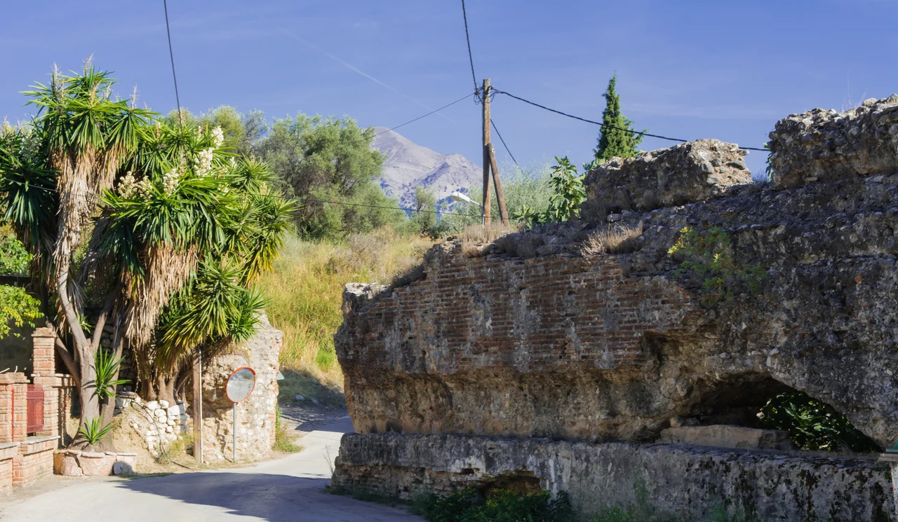

Roman and Medieval Aqueducts of Patras
Somewhere beneath the yards of a quiet Patras neighborhood called Asyrmatos, a Roman pipe is still threading through the soil. It was laid during the first or second century AD to carry water 6.5 kilometers from springs on Mount Panachaiko down to the city's acropolis — and according to travelers who visited centuries later, it was still doing its job as late as the 1600s. For roughly 1,500 years, this aqueduct functioned. The city changed around it: Greek, then Roman, then Byzantine, then Frankish, then Ottoman, then modern Greek. The water kept flowing.
Colony and Cistern
Rome made Patras a Roman colony in 31 BC, folding the ancient Greek city into the empire's administrative structure. It became a busy gateway between Greece and Italy — ships crossing to Brindisi and back, goods and people moving through the port. A city of that importance needed reliable water, and Roman infrastructure followed. Most scholars attribute the construction of a large cistern at the springs of Romanos, high on Mount Panachaiko, to the reign of Emperor Hadrian (117–138 AD), though the aqueduct itself may be older. The cistern was built in the form of an artificial dam; part of it survives today, incorporated into a modern water tank on the mountain. At the springs themselves, an inscription was found indicating that the Nymphs were worshipped there — the local divinities of flowing water, whose favor the city presumably needed.
6.5 Kilometers of Engineered Flow
From the Romanos springs to the city acropolis — now the site of Patras Castle — the aqueduct ran 6.5 kilometers. For most of that distance, water moved through an underground channel, hidden from view and protected from contamination. Where the terrain broke into valleys and gorges, the channel crossed on stone archways built with the precision Roman engineers brought to every province. Some of those arches still stand today, preserved in the Asyrmatos neighborhood and in the archaeological park that opened in September 2018. Walking past them, it is possible to see both the ambition and the pragmatism of the construction: nothing monumental for its own sake, but everything exactly as solid as it needed to be. Foreign visitors writing about Patras in the seventeenth century still mentioned the aqueduct as functional — a span of active use stretching perhaps fifteen centuries.
A Road Delayed by History
The aqueduct's modern story involves a traffic bypass. Patras needed a short ring road, and when engineers began planning its route, the path crossed directly over the Roman aqueduct. The project stalled for more than ten years while archaeologists documented and assessed the site. Then, in 2006, excavations for the road uncovered something unexpected just a few hundred meters from the Roman remains: a second aqueduct, this one from the Ottoman period, dating to the fifteenth or sixteenth century. Suddenly the site held two aqueducts from two different eras, separated by more than a millennium. The decision made in 2009 was pragmatic but careful: sections of the Ottoman aqueduct were cut, moved, and placed alongside the Roman ruins, creating a unified display. The bypass road finally opened in September 2018, and the archaeological park opened with it — a rare case where road-building and heritage preservation ended up, after a long delay, serving each other.
Water Through the Centuries
The park brings the two systems into conversation. One set of stones was laid by Roman hands under the direction of engineers who had built aqueducts across North Africa, Iberia, and the Near East. The other was built more than a thousand years later, under Ottoman administration, when Patras was adapting to new rulers but still needed the same fundamental thing: fresh water from the mountains above the city. Both structures solved the same problem with stone and gravity. Parts of both aqueducts remain outside the park, still embedded in private gardens in Asyrmatos, threading through yards where residents live alongside Roman-era masonry. The springs that fed the original system still flow on Mount Panachaiko — now supplying modern infrastructure rather than ancient stone pipes, but flowing from the same source the Romans tapped nearly two thousand years ago.
From the Air
The Roman and Medieval Aqueducts archaeological park sits at approximately 38.2465°N, 21.7530°E, in the Asyrmatos neighborhood on the southern outskirts of Patras. From the air, Patras spreads along the southern shore of the Gulf of Patras, with Mount Panachaiko rising steeply to the south — the mountain from which the ancient aqueduct drew its water. Patras Castle (the ancient acropolis, the aqueduct's terminus) is visible as a fortified hill above the city center. The nearest major airport is LGRX (Araxos), approximately 25 km to the southeast along the coast. A viewing altitude of 2,000–3,000 feet gives a clear sense of the topography the aqueduct had to traverse — the valley and gorge crossings that required the Roman archways still visible in the park below.
Nearby Stories
- Thermos (Aetolia) 8.2 km away
- 1861 Eliki Earthquake 9.6 km away
- Pheneus 14 km away
- Battle of the Echinades (1427) 15 km away
- HMS Perseus (N36) 19 km away
- Amfissa 20 km away
- Astras 21 km away
- Acarnania 28 km away