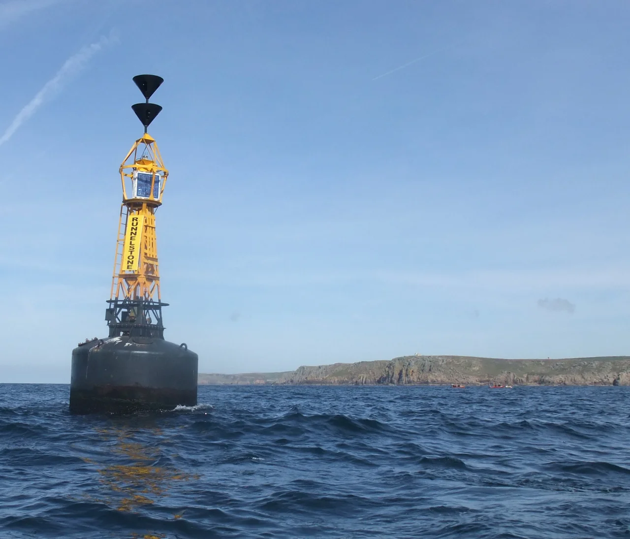

Runnel Stone
Pilots flying the Cornish coast learn to look for two small painted cones on Gwennap Head. They sit on the cliff above Porthgwarra, one red, one black-and-white, and they appear to be hiking poles abandoned by a giant. They are nothing of the kind. They are aiming marks. A ship's master out at sea, watching from the deck, keeps the black-and-white cone in view at all times. If the red cone slides in front of it and obscures it completely, the ship is at that exact moment passing directly over the Runnel Stone, a granite pinnacle that lies a few feet below the surface and has killed over thirty steamships. The cones have been doing this job for two hundred years.
The Stone That Used to Show
The Cornish name for the Runnel Stone means stone abounding in seals. Until 1923 it lived up to the description: a black knuckle of granite that appeared above the surface at low water and provided a basking platform for the local grey seal colony. In 1923 a steamship called the City of Westminster ran full into it. The collision sheared the pinnacle off below the waterline. The stone has not shown itself since. It is still there, one mile south of Gwennap Head, eight feet below the surface at low water, and the ships kept coming. Between 1880 and 1923, identified records show more than thirty steamships lost in the immediate area. The unidentified count, the casual wreckings that never made the newspapers, would be larger.
The Cones
Trinity House first put a marker on Gwennap Head in 1821, a bare wrought-iron pole that the sea carried away within a season. James Walker, the corporation's chief engineer, designed the replacement. Work began in 1841 and proved, in the surveyors' words, of great difficulty and danger. Only a small portion of the rock protruded from the water. Boats could land only at spring tides, and even then the sea was seldom calm enough to admit a footing. The completed daymarks are simple in concept and beautiful in execution. The principle is called a transit, a line of sight running through two known points. If you can see only the seaward red cone, you are too far south, in clear water. If the black-and-white inland cone shows alongside it, you are still safe. When the cones perfectly overlap, you are immediately above the stone. It is an analog navigation aid that requires no electronics, no batteries, and no maintenance beyond paint.
The Bell and the Whistle
A buoy has marked the position of the Runnel Stone since the 1870s. The most beloved version had three voices. A flashing light for the eye, a bell that rang as the buoy rocked, and a whistle set in a tube that emitted a long mournful note when there was a swell running. The whistle was the famous one. Walkers on the cliffs at Gwennap Head heard it drifting in from a mile offshore in foggy weather, an unhurried hooting sound that carried unmistakably through the mist. People came for the hooting alone. In May 2012 Trinity House replaced the buoy with a larger model, and the bell was retired in favour of a whistle to replace it. The cliffs are quieter now.
A Reserve Built on Wrecks
On 29 January 2016 the area was designated the Runnel Stone Marine Conservation Zone, twenty square kilometres of reef, sandy seabed, and crumpled steamships protected from bottom trawling and aggregate dredging. The MCZ exists because the stone has been so thoroughly successful at sinking ships. Divers go down at slack water, about ninety minutes before high tide at Newlyn, into visibility that can reach twenty metres on a good summer day. They find boilers and prop shafts and entire bow sections from a dozen different vessels, encrusted now with dead-men's fingers and jewel anemones in colours that nobody ever named. Sea fans grow in the current. The seals, the original tenants, are still around. They watch the divers from a safe distance and, occasionally, follow them home.
From the Air
Submerged pinnacle at approximately 50.030 N, 5.675 W, one nautical mile south of Gwennap Head and three miles south of Land's End cape. The transit cones sit on the clifftop at 50.036 N, 5.671 W and are visible to the trained eye from 1,500 feet on an east-west clifftop pass. Nearest airfield is Land's End Airport (EGHC), about four miles to the north. Best appreciated from 1,500 to 2,500 feet on a clear day when the buoy is visible offshore and the white wake of swell over the stone shows up clearly. Watch for clifftop turbulence and persistent sea fog south of the head.
Nearby Stories
- Mullion Cove 1.3 km away
- Great Wheal Charlotte 3.7 km away
- Castle Down 5.3 km away
- SS Georgia (1890) 30 km away
- Wheal Coates 41 km away
- 1979 Fastnet Race 55 km away
- HMS Affray 126 km away
- Routes of Santiago de Compostela: Camino Frances and Routes of Northern Spain 713 km away