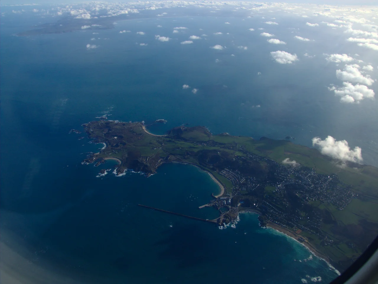

Saint Anne, Alderney
Saint Anne is a small town with a particular kind of silence underneath it. Walking Victoria Street today - founded in 1836, the commercial spine of the island, banks and shops and pubs facing each other across pastel-painted Georgian frontages - it would be easy to miss the fact that almost every land record from before 1945 is gone. So are the older land surveys. In 1940, the British government decided Alderney could not be defended and ordered its evacuation. The town's roughly 1,500 people left in three days. When islanders began returning in late 1945, they returned to a place that had been used as something else entirely - and they had to remake their civic memory from baptism registers reaching back to 1662 and from what surviving families could remember of who had lived where.
Up on the High Ground
Saint Anne sits on the high central plateau of Alderney, just south of Braye Harbour, with the town extending almost to the harbour itself. The island is roughly 10 miles off the Normandy coast at Auderville, with France visible across the water on clear days - only 8 miles east. As of 2010 the town had an estimated population of about 2,000 out of an island total of 2,400. Islanders traditionally call each other by nicknames - vaches for the people of one quarter, lapins (rabbits) for another, after the rabbits that proliferate on the island's grasslands. Victoria Street runs through the commercial centre, but the older heart of the town is the cluster around Saint Anne's parish church, whose earliest chapel dates to the late 1580s, replacing an even older parish church to the Virgin Mary that had fallen into ruins. The current church was renovated in 1850 and again after the war.
Gibraltar of the Channel
The island earned the wartime epithet 'Gibraltar of the Channel,' though the comparison flattered Alderney less than it might sound. From July 1940 to May 1945, Saint Anne was the headquarters of a German occupation that left almost no aspect of the town untouched. The Luftwaffe command bunker and tower and the German naval tactical headquarters were both established here. The courthouse on New Street, built in 1850, was destroyed by the occupying forces - the court room was not rebuilt until 1955. The empty civilian houses were used as billets and stores. And the labour to build the fortifications was supplied by foreign workers - prisoners, forced labourers, and slave workers - held in four SS-administered camps on the island. The largest, Lager Sylt and Lager Norderney, became concentration camps administered directly by the SS from 1943. Hundreds died there, including Russian, Polish, and French Jewish prisoners. The number commonly cited for the total labour force across the island over the occupation is in the thousands; the death toll is still being investigated by historians and forensic teams.
Rebuilding from Baptism Registers
When islanders returned in late 1945 the official records were largely destroyed. What survived was scattered: baptism registers since 1662, recovered from various sources; ecclesiastical records; some civil documents. Volunteers compiled what they could and contacted families who could fill in what the documents couldn't. Several hundred families were categorised - old Alderney families, Breakwater families (those whose ancestors came in for the 19th-century construction work), and others - tracing back to the 1800s. The recurring surnames read like a roster of the island's possible futures preserved: Duplain, Gaudion, Hougez, Le Vallée, Ollivier, Pezet, Audoire, Batiste, Barbenson, Renier, Le Cocq, Le Mesurier, Sebire, Simon. After the survey, no land records exist before 1945. The land below the houses had to be re-mapped from scratch. Returning to a place is a small act. Restoring a town is a much larger one.
Pastel Village, Mild Climate, Two Cricket Clubs
Today Saint Anne is known for what survives the rebuilding: the description applied by writers - 'piquant picturesque town' and 'pastel painted village' - earned by the lime-washed Georgian houses lining the older streets. Sporting facilities sit east of town, including Alderney Cricket Club and Alderney Golf Course. The Mignot Memorial Hospital, whose parent institution is the Princess Elizabeth Hospital in Guernsey, runs a small A&E, physiotherapy, and radiography unit; visiting specialists fly over from Guernsey. The town has a primary school, a secondary school, and a post office. Alderney Airport, built in 1935 and operating since 1936, sits about 1.2 miles to the south-east; Aurigny Air Services - founded on Alderney in 1968 - is still the only commercial airline operating in and out. The climate is unusually mild: oceanic, moderated by the sea, with characteristics of a warm-summer Mediterranean climate. February averages around 6-8°C, July and August 15-18°C. December is the wettest month. Snow is very rare. The town averages about 1,930 sunshine hours a year - more than most of Britain.
From the Air
Saint Anne sits in the centre of Alderney on the high plateau at 49.713°N, 2.206°W, roughly a mile inland from Braye Harbour. From the air the town is the cluster of pastel-painted houses dominating about half of the small island. Look for the church towers, the old clock tower, and the courthouse. Alderney Airport (EGJA) is 1.2 miles south-east of the town centre. Best viewing altitude 1,000-2,000 ft. Nearby airports: Guernsey (EGJB) 19 nm south, Cherbourg-Maupertus (LFRC) 23 nm east, Jersey (EGJJ) 36 nm south. France's Cap de la Hague is clearly visible 8 miles east on clear days.
Nearby Stories
- 1993 Cherbourg Incident 6.2 km away
- Channel Islands 7.4 km away
- Abbey of Saint-Sauveur-le-Vicomte 17 km away
- German Submarine U-672 21 km away
- HMS Formidable (1898) 38 km away
- HMS Affray 57 km away
- Needles Lighthouse 83 km away
- HMS Brisk (1851) 251 km away