The Shallow Sea Between Four Counties
In the 1880s, some five hundred Chinese immigrants lived on the western shore of San Pablo Bay, hauling shrimp from its shallow waters and drying them on wooden racks in the California sun. They shipped roughly ninety percent of their catch across the Pacific to China. The village is gone now -- its site absorbed into China Camp State Park -- but the bay that sustained it remains, a ninety-square-mile expanse of tidal estuary that most Bay Area residents drive past without a second glance. San Pablo Bay is not San Francisco Bay's glamorous sibling. It has no Golden Gate, no Alcatraz, no skyline reflected in its surface. What it has is depth of another kind: the combined outflow of the Sacramento and San Joaquin rivers, the sediment of California's entire Central Valley, and one of the most important wintering grounds for waterfowl on the Pacific coast.
Where the Rivers End
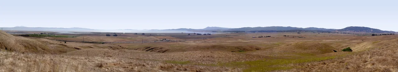
San Pablo Bay sits at the receiving end of a hydrological system that drains roughly forty percent of California. The Sacramento and San Joaquin rivers converge in the vast delta to the east, push through Suisun Bay, and squeeze through the narrow Carquinez Strait before emptying into San Pablo's broad, shallow basin. The bay stretches approximately ten miles across, shared among four counties -- Contra Costa on the south and east, Solano, Sonoma, and Marin on the north and west -- with their borders meeting somewhere near the center of the water. The Petaluma River, Sonoma Creek, the Napa River, and San Rafael Creek all feed in from the surrounding hills, carrying their own freight of silt and nutrients. The result is a bay so heavily silted that most of it is extraordinarily shallow, with a deep-water channel running roughly down the middle that allows commercial ships to reach the ports of Sacramento, Stockton, Benicia, and Martinez.
Difficult Water
Boaters learn to respect San Pablo Bay quickly, or they learn the hard way. The prevailing westerly wind, funneling in from the Pacific, meets strong tidal currents at both ends of the bay -- at the Carquinez Strait to the northeast and near the Richmond-San Rafael Bridge to the south. When wind opposes current, the shallow water kicks up steep, short-period waves that can swamp small craft in minutes. There are few protected harbors or coves to duck into, and the expansive mudflats that border much of the shoreline mean that running aground is as real a danger as the chop. For pilots, though, the bay is a different story. Its location near several major airports but outside the principal air traffic corridors makes it a popular training area -- a wide-open reference point for student aviators practicing maneuvers over water that will not put them in the path of commercial traffic.
Highway on the Flyway
Each autumn, canvasback ducks arrive by the tens of thousands, making San Pablo Bay their primary wintering stop on the Pacific Flyway. They join a broader cast of waterfowl that uses the bay's salt marshes and mudflats as a migratory staging ground -- birds traveling from breeding territories in Alaska and Canada to wintering habitat along the California coast. Much of the northern shore is protected within the San Pablo Bay National Wildlife Refuge, a landscape of restored and remnant tidal marsh that shelters several endangered species. The California clapper rail picks its way through the cordgrass. The salt marsh harvest mouse -- a tiny, reddish rodent found nowhere else on Earth -- threads through the pickleweed. Brown pelicans patrol the shallows. Beneath the surface, striped bass, sturgeon, leopard sharks, and starry flounder inhabit waters that, despite decades of siltation and urbanization along the southern shore, remain surprisingly productive.
Named for a Land Grant, Shaped by Sediment
The bay takes its name from Rancho San Pablo, a Spanish land grant awarded in 1815 to colonial settlers in Alta California. The rancho occupied the eastern shoreline at the site of the present-day city of San Pablo, and the name migrated outward to encompass the entire body of water. Two peninsulas separate San Pablo Bay from San Francisco Bay proper: Point San Pablo, jutting from Richmond on the east, and Point San Pedro, extending from San Rafael on the west. Between them, the Richmond-San Rafael Bridge carries Highway 580 across the gap, one of the few structures that physically marks the boundary between the two bays. Below the bridge, the currents that have been shaping this estuary for millennia continue their patient work, depositing sediment, shifting channels, and reminding anyone paying attention that the geography here is anything but static.
Echoes Along the Shore
The communities ringing San Pablo Bay -- Richmond, Pinole, Hercules, Rodeo, Vallejo, Novato -- are working towns, places where industry and residential neighborhoods crowd close to the waterline. The refineries and rail yards of the eastern shore give way to the open marshlands of the north, and then to the wooded hills of Marin on the west. It is not a picturesque circuit, but it is an honest one. The bay has inspired artists in unexpected ways: the band Primus set their four-part "Fisherman's Chronicles" here, and novelist Susan Choi used its waters as a symbolic homecoming in her novel American Woman. The Chinese shrimp fishers are long gone, but China Camp State Park preserves their story -- a reminder that this overlooked estuary has been feeding people, sheltering wildlife, and carrying the sediment of an entire valley for far longer than anyone has been counting.
From the Air
Located at 38.05N, 122.41W, San Pablo Bay is the broad shallow estuary immediately north of the Richmond-San Rafael Bridge. From the air, it reads as a wide, light-brown water body distinct from the deeper blue of San Francisco Bay to the south. The Carquinez Strait enters from the northeast. Nearest airports: Gnoss Field (KDVO) to the northwest, Buchanan Field (KCCR) to the east, Oakland International (KOAK) to the south. The bay is a common VFR training area. Best viewed at 3,000-5,000 ft AGL for the full geographic context of the estuary system.
Nearby Stories
- Lands End (San Francisco) 1.4 km away
- The House That Burned Before He Could Live in It 3.9 km away
- Sonoma Coast State Park 5.9 km away
- The Roadside Stand That Fed a Queen 6.1 km away
- From Ammunition Bunkers to Cattle Country 7 km away
- Niles Canyon Railway 24 km away
- The Hole in the Head 28 km away
- ʻAkaka Falls State Park 3681 km away