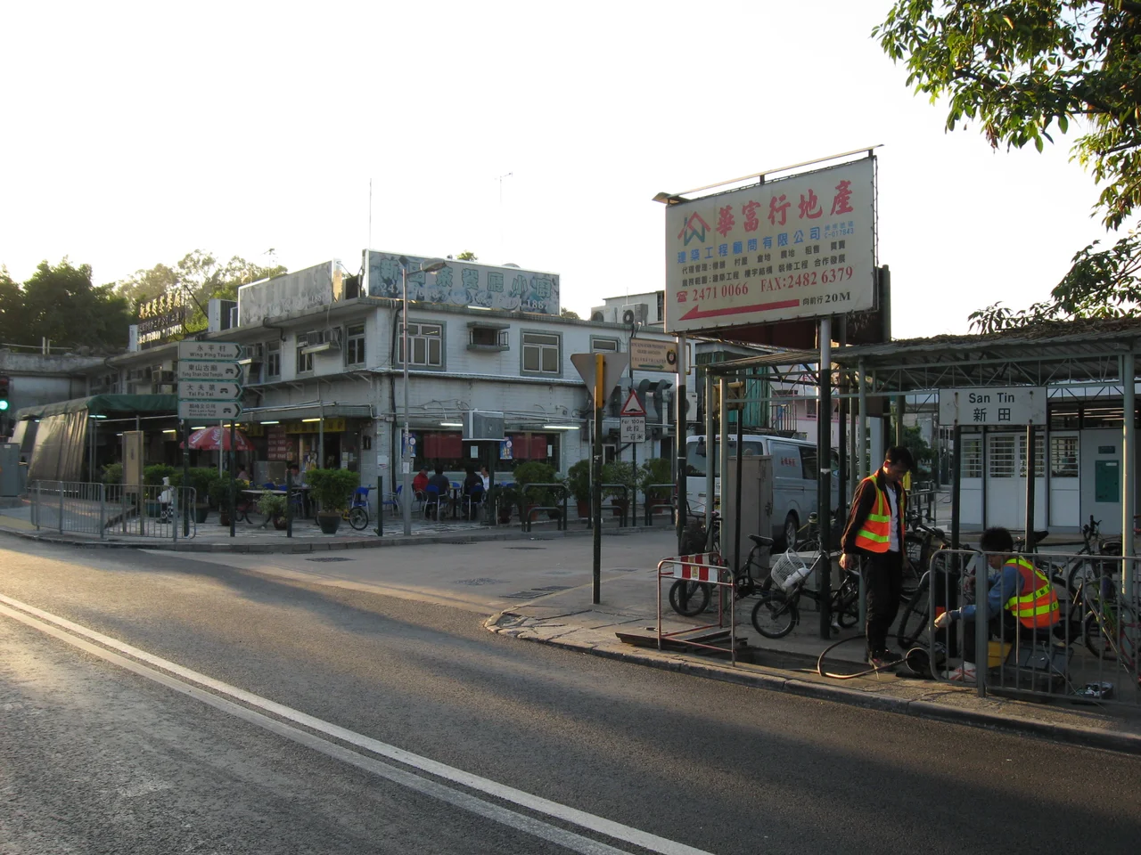

San Tin
Seven hundred years ago, a man named Man Sai-ko came to the waterlogged margins of what would become the New Territories and decided to stay. He drained the marshes, turned them into brackish paddies, and gave this place a name that described what he had made: San Tin, the new fields. His descendants are still here. The Man clan has held this corner of Yuen Long District across more than six centuries of dynastic change, colonial rule, wartime occupation, and post-colonial transition — making San Tin one of the most continuously inhabited sites of clan settlement in all of Hong Kong.
The Man Clan's Long Tenure
The clan traces its founding in this area to Man Sai-ko, who settled near San Tin in the 14th century. Over the following centuries the Man family built their eight compact hamlet-like settlements — each one a lane or two of brick houses, tight and purposeful — and farmed the surrounding land. The wetlands that made the area sparsely populated were also what made it survivable; the brackish paddies provided food and a degree of natural defence. San Tin was never a grand clan seat in the manner of some New Territories villages, but it was enduring. Today a related community can be found at Tai Hang in Tai Po District, another area settled by members of the same Man lineage — the clan's footprint across the New Territories is wider than San Tin alone suggests.
The Boundary's Edge
San Tin's position near Lok Ma Chau has given it a peculiar modern significance. The Lok Ma Chau Control Point, served by the San Tin Public Transport Interchange, is the only 24-hour border crossing between Hong Kong and mainland China. Buses, minibuses, and taxis move through day and night, connecting Hong Kong travellers with their counterpart facility at Huanggang Port in Shenzhen. A separate spur line control point links to Futian Checkpoint across the border. For a place that spent most of its history as a quiet agricultural settlement, San Tin now sits astride one of the most intensively used land borders in the world — a transformation that happened within a single generation.
Soldiers and Handovers
The barracks at San Tin carry a history that parallels Hong Kong's own. Before 1997, San Tin Barracks was known as Cassino Lines, a British military installation that housed various units over the decades — including Gurkha troops, the Nepalese soldiers who served in the British Army and formed one of the most distinctive presences in Hong Kong's garrison. When the handover transferred sovereignty to the People's Republic of China in 1997, the barracks passed to the People's Liberation Army Hong Kong Garrison, which occupies the site today. The Gurkha connection left a difficult legacy: reports have noted that Gurkha veterans have been denied access to approximately 200 graves that remain within the PLA-controlled compound.
Roads Through the Marsh
The infrastructure that San Tin now supports would have been unimaginable to Man Sai-ko's descendants even a generation ago. San Tin Highway, completed between 1991 and 1993, runs northeast to southwest through the district as part of Route 9, connecting Fanling Highway in the northeast to Yuen Long Highway in the southwest near Kam Tin River. Slip roads from San Tin Interchange provide the critical link northward to the Lok Ma Chau border crossing, just two kilometres away. What was marsh and paddy has become one of Hong Kong's key logistical corridors — the physical expression of the territory's deep economic integration with the mainland that gathered speed in the 1990s and has not slowed since.
Persistence in a Changing Place
San Tin remains sparsely populated by Hong Kong standards. The marshlands that Man Sai-ko worked are mostly gone, but the low density they enforced has persisted. Eight hamlets, one district councillor, a handful of schools in the net that serves the area — the social geography still carries the marks of its agricultural origins. A proposed MTR station on the Northern Link has been discussed for years, with the Yuen Long District Council pressing for its construction. When or whether that station arrives will partly determine what San Tin becomes next. For now, the clan's homeland holds its particular balance: ancient lineage and 24-hour border traffic, brackish paddy names and PLA barracks, all compressed into a loosely defined patch of the New Territories.
From the Air
San Tin sits at approximately 22.499°N, 114.076°E in the northwestern New Territories, near the Chinese border. From the air at 3,000–5,000 feet, the area is recognisable as a relatively open, low-density zone between the urban sprawl of Yuen Long to the south and the border fence to the north. The Lok Ma Chau Control Point infrastructure is visible as a cluster of road infrastructure near the boundary. The Sham Chun River marks the border with Shenzhen to the north. Hong Kong International Airport (VHHH) lies roughly 20 km to the southwest on Lantau Island. Approaching from the northwest over the Pearl River estuary provides the most expansive view of the border zone and the contrast between Hong Kong's New Territories and Shenzhen's denser development immediately across the line.
Nearby Stories
- Chapel of St. Francis Xavier 3.5 km away
- Cuiheng 4.1 km away
- 2015 Shenzhen Landslide 16 km away
- Shunde 31 km away
- Wanshan Archipelago 37 km away
- Nanxiong Formation 96 km away
- Heyuan 149 km away
- Checheng Fu'an Temple 629 km away