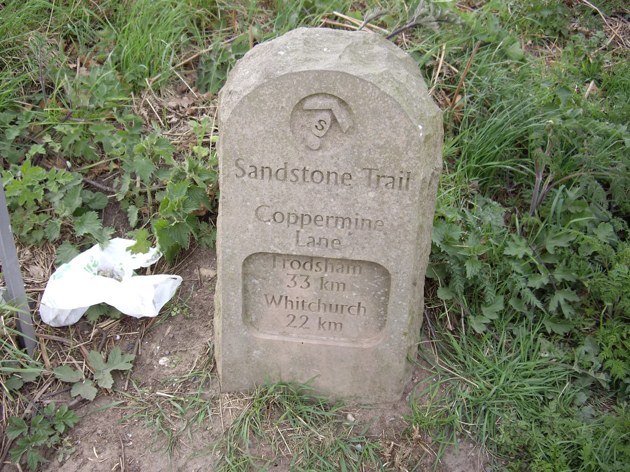

Sandstone Trail
At the Bears Paw pub in Frodsham, a sandstone obelisk marks the northern start. At Jubilee Park car park in Whitchurch, just over the Shropshire border, a two-metre sandstone archway marks the southern end. Between them stretches 55 kilometres of waymarked footpath, the Sandstone Trail, threading the length of the Mid Cheshire Ridge through woodland, farmland, and canal towpath. The yellow disc that points the way is inscribed with a single letter S inside a footprint, and after a few miles you start spotting it before you consciously look for it. The trail was created in 1974 and extended through the 1990s. It has since become one of the best-loved long-distance walks in northern England, popular precisely because it is long enough to feel like an expedition but short enough to finish in a long weekend.
Three Sections, Each Eighteen Kilometres
The trail divides naturally into three sections of about 18 kilometres each, which gives the standard three-day itinerary its rhythm. The northern section runs from Frodsham south to Willington, climbing onto the ridge almost immediately and passing through Delamere Forest at its midpoint. The central section, Willington to Bickerton, includes the two best-known monuments on the route - the medieval ruins of Beeston Castle and the Victorian mock-medieval Peckforton Castle, perched on adjacent crags. The southern section, Bickerton to Whitchurch, drops off the ridge into farmland and follows the towpath of the Shropshire Union Canal toward Grindley Brook, where a famous staircase lock raises narrowboats up onto the Llangollen branch. Between Frodsham and Whitchurch, sandstone distance markers count down the kilometres in both directions - useful and also pleasantly old-fashioned in an era of GPS.
What You See from the Ridge
The Mid Cheshire Ridge is not high - the highest point along the trail, Raw Head, reaches just 227 metres - but the Cheshire Plain that flanks it is so flat that even modest elevation buys a vast view. On a clear day from Bickerton Hill, the Liver Building and the Anglican Cathedral in Liverpool are visible to the north-west, and the Essar Stanlow oil refinery flares at Ellesmere Port. From Bulkeley Hill you can pick out the parabolic dish of Jodrell Bank Observatory away to the east. The Iron Age hill forts of Woodhouses and Maiden Castle bookend the ridge geologically and historically, both sited where the ancient inhabitants of this landscape recognised exactly the same defensive logic that brought medieval castle-builders to the same hilltops two thousand years later. Beeston Castle's slighted walls and Peckforton Castle's pristine Victorian towers face each other across a narrow saddle, and walking between them, on the ridge spine, is one of the most photographed stretches of any English long-distance path.
Following the Footprint
The waymarking system is straightforward but rewards attention. Yellow discs with the S-in-footprint logo point the way at every junction. Blue information boards at intervals along the route give local history, geology, and ecology. Stone markers count distance to each end of the trail. The one place to stay alert is Delamere Forest, where the Sandstone Trail intermingles with the Baker Way for several hundred metres; without watching the waymarks, walkers occasionally drift off onto the wrong path without realising it. The trail follows the ridge for most of its length, but in places it drops into the Cheshire Plain - farmland, canal towpath, hedge-bordered lanes - which gives the route variety and means the climbs are spread out rather than concentrated. The northern obelisk and southern archway, both carved from local sandstone, frame the whole walk in the material that gives the trail its name and its character.
Running It in Four Hours
For decades the Fire Service organised an annual full traverse of the trail as a long-distance event, and in May 2011 the Helsby Running Club revived it as an LDWA event. The current course record for the full 55 kilometres stands at 4 hours and 10 minutes, set by Duncan Harris of Chester Tri. The women's record, held by Caroline Hall of Wirral AC, is 5 hours and 4 minutes. Both figures are humbling if you have just spent three days walking the same distance with a pack. The shorter Sandstone Trail Races, organised by Deeside Orienteering Club every October since 1977, use the central portion of the trail - the longer race climbs to Raw Head and finishes in Delamere Forest at Barnes Bridge Gates. For most walkers, though, the trail is best done at the pace it was designed for: three days, three sections, an evening pint in a village pub at the end of each, and a slowly accumulating sense of the strange long ridge of red rock that runs the length of Cheshire.
From the Air
The Sandstone Trail runs roughly north-south between Frodsham (53.30 N, 2.72 W) and Whitchurch (52.97 N, 2.68 W), covering approximately 55 kilometres along the Mid Cheshire Ridge. Best viewed at 3,000-4,000 feet, where the ridge appears as a continuous wooded spine above the surrounding Cheshire Plain. Key landmarks visible from the air: Delamere Forest at the northern third, Beeston Castle and Peckforton Castle in the centre, and the Shropshire Union Canal threading the southern section. Nearest major airport: Manchester (EGCC), 22 miles east. Hawarden (EGNR), 12 miles west; Liverpool John Lennon (EGGP), 16 miles north-west.
Nearby Stories
- Battle of Winwick 2.1 km away
- Astley Deep Pit Disaster 3.8 km away
- Moel Famau 6.5 km away
- Sandon Hall 6.7 km away
- RAF Tern Hill 8.2 km away
- Brindley Water Mill 8.7 km away
- Battle of Maes Moydog 31 km away
- Piel Castle 70 km away