_22.jpg)
Moel Famau
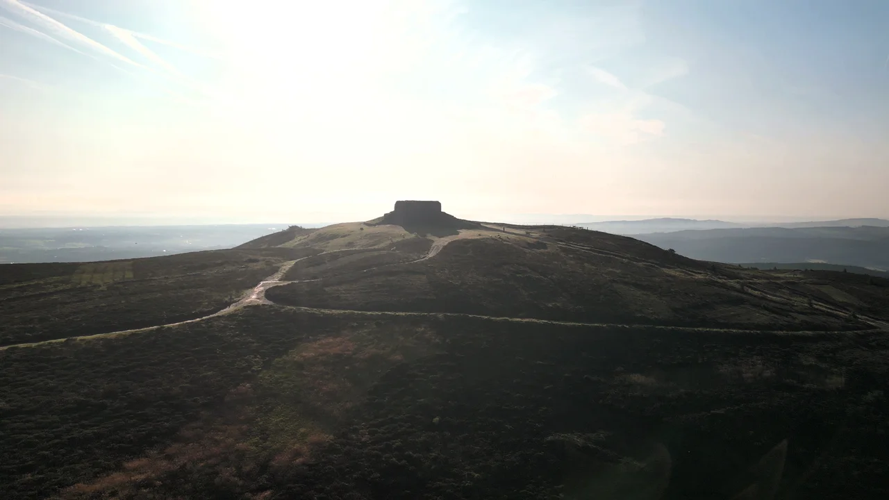
George Kenyon, the 2nd Baron Kenyon, laid the foundation stone in October 1810 for what was meant to become a soaring three-tier Egyptian obelisk on top of the highest hill in north-east Wales. The tower would celebrate the fiftieth year of George III's reign - a Welsh contribution to the king's golden jubilee. The inscription, drafted in Latin, called him Pio Justo Patri Patrio: pious, just, father of his country. The architect was Thomas Harrison of Chester. Funds ran out. The tower was never completed. In 1862, a major storm brought down the unfinished structure, the upper part was demolished for safety, and what stands today on Moel Famau - the Mothers' Bare Hill - is the squat, square base of an ambitious building Britain never quite managed to finish.
What the Name Actually Means
Moel is straightforward Welsh: it means bare, used in place-names across Wales to describe a hilltop without trees. The second word is more complicated. Historical spellings vary - Moel Famma, Moel Vamma, Moel Fammau, Moel Famau, Moel Fama. The forms attested from the 14th century onward end in -a, and the Dictionary of the Place-names of Wales considers Moel Fama to be the preferred spelling on linguistic grounds. The 'mothers' translation popular today - Moel Famau as Bare Hill of the Mothers - comes from an 18th-century antiquarian guess that took the second word as a lenited form of mamau, the Welsh common noun for mothers. The earlier evidence suggests instead that the second element is a lenited personal name, 'Mama' - possibly an early Welsh saint, possibly a local figure, possibly a mythological reference now lost. The romantic translation has stuck because it sounds better. Mothers' Hill is what every walking guide and tourist board calls it. The linguistic evidence is more cautious.
An Egyptian Tower in the Clwydians
Thomas Harrison, the architect, was the celebrated Chester-based designer of the Chester Castle Grosvenor Building, the Lyceum in Liverpool, and the Anglesey Column. The Jubilee Tower he designed for Moel Famau was an Egyptian obelisk in three tiers, faces sloping inward and upward to a point. The choice of Egyptian Revival was very of its moment - Nelson had won at Aboukir Bay in 1798, the Napoleonic campaigns had popularised Egyptian aesthetics, and a stone obelisk on a Welsh hilltop visible from Liverpool, the Wirral, and across the Vale of Clwyd was the kind of statement British provincial elites wanted to make in 1810. Three sides were to carry the inscription in Latin: Georgia III Brittaniarum Regi, Pio Justo Patri Patrio Commitatus, Denbigh et Flint, Jubilantus Posuere, 25 Octobris, Anno Domino 1809. The work stalled when subscriptions dried up. The tower was never crowned with its apex, never inscribed, never finished. It stood incomplete for half a century before the storm of 1862 brought the top down.
1862 and the Walls Built from the Rubble
The storm did serious damage. The upper part of the structure was so unstable afterward that it had to be demolished for public safety, leaving only the lower square base. Most of the dressed stone rubble was removed from the summit and carted down the hill, where local farmers reused it for dry-stone walls. If you walk the lanes around Llangynhafal and Cilcain on the hill's flanks, some of the field walls are built from the unbuilt Egyptian obelisk that was never quite a memorial. There is something appropriate about the recycling. A monument that George III never saw, designed to celebrate a reign that ended in his madness and his son's regency, dispersed across Welsh fields by men who needed building stone more than they needed jubilee architecture. In October 2010, communities in Denbighshire and Flintshire marked the 200th anniversary of the foundation stone with a celebration. A local artist commissioned by the councils installed a temporary light and laser installation that illuminated the tower base by night.
Iron Age Forts and Offa's Dyke
Moel Famau is 1,818 feet (554 m) high, the highest point in the Clwydian Range and the county top of Flintshire. It sits on the boundary between Denbighshire and Flintshire. Despite local pride, it is not actually the highest point in north-east Wales - that honour goes to Cadair Berwyn, and Moel Famau is also lower than Moel y Gamelin and Moel Fferna in the Clwydian Range and Dee Valley AONB. The Clwydian Range was designated an Area of Outstanding Natural Beauty in 1985. Several remarkably preserved Iron Age hillforts ring Moel Famau's slopes - Foel Fenlli, Penycloddiau, Moel y Gaer - earthwork enclosures that predate the Roman conquest by centuries. The Offa's Dyke Path, one of Britain's most popular National Trails, crosses the summit. Walkers come up from the car parks in Loggerheads Country Park or Bwlch Penbarras and reach the Jubilee Tower base on a clear day to look west across the Vale of Clwyd to Snowdonia, north to Liverpool Bay, east to the Cheshire plain, and south down the spine of the Clwydian hills. The unfinished Egyptian obelisk, even as a stump, is a navigational landmark for half of north Wales.
From the Air
Moel Famau sits at 53.15N, 3.26W on the spine of the Clwydian Range, summit elevation 554m (1,818 ft). The Jubilee Tower base is the most prominent man-made landmark for many miles in any direction - visible from the Cheshire plain, the Wirral, Liverpool Bay, and the entire Vale of Clwyd. The ring of Iron Age hillforts on the surrounding peaks (Foel Fenlli, Penycloddiau, Moel y Gaer) is clearly visible from low altitude as concentric earthworks. Nearest airports are Hawarden (EGNR, ~14nm east) and Caernarfon (EGCK, ~30nm west). Maintain a safe altitude - the summit is exposed and weather can change rapidly. Cruise at 3,500-4,500 ft AGL for the best views.
Nearby Stories
- Carnedd Llewelyn 7 km away
- Tarporley 9.7 km away
- Battle of Winwick 14 km away
- RAF Shawbury 16 km away
- Cymer Abbey 17 km away
- New Brighton Lifeboat Station 19 km away
- Battle of Oswestry 20 km away
- Celtic Array 52 km away