Santarém, Pará
Before the Jesuits arrived in 1661, before the Portuguese, before any European, the Tapajós people had built an agricultural chiefdom here large enough that Spanish explorer Francisco Orellana, sailing down the Amazon in 1542, thought it worth sacking their corn plantations. They were the first people of this river, and the river took their name. Four centuries later, Santarém is still organized around the confluence where their chiefdom flourished: the point where the Tapajós flows clear blue into the brown Amazon and the two waters run side by side for kilometers without mixing. Everything else here, the Jesuit mission and the fortress and the soy terminal and the 306,000 residents, layered in on top of that geography.
The Tapajós People and the Portuguese
When the Portuguese explorer Pedro Teixeira came up the Amazon in 1621, ten years after the founding of Belém at the river's mouth, he found a settlement of people the Portuguese called Tupuliçus near the Tapajós mouth. They had already traded with Spanish explorers, and they now traded with Teixeira and his party of 26 soldiers, Father Cristovão, and a large group of indigenous allies. The Jesuits followed. Father António Vieira visited the site in 1659. On June 22, 1661, Father João Filipe Bettendorff founded a mission he called Aldeia do Tapajós, the Tapajós Village, and built the Chapel of Our Lady of Conception. The indigenous population that had built corn terraces here was by then being displaced by disease, enslavement, and missionary reduction; their numbers collapsed within a few generations of contact. The Portuguese built a fortress from 1693 to 1697, renamed the village Santarém in 1758 after a city in Portugal, and elevated it to city status in 1848. Today, two cannons from the old Fortress of Tapajós sit at the airport. Two more stand in Centenário Square. The fortress itself is gone; its stones were reused for other buildings. Only the name of the people who lived here before survives, attached to a river, a national forest, and a proposed future state.
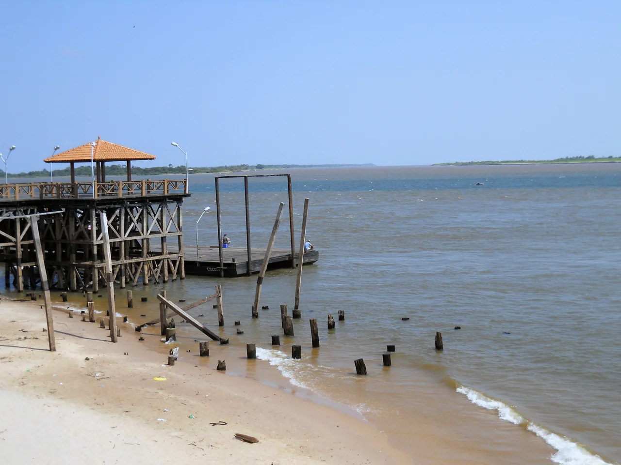
Where the Rivers Meet
Santarém is defined by two rivers running past its front door side by side. The Amazon's milky water carries sediment from the Andes, thousands of kilometers upstream, and appears yellow-brown in the sun. The Tapajós runs warmer and clearer, with a deep-blue tone that comes from low sediment and a sandy basin. They meet directly in front of the city and flow together without mixing for more than a dozen kilometers; the line between them is visible from airplanes cruising to Belém. Locals call this o encontro das águas. Because of the crystalline Tapajós, Santarém has more than 100 kilometers of natural beaches. Alter do Chão, 35 kilometers downriver, has white sand beaches that The Guardian ranked the most beautiful in Brazil, earning it the nickname Caribe Brasileiro, the Brazilian Caribbean. The Sairé festival, one of the most important folklore festivals in the Amazon, happens in Alter do Chão every September, with two rival boi-bumbá groups performing ritual dances for the crowd. The climate is tropical monsoon: average temperature 25 to 28 degrees Celsius, humidity 86 percent, about 2,150 millimeters of rain per year, wet season November through July and dry August through October.
Cycles
Santarém has lived through a series of economic waves, each leaving a layer in the city's structure. Rubber extraction dominated the late nineteenth and early twentieth centuries. Coffee production had its run. Gold mining surged in the 1980s when the Serra Pelada discovery to the east pulled tens of thousands of garimpeiros through the region; when that ended, Santarém actually lost population from 1996 to 1999 as miners and their families moved elsewhere. Then in 2003 the US-based agribusiness giant Cargill opened a soybean port terminal in the city. The facility dramatically lowered the cost of moving soy from the southern Amazon to global markets, and it triggered both an expansion of the BR-163 highway south to Cuiabá and a wave of deforestation as farmers cleared land for soy. The terminal was controversial from the start. Cargill had not completed an Environmental Impact Statement before construction, had contested in court its obligation to do so, and Greenpeace launched a 2003 campaign documenting the deforestation. In February 2006, federal courts gave Cargill six months to complete the assessment. The jobs that locals had been promised mostly did not appear. The soy kept moving. The controversy continues.
Richard Henington and Other Outsiders
In 1867, Richard Henington, born in Crystal Springs, Mississippi, arrived in Santarém. He was part of a migration of former Confederates who, after the American Civil War, had left the southern United States rather than accept Reconstruction. The Brazilian Emperor Dom Pedro II had offered them land and cheap passage, hoping to import their cotton expertise. Most settled in what is now the São Paulo state, at a place still called Americana. Some came to Santarém. Henington apparently made enough of an impression that a state primary and high school here now bears his name. The school has 13 classrooms in three sections. The story is quietly strange: a school named for a Confederado, an immigrant who fled one country's decisive historical defeat and found a home in a Jesuit mission town on the Amazon. Santarém has absorbed many such arrivals over 360 years - Portuguese Jesuits, Confederados, Brazilian gold miners, Cargill executives, tourists looking for the Caribbean in the middle of a continent. The waters still refuse to mix in front of the waterfront. The city keeps accumulating.
From the Air
Santarém occupies the southern bank at the confluence of the Tapajós and Amazon rivers at 2.44 S, 54.71 W, second-largest city in Pará with 306,000 residents. Santarém-Maestro Wilson Fonseca Airport (SBSN) serves the region with daily Gol and Azul flights to Manaus, Belém, and Brasília. Recommended viewing altitude 4,000-8,000 feet for the full sweep of the meeting of the waters, with the distinct line between blue Tapajós and brown Amazon visible for at least 15 kilometers downstream. The Cargill soybean terminal sits prominent on the western waterfront, and the colonial grid of the old city center is visible around Praça Tiradentes and the Cathedral.
Nearby Stories
- Amazon River 39 km away
- Tapajós National Forest 108 km away
- Fordlândia 137 km away
- Terra do Meio Ecological Station 159 km away
- Parintins 174 km away
- Serra do Pardo National Park 394 km away
- Oyapock 487 km away
- Caverna do Maroaga Environmental Protection Area 518 km away