Tapajós National Forest
This is not a national park. The distinction matters. In Brazilian law, a floresta nacional, a national forest, is an IUCN category VI protected area - a protected area with sustainable use of natural resources. Which means you can log in Tapajós National Forest, carefully and selectively, in ways you cannot log across the border of a national park. You can harvest Brazil nuts. You can extract oils. You can live here as a traditional community. What you cannot do is clear-cut, convert to pasture, or export hardwood for buyers who do not ask where it came from. The forest, 549,066.87 hectares on the east bank of the Tapajós River, has been running this experiment in regulated use since its creation by decree in February 1974.
The Boundaries
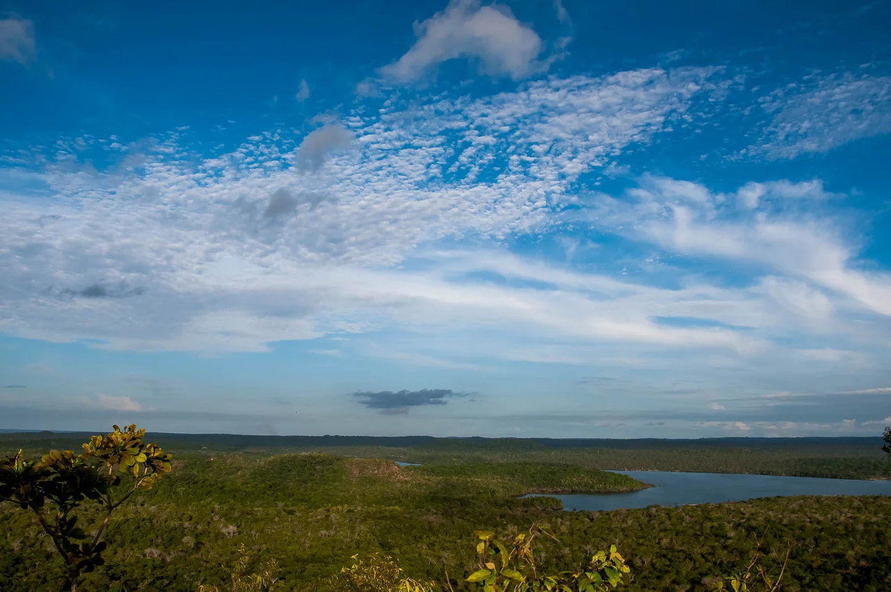
The forest lies in the municipalities of Belterra, Aveiro, Rurópolis, and Placas in western Pará. Its boundaries are drawn by water and by road. The Tapajós River forms the western edge, a broad blue-black tributary of the Amazon that runs for a hundred and some kilometers along the forest's flank. The Cupari River, a tributary of the Tapajós, marks the northern boundary. The BR-163 highway, the infamous Santarém-Cuiabá road that cuts south through the Amazon to the agricultural frontier of Mato Grosso, forms the eastern boundary. Inside these lines, the forest is divided by watershed: western slopes drain into the Tapajós, eastern slopes into the Curuá-Una River basin. The Moju River rises inside the forest. Elevations along the Tapajós bank are about 100 meters, cut by ravines and deep valleys, and the flat zones flood periodically during the wet season. Further east, on the Tapajós-Xingu plateau, elevations climb to 120 meters and the land flattens out. Annual rainfall averages 1,820 millimeters. Temperatures range from 21 to an average of 26 degrees Celsius.
The Canopy and the Trees
Botanists working the Tapajós have catalogued more than twenty named commercial tree species and dozens more that appear in the forest's three major vegetation types: dense rainforest with emergent giants, alluvial rainforest that floods seasonally, and open tropical forest where palms and lianas take over. The emergent trees include Bertholletia excelsa, the Brazil nut, whose pods harvested here supply markets across northern Brazil. Aniba canelilla yields an essential oil used in perfume. Aspidosperma carapanaúba, Cordia goeldiana, Mezilaurus itauba, and Dinizia excelsa are among the timber species that legal logging concessions here target under the forest's sustainable-use mandate. Ceiba pentandra, the kapok tree, sends buttressed trunks forty meters up. Mauritia flexuosa, the moriche palm, grows in wet lowlands forming the distinctive palm stands visible from aircraft. The variety is not only botanical. It is what makes managed extraction possible: a dozen species bring enough market value that concessionaires do not need to convert forest to pasture to make a living.
The Animals That Stay
The protected species list reads like an index of Amazonian big fauna: white-bellied spider monkey and white-cheeked spider monkey, both threatened; giant anteater; jaguar; giant armadillo; giant otter. The jaguars here move between the forest and the adjacent Amazônia National Park to the south, part of a larger predator range that depends on the continuity of protected land across southern Pará. The proposed South Amazon Ecological Corridor would formalize that continuity, linking Tapajós National Forest to the other protected areas and indigenous territories in the region. For now the continuity is partial. Tapajós National Forest is one of 12 sustainable-use conservation areas and six fully protected areas in a mosaic that covers over fourteen million hectares. The fully protected areas include Amazônia, Jamanxim, Rio Novo, and Serra do Pardo national parks, the Nascentes da Serra do Cachimbo Biological Reserve, and the Terra do Meio Ecological Station, for 6.67 million hectares total. The sustainable-use areas, including Tapajós and Altamira and Amaná and Itaituba I and II national forests, add another 7.55 million hectares.
Harvard in the Canopy
The most consequential research at Tapajós is not ecological in the classical sense. It is atmospheric. Since the early 2000s, the Large Scale Biosphere-Atmosphere Experiment in Amazonia, or LBA, has operated a tall flux tower inside a primary Tapajós forest site. The tower, instrumented top to canopy, measures the net exchange of carbon dioxide and water vapor between undisturbed rainforest and the atmosphere. The question matters because nobody is sure whether the Amazon is a net carbon sink, a net source, or oscillating between the two. The answer depends on forests like this one, intact, old-growth, still functioning at baseline. The LBA is a joint project of Harvard University and Brazil's National Institute for Space Research, INPE. Graduate students from Cambridge and São José dos Campos rotate through the tower, taking shifts to process air samples. Their findings feed into the global climate models that project what the Amazon does as temperatures rise and rainfall patterns shift. Below the tower, jaguars cross the trails at night and Brazil nut collectors work the forest floor by day, while above, the instruments measure the breath of the trees.
From the Air
Tapajós National Forest stretches across 549,000 hectares at 3.52 S, 55.07 W in western Pará, on the east bank of the Tapajós River. Nearest airport is Santarém-Maestro Wilson Fonseca (SBSN), about 80 km north. The forest is visible from altitude as an unbroken continuous canopy bounded sharply on the west by the blue-black Tapajós River, on the east by the distinct scar of BR-163 highway deforestation, and on the north by the Cupari tributary. Recommended viewing altitude 4,000-8,000 feet. The contrast between protected forest and the cleared soy and pasture lands along BR-163 is one of the most dramatic visible borders in the Amazon basin.
Nearby Stories
- Terra do Meio Ecological Station 101 km away
- Santarém-Maestro Wilson Fonseca Airport 105 km away
- Tapajos Hydroelectric Complex 116 km away
- Parintins 154 km away
- Amazonia National Park 171 km away
- Sawre Muybu Indigenous Territory 208 km away
- Tapajós–Xingu moist forests 257 km away
- Oyapock 629 km away