.jpg)
São Carlos
One in every 135 people walking the streets of São Carlos holds a doctorate. The national ratio is one in 5,423. That single statistic - the density of minds per square block - is why President Dilma Rousseff declared this interior São Paulo city the National Capital of Technology in 2011. It is a place where Volkswagen engines are built alongside federal university laboratories, where 1.5 billion pencils leave the Faber-Castell factory each year (the largest in the group's worldwide network), and where the windy afternoons up at 856 meters carry the sound of students arguing about research papers on their walk home from the cafeteria.
A Chapel and a Coffee Baron
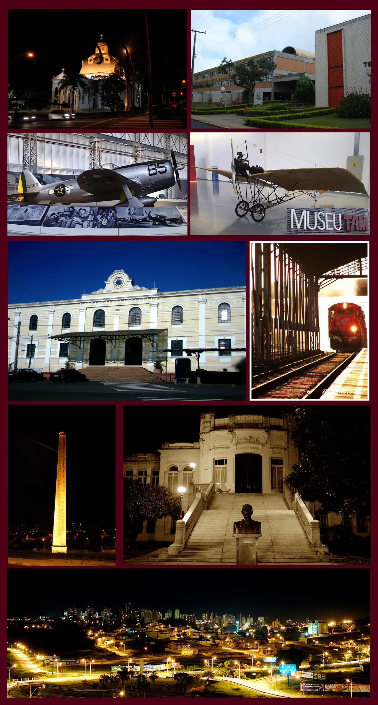
São Carlos was founded on November 4, 1857, around a chapel built by the heirs of the Arruda Botelho family - specifically, Antônio Carlos de Arruda Botelho, the Count of Pinhal. The "Pinhal" allotment had been demarcated in 1831, and coffee arrived at the Pinhal farm in 1840. The Count brought in German immigrants as early as 1876, and between 1880 and 1904 the city became one of the most important immigration centers in São Paulo state. Most of the arrivals were Northern Italians, and they worked the coffee plantations, the factories, the small trades. The Italian presence grew so substantial that during the first half of the twentieth century, the Italian government kept a consulate branch right here.
The Railway Year
The railway reached São Carlos in 1884 and changed everything. Before the trains, coffee moved slowly by mule and oxcart over long distances to the port of Santos. After them, coffee moved fast. The profits the Pinhal coffee barons extracted from those red-earth plantations got reinvested locally - banks, electricity, cable cars, telephones, water pumps, sewers, theaters, hospitals, schools. When the 1929 Wall Street crash gutted coffee prices, the infrastructure those profits had built let the city pivot. Workers left the rural plantations for factories: processing machinery, fertilizers, pasta, cigars, pencils. By the 1950s, São Carlos was a manufacturing center of real regional weight.
Two Universities, One Identity
The technological turn began in 1953, when the University of São Paulo opened its Engineering School here. In the 1970s the Federal University of São Carlos (UFSCar) was launched. Today the city hosts two USP campuses, UFSCar, the Federal Institute of São Paulo, FATEC, and a network of private institutions - and a floating population of twenty-nine thousand graduate and undergraduate students from other cities and states. UFSCar runs the PhD-density survey that makes the 1-in-135 ratio famous. Two Embrapa research complexes further stack the city with agricultural scientists. The student economy spills everywhere: cheap restaurants, late-night cafes, the legendary student parties that give São Carlos a reputation for both intellectual seriousness and a certain irreverent energy.
Industry on a University Foundation
The multinationals that set up shop here came for the technical labor. Faber-Castell's São Carlos plant produces 1.5 billion pencils annually - the biggest in the entire global group. Volkswagen builds engines. Electrolux, Tecumseh, Husqvarna, Leica Geosystems, Serasa Experian, Grupo Segurador BB-MAPFRE all have operations. Locally-grown optical technology firms like Opto Eletrônicos emerged from university spinouts. The tertiary sector accounts for 65.9% of the city's GDP; industry takes 32.3%. Agriculture - sugarcane, oranges, milk, chicken - holds just 1.7%. The National Capital of Technology title was earned on the strength of that composition.
The Names Who Left
São Carlos has also produced a roster of people who made their names elsewhere. Maurren Maggi won the women's long jump gold at the 2008 Beijing Olympics. Nenê played seventeen seasons in the NBA. Fábio Aurélio anchored Liverpool's defense. Izabel Goulart walked the global fashion runways as a supermodel. Thiago Silva fought in the UFC. Ronald Golias defined a certain style of Brazilian television comedy. Felipe El Debs became a chess grandmaster. A university town that produces PhDs at five times the national rate also sends athletes, entertainers, and strategists out into the world - and most of them, if asked, will tell you they grew up somewhere with very good schools and a coffee-barons' street grid still stamped into the downtown blocks.
Up in the Wind
The city sits at 856 meters on the basaltic and sandstone slopes between the Western Plateau and the Paulista Periférica Depression, inserted in the Paraná Basin. Most of the year it is windy and sunny, hot but not oppressive. In 2020 and 2021 São Carlos was recognized by the UN Food and Agriculture Organization's Tree Cities of the World program. From the air, the grid reads like a classic coffee-era layout - streets radiating from the historic center around Avenida Doutor Carlos Botelho and Rua Conde do Pinhal, both named for nineteenth-century figures whose decisions still shape the city the researchers live in today.
From the Air
Located at 22.02°S, 47.89°W, São Carlos sits at 856 meters elevation in the geographic center of São Paulo state, 254 km northwest of the state capital. The city extends across the Planalto de São Carlos. Nearest airport: Mário Pereira Lopes International Airport (SBSC, São Carlos), which hosts a TAM Airlines maintenance base. Ribeirão Preto Airport (SBRP) is 90 km northwest for scheduled commercial service. SP-310 (Rodovia Washington Luís) is the major surface reference running east-west. Recommended viewing altitude: 6,000-10,000 feet AGL for full urban footprint.
Nearby Stories
- Brazilian Air Force Academy 15 km away
- Torrinha 22 km away
- Pederneiras 27 km away
- Vassununga State Park 42 km away
- Titanochampsa 58 km away
- Bauru 63 km away
- Itapira 67 km away
- Poços de Caldas 93 km away