Savassi
A neighborhood named for a bakery is a strange thing, but Savassi came by it honestly. In the mid-1930s, an Italian family named Savassi took over a bakery on Praça Diogo de Vasconcelos in Belo Horizonte and put their surname on the storefront. Locals began calling the square by the bakery's name, then the surrounding streets, and eventually the mayor formalized what the neighbors had already decided. The bread the Savassis sold is remembered chiefly because Minas Gerais got its trendiest district out of it. Today the Praça da Savassi is surrounded by bars, bistros, galleries, and some of the highest per-square-meter real estate prices in Belo Horizonte, but the origin story still involves someone selling pastries.
How a Bakery Became a District
For most of the twentieth century, what is now Savassi was officially part of the Funcionários neighborhood, the civil servants' district. The bakery on the Praça Diogo de Vasconcelos was the social anchor - a place to meet, to eat bread and pastries, and to be recognized by the regulars. The mayor declared Savassi a square first, then something larger, and finally in 2006, ahead of an Inter-American Development Bank meeting that Belo Horizonte would host that year, the city officially dismembered Savassi from Funcionários and made it its own neighborhood. The new boundary pushed Funcionários south. Savassi became the area stretching from Pátio Savassi up to Minas Tênis Clube. A place that started as a bakery was now a CRECI A-list real estate classification.
The Geography of Money
Savassi sits inside some expensive company. Its southern edge is Contorno Avenue, where Pátio Savassi - one of the city's most upscale shopping malls - anchors the neighborhood's commercial district. Afonso Pena Avenue runs the east side. Brasil Avenue runs the north. To the northwest sits Praça da Liberdade, the old government square now ringed with museums and cafes. To the west is Rua da Bahia. Just past those borders sit Funcionários, Boa Viagem, and Lourdes - Lourdes being the wealthiest residential district in Belo Horizonte. The schools in Savassi match the demographics: Colégio Santo Antônio, Colégio Sagrado Coração, Colégio Marista São José, Colégio Padre Machado, all Catholic, all selective. The Architecture School of UFMG is here. So is the Social Sciences School of PUC-Minas. The Human Development Index inside the neighborhood is one of the highest in southeastern Brazil, and the per-capita income tracks accordingly.
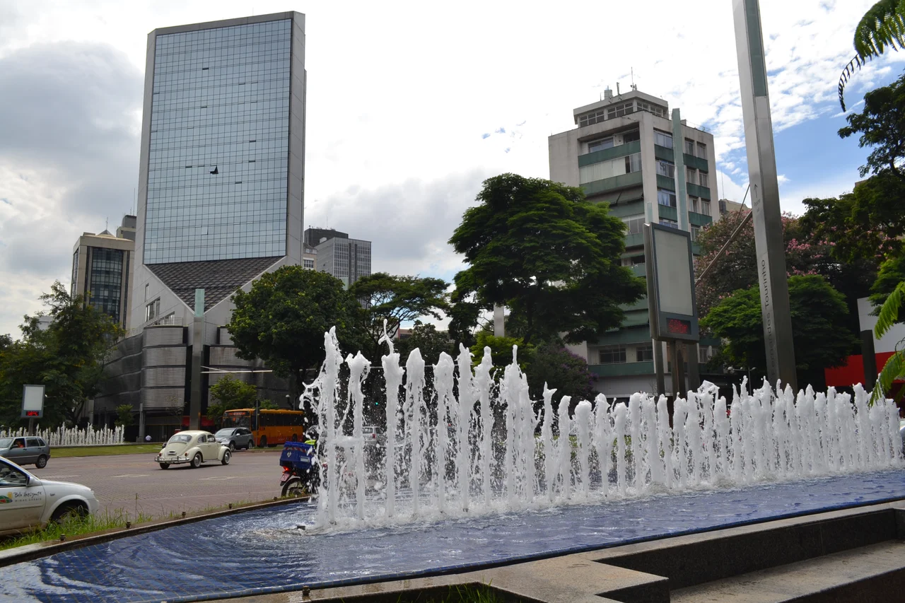
To See and To Be Seen
What happens in Savassi at night is what the neighborhood is actually known for. The cafes fill up in the afternoon and stay full. The bars turn over two or three crowds by closing time. Restaurants line up along Getúlio Vargas Avenue and Cristóvão Colombo Avenue, and the private clubs sit behind doors that look unimpressive from the street. There is a practical sociology to the evening: the elite from the surrounding wealthy districts come here to shop, to visit the galleries, to attend public fairs, to sit at the ever-full terraces, to dance at the most-wanted parties. The phrase locals use is ver e ser visto - to see and to be seen. But Savassi is also the straightest-dealing neighborhood in town in the sense that every subculture is here. Hipsters, rockers, emo kids, students from the nearby architecture and social sciences schools - the district absorbs them all without making any of them feel out of place.
The 2011 Restructuring
Starting in 2011, the city undertook a major overhaul of the Praça da Savassi itself. The central square was reconfigured, cycle paths were installed through the commercial area, and an underground car park was built beneath the plaza to take the parked cars off the street. These changes mattered because Savassi's density had outrun its original infrastructure. A bakery-era square designed for foot traffic was trying to accommodate the Ubers and delivery scooters of a Brazilian city entering the 2010s with oil-money prosperity in the air. The redesign worked well enough that the district weathered both the economic crisis of the mid-2010s and the pandemic-era loss of restaurant traffic without losing its central role in how Belo Horizonte entertains itself.
What the Neighborhood Is For
Belo Horizonte is a planned city, built in the 1890s to be the modern state capital of Minas Gerais, with avenues laid out in a regular grid. Most of the city honors that rationality. Savassi does not. Its streets bend and cross each other at odd angles, shaped by the accumulated foot traffic of a century of people walking to the bakery, then to the bars, then to the private parties in the apartment towers. The neighborhood functions as Belo Horizonte's main evening destination, the place where Mineiros - the people of Minas Gerais, famous in Brazil for being reserved and private in a national culture that values neither - do their public performance of social life. The food arrives. The drinks arrive. The people across the table lean in. The conversation, always, is about what happens next.
From the Air
Savassi sits at 19.93 degrees south, 43.93 degrees west, in the Central-South zone of Belo Horizonte. The neighborhood sits at roughly 850 m elevation in the Minas Gerais highlands. Recommended viewing altitude 2,500-4,000 ft AGL over downtown. The Praça da Savassi - the central square - is the visual anchor, surrounded by dense mid-rise commercial and residential buildings. Pátio Savassi mall marks the southern edge along Contorno Avenue; Praça da Liberdade with its palatial government buildings sits just to the northwest. Belo Horizonte's main airports are Pampulha (SBBH) about 10 km north for regional flights and Confins (SBCF) about 40 km north for international service.
Nearby Stories
- Crucilandia 19 km away
- Sumidouro State Park 25 km away
- Iron Quadrangle 28 km away
- Paraopeba 47 km away
- São Gonçalo do Pará 59 km away
- Robert Quayle (1814 ship) 61 km away
- Serra dos Cocais 64 km away
- Coronel Fabriciano 80 km away