Schiermonnikoog National Park
When the Netherlands declared its first national park to include not just land but tidal flats and sea, the choice of Schiermonnikoog made sense in a way the map alone could not explain. The island is a country in miniature - dune ridges, pine forest, polders, salt marsh, beach, and shallow Wadden water all crammed into a sliver of sand 16 kilometers long. In 1989, 72 square kilometers of that sliver became a protected national park, covering nearly the entire island and reaching into the sea around it. The point was simple. Most of the Netherlands has been dredged, drained, dyked, or built upon. The park was a place to let the wind decide instead.
The Drifting Island
Schiermonnikoog is geologically young - it arose during the last glacial period as winds, currents, and sediment settled into a barrier between the North Sea and the shallow Wadden Sea behind it. Like the other West Frisian Islands, it has never sat still. Sand drifts west to east along the coast, eroded from one end and laid down at the other, so the island is slowly migrating eastward. The movement has been quick enough that the legal border between the provinces of Friesland and Groningen has been adjusted twice in the 21st century alone - first in 2006 and again in 2018 - to keep pace with the sand. The national park manages the island knowing it cannot be held in place. One of management's stated aims is to make the dunes more dynamic, not less.
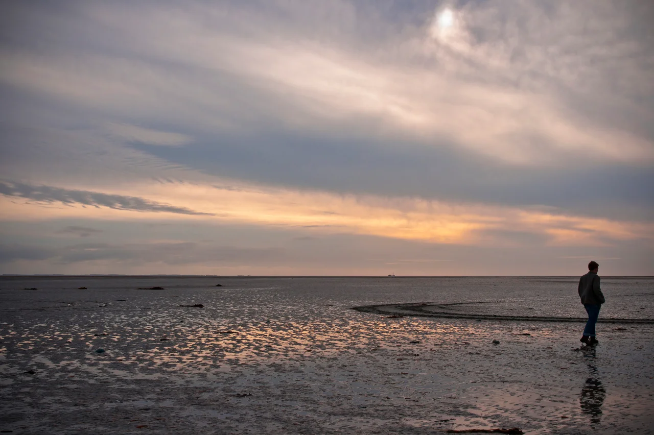
Five Habitats in 72 km2
The park is a compressed catalogue of Dutch coastal landscapes. The North Sea side carries broad beaches and primary dunes, anchored by sea buckthorn, common hawthorn, and tangles of honeysuckle. Behind them, pine plantations from the early 20th century - planted to stop the dunes from drifting onto the village - have matured into proper woodland. Inland of the trees lie polders, the rectangular drained fields that one century of farming carved out of the marshes. Beyond the polders, the salt marshes spread along the Wadden Sea side: sea lavender, sea wormwood, sea aster, glasswort - the specialist plants that thrive in soil flooded by every high tide. And then the tidal flats themselves, kilometers of glistening mud that empty and refill with the moon.
Birds by the Thousand
The Wadden Sea is a global staging ground for migrating birds, and Schiermonnikoog sits in the middle of it. Spoonbills wade in the Westerplas lake near the village, conspicuous with their flat bills sieving the shallows. Barnacle geese arrive in winter from Svalbard and Greenland in flocks that darken the marshes. Oystercatchers and bar-tailed godwits work the tideline; common redshanks and curlews call across the salt grass; hen harriers quarter the dunes. Red knots arrive in great smoke-like clouds during migration. European herring gulls patrol the beaches year-round. In spring and summer the park restricts visitor access to certain areas so the breeding colonies have space to nest. The rabbits, once everywhere on the dunes, have grown rare since rabbit haemorrhagic disease moved through the population.
Seals and Seagrass
In the waters around the island, gray seals and common seals haul out on the sandbanks that emerge at low tide, a few kilometers offshore. The two species look similar at distance but the gray seal is larger and longer-faced. Both populations have recovered substantially since hunting ended in the mid-20th century. Beneath the water, eelgrass meadows - Zostera marina - root in the mudflats wherever the conditions are right, providing nursery habitat for shrimp, juvenile fish, and the invertebrates that the birds above eat. Seaweeds drape the rare hard surfaces. The Wadden Sea is shallow and turbid, but the productivity in those few meters of water is extraordinary.
Protected by Difficulty
Visitors call Schiermonnikoog one of the best-preserved national parks in the Netherlands, and there are concrete reasons for the protection. Cars are banned for tourists - you can only bring a vehicle with municipal permission, which is rarely granted. The island can only be reached by ferry from Lauwersoog on the mainland, a 45-minute crossing that imposes its own filter on visitor numbers. Fewer than a thousand people live on the entire island year-round, almost all of them in the single village. Two agencies share management: Natuurmonumenten handles the park itself, Rijkswaterstaat handles coastal protection. There is one campground, several hotels and restaurants, a visitor center in the village. The rest is dune, marsh, and the wind that keeps shaping them.
From the Air
Coordinates 53.4893N, 6.232E. Schiermonnikoog National Park covers nearly the entire 18-km length of the island and reaches into the Wadden Sea and North Sea around it. From 2,000-5,000 ft AGL the island reads as a clear east-west bar of dune, forest, polder, and salt marsh between two seas, with the village clustered near the western end and the long uninhabited tail trailing east toward the sandbank Balg. The pine forests behind the dunes are visible as dark green ribbons. Groningen Airport Eelde (EHGG) lies about 30 nm south. Leeuwarden Air Base (EHLW) is about 35 nm southwest. The island's eastern tip is gradually being separated from the main island by tidal erosion.
Nearby Stories
- Groningen (province) 3.9 km away
- Protestant church of Jistrum 7.9 km away
- Liauckamastate 11 km away
- Eemshaven Railway Station 12 km away
- HMS Arethusa (1913) 20 km away
- Terschelling 24 km away
- HVDC DolWin1 29 km away
- Alexander L. Kielland (Platform) 338 km away