Sellingerbeetse
Between 1935 and 1948, the same small set of barracks near Sellingerbeetse held five different categories of human beings. The first were unemployed Dutchmen sent there to work during the Depression. The last were former Dutch Nazi collaborators awaiting trial after liberation. In between came a transport of Jews from Amsterdam who were held there before being sent to Auschwitz, then Dutch civilians compelled into farm labor, then NSB members fleeing the liberated southern Netherlands. One barrack is all that is left of Kamp de Beetse today.
Five Walls, Five Purposes
Kamp de Beetse opened in 1935 as a werkkamp for jobless Dutchmen during the Depression. The men cleared land, dug ditches, and worked the surrounding fields in exchange for room, board, and a small wage. In January 1942 the German occupiers repurposed the camp. Several hundred Jews from Amsterdam were transported here and held over the summer of 1942. In October they were transferred to Camp Westerbork, and from there deported to Auschwitz, where almost all were murdered. In 1944 the camp was filled again, this time with several hundred Dutchmen forced into agricultural labor for the German war effort. Later that year, as Allied forces liberated the southern Netherlands, the same barracks briefly housed members of the NSB - the Dutch Nazi party - who had fled north. After liberation in 1945, hundreds of former NSB and SS members were imprisoned at the camp pending postwar trials. It closed in 1948.
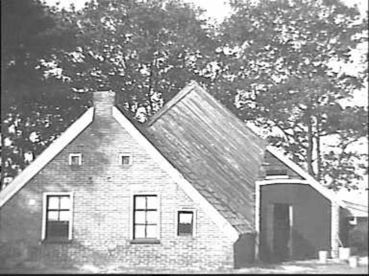
What One Remaining Barrack Holds
Only a single barrack still stands at the site. It is not much - a long, low wooden building with small windows, the kind of structure that could be assembled or dismantled in a week. But it carries the full weight of what happened there. The same wood that sheltered Depression-era workmen heard the German guards who arrived in 1942. The same floor was crossed by the families from Amsterdam who would not see Amsterdam again. The Dutch government recognizes Kamp de Beetse as a Holocaust site, and the surrounding village of Sellingerbeetse is listed in the Wikipedia category of Holocaust locations in the Netherlands. There is no museum complex here, no large memorial visitor center - just the building, the field around it, and the memory.
Opwaarts, Built in 1925
A decade before the camp, the village built a different kind of building. In 1925 the Dutch Reformed Church commissioned Opwaarts! - the name means Upwards! and the exclamation point is part of it - in the style of the Amsterdam School. The Amsterdam School was a Dutch architectural movement of the early twentieth century characterized by sculptural brickwork, decorative iron details, and flowing organic forms. Finding it in a village this small is unusual; Amsterdam School buildings are far more common in the capital city that gave the movement its name. Opwaarts! is no longer a working church. Today it serves as a cultural venue used for exhibitions and other community events, its 1925 brickwork still standing on the same small plot.
The Lake That Excavators Made
Just outside the village lies the Sellingerveld, an area of woods, heath, and water known as the field of Sellingen. Its centerpiece is the Beetserplas, called Beetser koeln in the Gronings dialect, a lake that did not exist a century ago. It formed when intensive excavation - probably for sand or peat - left a deep pit that filled with groundwater. The lake is now a recreation area with a camping site nearby. People swim there in summer and walk the perimeter year-round. The transformation is the same kind of accidental landscape-making that produced lakes across much of the northern Netherlands: industrial work leaves a hole, the water table fills it, and over time the result becomes indistinguishable from a natural feature.
210 People Now
Today the core village has about 210 residents. Including the surrounding countryside the population rises to roughly 760. Sellingerbeetse lies five kilometers southwest of Sellingen and eight kilometers north of Ter Apel, in the southern part of the Westerwolde municipality formed by the 2018 merger that consolidated Vlagtwedde and Bellingwedde. It is small. The 2018 municipal reorganization did not change much about daily life here, which still revolves around farming, the lake, and the occasional cultural event at Opwaarts! The single remaining barrack on the edge of the village holds the difficult part of the village's history; the lake and the church hold the rest.
From the Air
Located at 52.9308 N, 7.0797 E in the Westerwolde municipality of Groningen province, Netherlands. The Beetserplas lake is visible from the air as a small body of water surrounded by woods and fields. Nearest airport is Groningen Airport Eelde (EHGG), about 55 km northwest. Bremen Airport (EDDW) is about 130 km east. The German border lies about 10 km east. The village sits in flat agricultural country with the Sellingerveld nature area immediately south. Best viewed at low to medium altitudes in clear conditions.
Nearby Stories
- Dollart 4.3 km away
- St. Walfriduskerk 6.7 km away
- Meppen 7.5 km away
- 2011 CPISRA Football 7-a-side World Championships 7.6 km away
- Friesoythe 8.7 km away
- Hoogeveen 15 km away
- Quakenbrück 16 km away
- Lordship of Gödens 29 km away