
Sha Tin Pass
Six hundred people crossed Sha Tin Pass every day in 1904. A survey that year captured what the pass actually was: not a scenic route but a working corridor, 280 of those daily crossers carrying goods on their backs or on shoulder poles. Much of what they carried was fresh fish from Tolo Harbour, bound for the markets of Kowloon City. The pass between Temple Hill and Unicorn Ridge was, at that point, the only way to get from Kowloon to Sha Tin without going around by boat. Everything that needed to move between the two places — fish, produce, people, news — came through this narrow gap in the hills.
The Gap Between Two Worlds
Sha Tin Pass sits at the border of two administrative districts: Sha Tin District to the north, inside the mountain, and Wong Tai Sin District to the south, at the foothill. The line between them runs through the pass itself, marked today by Tsz Chuk Pavilion. The hills on either side — Temple Hill and Unicorn Ridge — are part of Lion Rock Country Park, which presses in close on the Kowloon side. The pass is also known as Sha Tin Au, the Cantonese word for a mountain gap. Its position north of the densely built residential district of Tsz Wan Shan places it at the edge of Hong Kong's urban mass, a point where the city abruptly ends and the country park begins.
The Fish Carriers' Road
The British Army constructed Shatin Pass Road in the 19th century, improving what had been a footpath into something more passable. But the road reached the pass and some villages beyond it without extending all the way to the town of Sha Tin itself — which meant the trade flow that the 1904 survey recorded was still largely on foot. Those fish carriers from Tolo Harbour represent a now-vanished economy of human porterage that once connected Hong Kong's fishing waters with its urban markets by the most direct route available: up and over the hills. When roads and eventually the railway changed the geography of movement, the pass's commercial function disappeared, leaving behind its physical form and a set of trails.
Where the Trails Meet
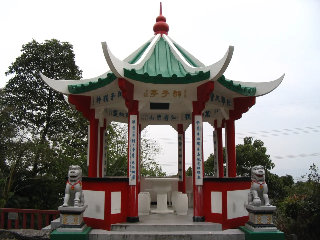
Today Sha Tin Pass is most visited as a hiking destination — specifically as the point where two of Hong Kong's great long-distance trails diverge. Stage 4 of the Wilson Trail and Stage 5 of the MacLehose Trail split at the pass, each heading off into different terrain. The Wilson Trail runs north to south across Hong Kong Island and the New Territories; the MacLehose Trail traverses the New Territories east to west. Where they briefly coincide and then separate, Sha Tin Pass provides the junction. Hikers arrive from both directions, often stopping at the pavilions near the top before descending into whichever district awaits below. The Lions Pavilion near the summit serves as a rest point and meeting place.
Villages Above the City
North of Sha Tin Pass, two small villages have persisted in relative isolation from the urban growth below: Mau Tat and Shap Yi Wat. Their position above the pass, tucked against the hillside, kept them outside the development pressure that reshaped most of Sha Tin New Town from the 1970s onward. Sheng Kung Hui, the Anglican Church in Hong Kong, maintains a Diocesan Youth Retreat House at the pass — one of the few permanent built structures in this otherwise trail-and-forest terrain. It occupies a spot that for centuries meant transition: from city to country, from the urban grid of Kowloon to the valley opening out toward Sha Tin's wider sky.
From the Air
Sha Tin Pass sits at approximately 22.355°N, 114.199°E in the hills between Kowloon and Sha Tin, inside Lion Rock Country Park. From the air at 3,000–5,000 feet, the pass is identifiable as the lowest notch in the ridge running east from Lion Rock. The distinctive profile of Lion Rock itself — the silhouette that defines Hong Kong's self-image — lies to the west-northwest. The Shing Mun River and the flat valley floor of Sha Tin New Town open up immediately to the north, while the densely packed residential towers of Tsz Wan Shan press in from the south. The nearest airport is Hong Kong International Airport (VHHH) approximately 30 km to the west-southwest. The pass is best appreciated from lower altitudes, where the ridge topography and the abrupt transition from urban density to country park are clearly visible.
Nearby Stories
- Chapel of St. Francis Xavier 3.5 km away
- Cuiheng 4.1 km away
- 2015 Shenzhen Landslide 16 km away
- Shunde 31 km away
- Wanshan Archipelago 37 km away
- Nanxiong Formation 96 km away
- Heyuan 149 km away
- Checheng Fu'an Temple 629 km away