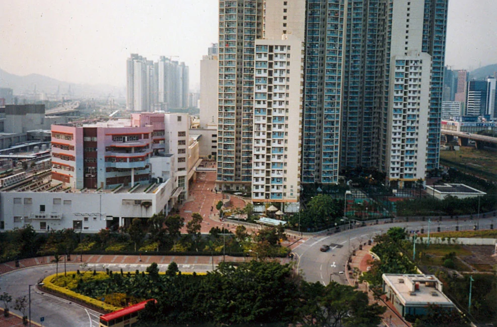

Sham Shui Po Ferry Pier
Three piers, three generations, one neighbourhood. Between 1919 and 1992 the waterfront at Sham Shui Po was never without a ferry landing, even as the shore itself shifted outward decade by decade under Hong Kong's relentless campaign of land reclamation. Where the original wooden pier stood at the foot of Nam Cheong Street, the sea no longer exists. Where the replacement concrete pier opened in July 1931 — built because the government considered wood inadequate for the growing district — the harbour is a memory. Where the third-generation pier stood near Yen Chow Street, moved in 1979 to make way for the Nam Cheong Estate, the MTR now runs underground. The Sham Shui Po Ferry Pier is one of those places whose absence reveals exactly what it once was: an artery, daily and irreplaceable, connecting a dense working neighbourhood to the rest of the city.
Where the Boats First Came
The pier's story begins on 1 January 1919, when the Kau Lung Sze Yeuk Kai Fong Ferry Company inaugurated service between Sham Shui Po and West Point — the area around Eastern Street on Hong Kong Island — carrying the district's workers and families across the harbour. The company name translates roughly as 'Kowloon Four Agreements Neighbourhood Ferry Company,' a reminder that these early services were community ventures as much as commercial ones. By 1924 the route had grown important enough to attract the Hongkong and Yaumati Ferry Company (HYF), which took over operations and extended service to Central. The wooden pier at Nam Cheong Street handled this growing traffic for a decade before the government decided it was time for something more permanent.
Concrete and Connection
In 1929 the Hong Kong Government commissioned a reinforced concrete replacement. The new structure opened in July 1931 at the junction of Tung Chau Street and Pei Ho Street — a corner that still pulses with life today. From this pier, ferries ran to Central, Sheung Wan, and Macau, threading between junks and lighters across a harbour that was, in those decades, Hong Kong's highway. The 1931 report of the Director of Public Works notes the opening as routine infrastructure, but for the people of Sham Shui Po — the factory workers, market vendors, and immigrants from rural Guangdong who crowded the tenements just behind — a reliable and affordable crossing was anything but routine. It was how life worked.
Shifting Ground
The third and final pier arrived in 1979, moved to the shore near Yen Chow Street to accommodate both land reclamation and the construction of Nam Cheong Estate. Hong Kong was reshaping itself at speed, and the waterfront was always the first casualty. The same year, a typhoon destroyed the Wilmer Street Ferry Pier in Sheung Wan, ending the cross-harbour connection to that neighbourhood. The Macau service lasted until 1989, when the Hong Kong China Ferry Terminal in Tsim Sha Tsui absorbed the route. The final service — to Central — was discontinued in 1992, and the pier closed. The bus terminus attached to it kept serving the district until 1999, when a replacement opened on Tonkin Street.
What Came After
Fu Cheong Estate now occupies the site of the old bus terminus. The waterfront where generations of Sham Shui Po residents boarded ferries to work and back has been fully reclaimed, built over, absorbed into the grid. The MTR Nam Cheong station — opened in 2003 — stands in the footprint of the last pier, offering faster crossings to the city in air-conditioned cars. It is efficient and convenient and it erases almost entirely the particular texture of a commute that involved standing at a railing with the harbour wind coming off the water, watching Hong Kong Island grow closer. A bus route list is all that survives in the record: dozens of KMB routes that once terminated here, carrying people from Tsuen Wan and Tuen Mun and the public estates of Kwai Chung to this now-vanished edge of the water.
From the Air
Sham Shui Po Ferry Pier stood at approximately 22.3267°N, 114.154°E on the western Kowloon shore of Victoria Harbour. Approaching from the east along the Kowloon waterfront at 1,500–2,000 feet, the former site sits just west of where the MTR Tsuen Wan Line curves beneath Nam Cheong. The distinctive high-rise blocks of Fu Cheong Estate mark the approximate location. Hong Kong International Airport (VHHH) lies 22 km to the west; Kai Tak (the former airport, now a cruise terminal, VHXX historically) is 4 km to the east across the peninsula. Victoria Harbour is immediately to the south. Visibility across the harbour is typically excellent in winter and hazy in summer.
Nearby Stories
- Chapel of St. Francis Xavier 3.5 km away
- Cuiheng 4.1 km away
- 2015 Shenzhen Landslide 16 km away
- Shunde 31 km away
- Wanshan Archipelago 37 km away
- Nanxiong Formation 96 km away
- Heyuan 149 km away
- Checheng Fu'an Temple 629 km away