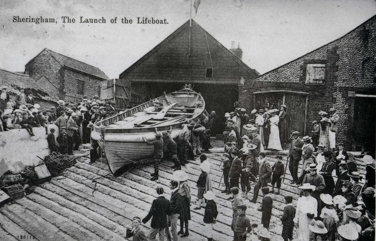

Sheringham Lifeboat Station
There is no harbour at Sheringham. There never has been. The town sits on an open beach on the north Norfolk coast, with nothing between the fishing boats and the North Sea. In the late 1800s, upwards of 200 boats worked from this shore. When the sea turned, they were on their own — unless someone launched a lifeboat to meet them. The question of who would pay for that boat, and who would crew it, was answered here in 1838 by Mrs Charlotte Upcher of Sheringham Hall, who funded the town's first lifeboat out of her own pocket.
The Upcher Gift
The Upcher family of Sheringham Hall were the dominant force in the local economy, and they understood what the sea cost the fishing community. As the fishing industry grew through the early 19th century, so did the loss of life offshore. The Upchers donated money to build the first boathouse in 1838 — a two-storey brick structure on the seafront, with the boat hall on the ground floor and a room above that served as both lecture space and reading room, where fishermen could rest and educate themselves in their time off the water.
The first boat, named Augusta, was a 33-foot non-self-righting vessel funded privately by Charlotte Upcher. It served the town until 1894. By then the Royal National Lifeboat Institution, established separately at Sheringham in 1867, had taken over the primary rescue role. The private service ran in parallel until 1935, when it was finally wound up. Between them, the two services covered nearly a century of continuous operation on one of Britain's most exposed coastlines.
Four Boats, One Town
What makes Sheringham unusual among British lifeboat communities is what it kept. Most decommissioned lifeboats were broken up, sold, or simply lost. Sheringham held on to its. The town is reputed to be the only place in the world that has four of its original lifeboats still preserved.
Three are held by the Sheringham Museum Trust: the J.C. Madge (1904–1936), a pulling and sailing lifeboat; the Foresters Centenary (1936–1961), the town's first motorised lifeboat; and the Manchester Unity of Oddfellows (1961–1990), an Oakley Class vessel and the last offshore boat stationed here. A fourth is displayed in the former lifeboat shed. Together they form an accidental maritime museum, a record of how rescue technology evolved across ninety years of service on a coastline with no shelter and no margin for error.
No Harbour, No Ramp
Because Sheringham has no harbour, lifeboats have always been launched by tractor from the beach — a slow, exposed, and physically demanding process that requires crew and equipment to be in place before conditions deteriorate further. Fishing boats are hauled up the same beach. This is not a managed port. It is a working seafront where the relationship between people and water has always been direct and unglamorous.
Since 1992, with all-weather lifeboats stationed to the east at Cromer and to the west at Wells-next-the-Sea, Sheringham has operated an inshore lifeboat, The Oddfellows. The station covers the coastal gap between its neighbours, a stretch of shore that has no natural harbour for many miles in either direction. The area served by Cromer and Sheringham together represents one of the longest exposed runs of coastline in England.
A Station at Risk
In December 2024, engineers undertook a full structural survey of the current station building, which was constructed in 1936. When the results were published, they raised a serious concern: the building may be at the end of its lifespan. A second report noted that the cliff immediately behind the station may also be structurally unsafe. In February 2025, RNLI activity at the station was suspended entirely while the situation was assessed.
The station has faced the erosion of the north Norfolk coast for nearly ninety years. That the cliff itself might now be retreating toward the building is, in its way, a fitting summary of what this coastline does: it gives nothing permanently. Every structure here, every boat, every harbour wall, exists in negotiation with the sea. The people of Sheringham have been conducting that negotiation since before anyone thought to write it down.
From the Air
Sheringham Lifeboat Station is located at 52.9459°N, 1.2026°E at the western end of the town promenade on the north Norfolk coast. From the air at 1,500–2,500 feet, the station is identifiable at the seafront, west of the main town. Beeston Bump, the prominent glacial hill to the east, is a useful navigation reference. Norwich International Airport (EGSH) is approximately 26 miles south. Wells-next-the-Sea is approximately 15 miles west along the coast.
Nearby Stories
- Castle Acre Castle and Town Walls 3.5 km away
- Brancaster 5.8 km away
- City of Norwich Aviation Museum 6.8 km away
- HMS Cobra 21 km away
- Alford Windmill 35 km away
- Battle of Lowestoft 83 km away
- SM U-97 95 km away
- Battle off Texel 119 km away