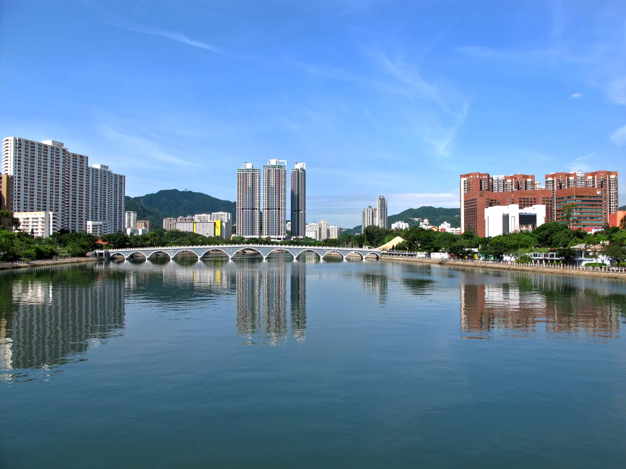

Shing Mun River
In the 1970s, engineers looked at a shallow tidal bay called Tide Cove on the southern shore of the New Territories and decided to fill it in. Sha Tin New Town rose on the reclaimed land, eventually housing hundreds of thousands of people where oyster catchers once waded. The Shing Mun River, which had originally emptied into the bay after flowing down from Needle Hill, needed to go somewhere. The solution was a 7-kilometre, 200-metre-wide artificial channel cut through the middle of the new town, directing the river northward to Tolo Harbour. The channel that resulted is both utilitarian and quietly remarkable: a concrete-banked urban waterway that carried so much pollution in the 1980s that nothing lived in it, and that now — after twenty years of remediation — hosts rowing clubs, dragon boat festivals, and the occasional fish.
Engineering a New Course
The original Shing Mun River was a natural stream fed by the hills around Needle Hill and Grassy Hill, winding down through the valley before debouching into Tide Cove (Sha Tin Hoi). When Tide Cove was reclaimed in the 1970s to build Sha Tin New Town, the bay's other tributaries — rivers that had found their own way to the sea — were incorporated into the new drainage system as concreted nullahs, essentially open concrete channels that function as tributaries of the extended Shing Mun River. Three major ones feed the main channel today: Tai Wai Nullah, Fo Tan Nullah, and Siu Lek Yuen Nullah. The channel runs from the Tai Wai area through Sha Tin's town centre to Tolo Harbour, roughly 7 kilometres of engineered waterway flanked on both sides by the towers, shopping malls, and housing estates of one of Hong Kong's densest new towns. Several bridges cross it — the Banyan Bridge on Fo Tan Road, Dragon Bridge on Sha Tin Road, Lion Bridge on Lion Rock Tunnel Road, Sand Martin Bridge on Sha Tin Rural Committee Road, and the pedestrian Lek Yuen Bridge.
The Years Nothing Lived Here
By the 1980s, the Shing Mun River had become a case study in what happens when a rapidly industrializing city discharges waste without adequate treatment. Livestock farms, factories, commercial kitchens, and domestic drains all contributed to the load. Measured in population equivalents — the amount of organic pollution that would be generated by a given number of people — the river's burden reached 160,000 by the decade's peak. Dissolved oxygen in the water dropped so low that aquatic life became essentially impossible. Fish and invertebrates disappeared. The channel smelled. It was visible evidence of the environmental cost of the economic development that had transformed the New Territories in a generation. Improvement began slowly in the late 1980s and accelerated through the 1990s. The Water Quality Index for the river moved from bad to good after 1993. Bioremediation and dredging works started in 2001, and sulphide levels and E. coli counts dropped sharply. The fish came back.
Water Sports and Torch Relays
The cleaned-up Shing Mun River turned out to be well-suited to competitive rowing. The channel's straight, 2,000-metre stretches meet the international standard length for regattas, and three boathouses operate along the river at Yuen Wo Road and Shek Mun. Dragon boat racing has been held on the river every year since 1984, tied to the Dragon Boat Festival. In 2008, the Shing Mun River Channel hosted a section of the Hong Kong leg of the Summer Olympics torch relay — an unlikely distinction for a waterway that had been biologically dead two decades earlier. Pedestrian promenades run continuously along both banks, making the riverside a popular route for cyclists, joggers, anglers, and people simply walking the length of Sha Tin without entering the shopping centres that flank it. Chinese Banyan trees and cotton trees have been planted along the banks, their spreading canopies providing shade along what would otherwise be a sun-exposed concrete corridor.
Pollution's Persistence
Recovery has not been complete. Tolo Harbour, into which the Shing Mun River flows, remains polluted, and during high tide the harbour's contaminated water backflows into the river channel, partially undoing the work of the cleaner upstream water. The 2015 pollution of the Fo Tan Nullah illustrated the ongoing vulnerabilities of the system: in December of that year, the tributary turned an electric blue, then shifted to partly grey and turquoise. Residents suspected illegal dumping of pigments or industrial waste. Investigators from the Environmental Protection Department and the Drainage Services Department could not determine the cause. Tests commissioned by a district councillor in late 2015 found E. coli levels in the Shing Mun River running 1,300 times the government's acceptable standard, and water acidity and suspended solids at three times the standard. In November 2016, the real estate investment trust Link REIT was fined HK$15,000 for illegally discharging wastewater from the Mei Lam Shopping Centre into the river. The fine was modest; the violation was not unusual. The river's second life is genuine, but it remains an urban waterway in one of the world's most densely built environments, and the pressures on it have not gone away.
From the Air
The Shing Mun River channel lies at approximately 22.374°N, 114.166°E, running roughly north through the Sha Tin district of Hong Kong's New Territories before emptying into Tolo Harbour. From altitude at 5,000 to 8,000 feet, the channel is a clear linear feature cutting through the dense residential development of Sha Tin — a straight blue-grey line in a sea of high-rise towers. Tolo Harbour appears at the northern end of the channel, with Ma On Shan's green ridgeline beyond it. Nearest airport: Hong Kong International (VHHH), approximately 35 km to the southwest. The University of Hong Kong's Ma Liu Shui campus on Tolo Harbour's western shore is a useful visual landmark near the river's outlet.
Nearby Stories
- Chapel of St. Francis Xavier 3.5 km away
- Cuiheng 4.1 km away
- 2015 Shenzhen Landslide 16 km away
- Shunde 31 km away
- Wanshan Archipelago 37 km away
- Nanxiong Formation 96 km away
- Heyuan 149 km away
- Checheng Fu'an Temple 629 km away