Bengawan Solo: Java's River of Deep Time
In 1891, a Dutch anatomist named Eugene Dubois was digging along a riverbank in central Java when he pulled a skullcap and a femur from the volcanic sediment. He called the creature Pithecanthropus erectus - 'upright ape-man' - and it became the first early human fossil ever found outside of Europe. The river that yielded this discovery is the Bengawan Solo, and it has been shaping Java far longer than any human civilization. Stretching approximately 600 kilometers from the volcanic highlands near Surakarta to its engineered delta on the Java Sea, the Solo is Java's longest river, its most important agricultural artery, and a geological archive that records a million years of human presence. In Old Javanese, bengawan simply means river. But there is nothing simple about this one.
A River Older Than the Sea
The Solo River is a remnant of a vast drainage system that once crossed a landmass called Sundaland, a continental shelf that connected Java, Sumatra, and Borneo during the last Ice Age. When sea levels rose and Sundaland drowned, the Solo was cut off from its sister rivers - the Musi in Sumatra, the Kapuas in Borneo - and became an island waterway, confined to Java. But the river remembers its continental past in its scale: 600 kilometers is enormous for an island river, and its drainage basin covers a significant portion of eastern Java. The volcanic highlands that feed it - including the slopes around Mount Lawu - deposit rich, fertile soil downstream, creating some of the most productive rice land in Southeast Asia. For centuries, the Solo was the highway that connected Java's interior rice paddies to the port cities on the northern coast, with shallow-draft boats carrying the grain that made Java a prize in the spice trade.
The Skull in the Riverbank
Eugene Dubois came to the Dutch East Indies in 1887 specifically to find the 'missing link' between apes and humans - an audacious goal that most of the scientific establishment considered quixotic. He chose Java because Alfred Russel Wallace had noted the island's rich fossil deposits. After years of searching, Dubois found what he was looking for along the Solo River near the village of Trinil: a skullcap with a brain case larger than any ape's, and a femur that showed its owner had walked upright. He named it Java Man. The discovery was controversial for decades, but it opened the door to understanding that human evolution had unfolded across Asia as well as Africa. The Solo River valley continued to yield hominid fossils - the site at Sangiran, also along the Solo's tributaries, has produced remains dating from 100,000 to 1.5 million years ago and is now a UNESCO World Heritage Site. The river had been burying and preserving the evidence of human ancestry in its volcanic sediment for longer than Homo sapiens has existed.
Colonial Engineering and a Diverted Delta
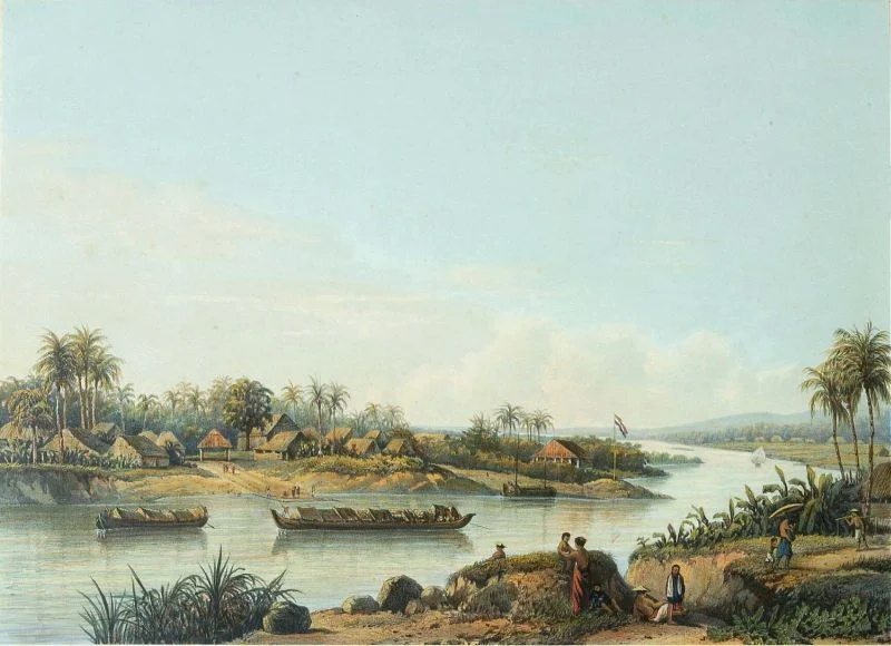
By the late nineteenth century, the Solo River was creating a problem for the Dutch colonial government. Centuries of volcanic silt flowing downstream had built up the river's delta in the Madura Strait, and the accumulating sediment was threatening to choke the shipping lanes into Surabaya, the colony's most important port. The Dutch response was characteristically direct: in the 1890s, they built a canal that diverted the Solo's mouth away from the Madura Strait and into the Java Sea, rerouting the river's final kilometers through the Gresik Regency. The canal still alters the river's course today. Under colonial rule, the Solo basin was also transformed by the Cultivation System, which replaced subsistence rice farming with cash crops - coffee, sugar, and cotton - forced upon Javanese farmers for export. The river that had sustained local agriculture for centuries became an instrument of extraction, its fertile bottomlands conscripted into the colonial economy.
A Song Across Asia
In 1940, a young Javanese musician named Gesang Martohartono composed a kroncong song about the river that flowed past his hometown of Surakarta. 'Bengawan Solo' describes the river's journey from the mountains to the sea with a gentle, wistful melody that captured something essential about Javanese life - the rhythm of water, the patience of rice cultivation, the passage of time. The song became a sensation, first in Java, then across Japanese-occupied Southeast Asia during the war, and eventually throughout East Asia. It remains one of the most recognizable songs in Indonesia and is widely known in Japan, where it was popularized during and after the occupation. Gesang, who lived to the age of 92, once said he wrote it in a single afternoon. The river, apparently, had been composing it for much longer.
The Living River
Today the Bengawan Solo faces the pressures common to major rivers in densely populated regions: pollution, flooding, sedimentation, and competing demands from agriculture, industry, and urban water supply. A centralized river basin management authority oversees both the Solo and the neighboring Brantas River, working to balance flood control, irrigation, and water quality. Several dams regulate the flow, including the Gondang Dam on a tributary in the Lamongan Regency, completed in the 1980s. The river still irrigates vast stretches of rice paddy, and its lower reaches pass through the flat coastal plains of East Java before emptying into the Java Sea near the town of Sidayu. From the air, the Solo is a brown-green ribbon threading through a patchwork of emerald rice fields, its meanders tracing the same path they have followed since before the first hominids walked its banks.
From the Air
Located at approximately 6.85S, 112.58E near its delta on the Java Sea coast of East Java, Indonesia. From altitude, the Bengawan Solo is visible as a wide, meandering brown river cutting through bright green rice paddies across the flat coastal plain of East Java. The river's engineered delta near Sidayu is visible where the channel meets the Java Sea. Surabaya and its port facilities are visible to the east across the Madura Strait. Nearest major airport is Juanda International Airport (WARR) in Surabaya, approximately 40 km to the east. The river can be traced inland toward the volcanic highlands around Surakarta, passing through Bojonegoro, Ngawi, and the paleoanthropological sites at Sangiran.
Nearby Stories
- HNLMS Kortenaer: A Destroyer's Last Two Minutes 7.5 km away
- Madura: Salt, Bulls, and the Island That Emptied Itself 11 km away
- Giri Kedaton: Java's Pope on the Hilltop 16 km away
- Where Teak Meets Oil 32 km away
- Cepu Forest Railway 75 km away
- Where Three Worlds Meet: The Great Mosque of Sumenep 77 km away
- Eighteen Minutes Over Bawean 110 km away
- Forty Hours in the Masalembo Sea 177 km away