.jpg)
Tabin Wildlife Reserve
Somewhere in the 122,539 hectares of Tabin Wildlife Reserve, a Sunda clouded leopard is watching something you cannot see. This is the largest predator in the reserve, and you will almost certainly not find it. What you may find, at the mud volcanoes where animals gather to lick mineral salts from the earth, are the creatures that make Tabin one of the most significant wildlife refuges in Southeast Asia: Borneo elephants wading through the muck, their ears flapping in the humid air, alongside the ghosts of species the modern world is rapidly losing.
The Big Three
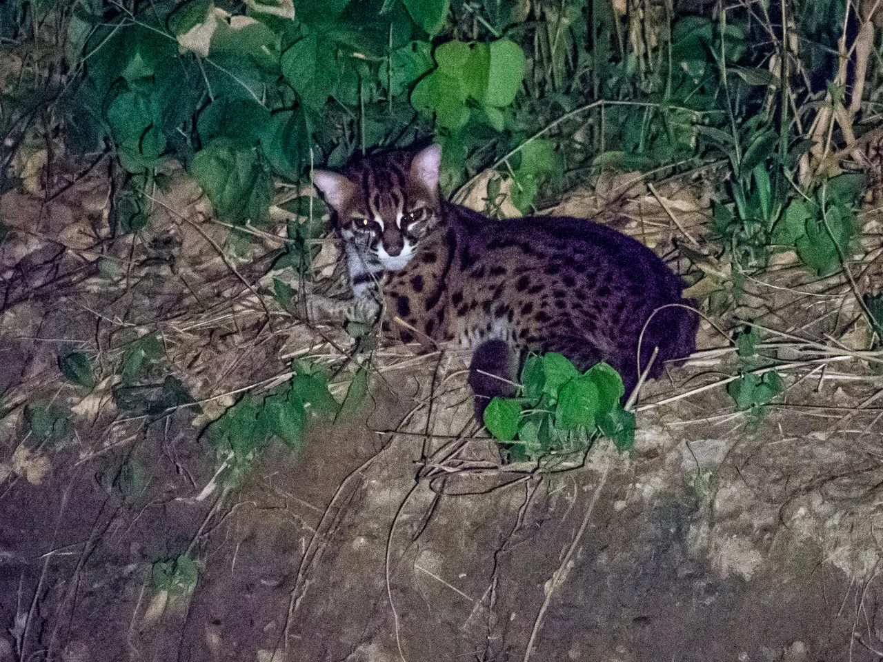
Tabin holds all three of Sabah's largest mammals. The Borneo elephant, a smaller and more gentle-faced cousin of the Asian elephant, maintains a population estimated at 120 to 300 animals as of a 1993 survey. The Bornean rhinoceros, a subspecies of the Sumatran rhinoceros, survives here in numbers so small that each individual matters to the species' survival. And the tembadau, a wild cattle also known as the banteng, roams the forest floor in herds that rarely show themselves to human visitors. Seven of Sabah's eight primate species inhabit the reserve as well, including orangutans and proboscis monkeys, though both occur in relatively low numbers. The roster of birds spans 42 families and 220 recorded species. The forest is alive, and most of it is hidden.
Lowland Forest on a Peninsula
The reserve occupies a rectangular block of land on the Dent Peninsula, northeast of Lahad Datu, south of the lower Segama River, and north of the Silabukan Protection Forest Reserve. The terrain is covered with lowland dipterocarp forest, the tall-canopied tropical rainforest that once blanketed much of Borneo's coastal lowlands. Dipterocarp forests are named for their dominant tree family, whose members produce winged seeds that helicopter down from heights that can exceed 60 meters. These forests are among the most complex terrestrial ecosystems on Earth, layered from root buttresses to emergent crowns, each stratum hosting its own community of animals, insects, and epiphytes. What makes Tabin particularly valuable is that much of Sabah's lowland forest has been converted to oil palm plantations. Tabin is one of the places where the original landscape endures.
Mud, Salt, and Wildlife Watching
The reserve's natural mud volcanoes are among its most distinctive features. These geological oddities push mineral-rich mud to the surface, creating clearings in the forest where animals come to supplement their diets with salts and minerals otherwise scarce in the rainforest ecosystem. For wildlife, the mud volcanoes are essential gathering points. For visitors, they are the rare places where the forest reveals its inhabitants rather than concealing them. Since 1998, when the Malaysian government privatized ecotourism programs at Tabin, increasing numbers of visitors have come for jungle trekking, wildlife viewing, and photography. The reserve is accessible via sealed and gravel roads from Lahad Datu, a drive of about 40 minutes.
A Reserve for the People of Sabah
Created in 1984 to preserve Sabah's disappearing wild animals, Tabin operates under a dual custodianship. The Sabah Wildlife Department manages the animals. The Sabah Forestry Department is responsible for the trees. The land itself belongs to the people of Sabah, held under government ownership with reserve status. This arrangement reflects a broader truth about conservation in Borneo: protecting wildlife means protecting forest, and protecting forest means navigating the competing pressures of timber extraction, plantation agriculture, and the economic aspirations of a growing population. Tabin exists because someone decided, in 1984, that this particular patch of lowland forest was worth more standing than felled. Every elephant that drinks at a mud volcano validates that decision.
From the Air
Located at approximately 5.27N, 118.65E on the Dent Peninsula in eastern Sabah. The reserve appears from the air as a large, unbroken block of dark green forest contrasting sharply with the surrounding oil palm plantations. Nearest airport is Lahad Datu Airport (WBKD), approximately 48 km to the southwest. The Segama River is visible along the reserve's northern boundary. Best viewed at 5,000-10,000 feet to appreciate the scale of the forest block and its contrast with the agricultural landscape.
Nearby Stories
- Gomantong Caves 9.9 km away
- Agop Batu Tulug Caves 33 km away
- Tun Sakaran Marine Park 36 km away
- Danum Valley Conservation Area 51 km away
- Sandakan Japanese Cemetery 73 km away
- Sheikh Karimul Makhdum Mosque 74 km away
- Tawi-Tawi 100 km away
- Japanese Destroyer Tanikaze 169 km away