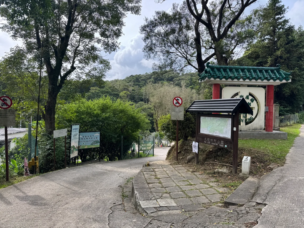

Tai Lam Country Park
The name means large forest — tai for large, lam for forest — and it delivers. Established on 23 February 1979, Tai Lam Country Park covers 54 square kilometers of hills and valleys in the western New Territories, forming a green buffer between the dense new towns of Tuen Mun to the west, Yuen Long to the north, and Kam Tin and Shek Kong to the northeast. Inside the park boundary, the Tai Lam Chung Reservoir sits entirely encircled by protected land. Tunnels pass through the hills underground. Trails branch across the ridges. The city presses against the edges, but the interior holds.
The Name and Its Landscape
The Tai Lam stream — Tai Lam Chung — gives the park and the reservoir their names. A dam built across the valley in the 1950s turned the stream into a reservoir; the park grew up around the resulting landscape of water and forested slopes. The contrast with nearby Siu Lam is implicit in the language: siu means small, tai means large. Two areas that share the same visual logic of wooded hills, one diminutive and one expansive.
Two of Hong Kong's major road tunnels pass through the park underground — the Tai Lam Tunnel and the Tai Lam railway tunnel for the Tuen Ma Line — connecting the western New Territories to the urban core without cutting across the surface. From above, the park appears unbroken. From inside a car or train passing through, the tunnel gives no hint of the forested landscape just meters overhead.
Trails That Go Somewhere
Tai Lam Country Park is traversed by some of Hong Kong's most celebrated long-distance routes. The MacLehose Trail, which runs 100 kilometers across the New Territories from Sai Kung to Tuen Mun, passes through the park. So does the Kap Lung Forest Trail, which starts from the top of Route Twisk near the Country Park Management Centre and descends through dense secondary forest toward Lam Tsuen Valley.
Route Twisk — the winding road that climbs from Tsuen Wan over the hills to Kam Tin — runs along the park's eastern edge and provides a series of barbecue and picnic sites along its length. The Shek Kong catchwater, Pat Heung catchwater, and Tuen Mun catchwater all cross the park, offering flat, shaded paths that are popular with morning walkers and families. At the So Kwun Wat catchwater, a dedicated fitness trail provides 14 sets of exercise equipment at intervals. The park is used hard, in the specifically Hong Kong way: intensively, efficiently, and with genuine enthusiasm for the outdoors compressed into whatever time the week allows.
The Reservoir at Its Heart
Tai Lam Chung Reservoir, the first built in Hong Kong after World War II, occupies the valley at the park's centre. Its construction between 1952 and 1957 required flooding several villages whose residents were relocated to Tai Uk Wai Villages; the Water Supplies Department has managed it ever since as a key piece of the city's water infrastructure. From a hiking trail on the surrounding ridges, the reservoir spreads below in irregular blue-grey curves, its islets of vegetation giving rise to the local nickname — the Thousand Island Lake of Hong Kong.
The park's protected status has kept the reservoir catchment clean. No development is permitted inside the boundary; the forested slopes filter rainwater and prevent runoff. What looks like conservation is also engineering. The country park system, which Hong Kong established from 1976 onward under the Country Parks Ordinance, treats green space and water supply as linked — protect the hills, protect the water.
Edge of the City, Edge of the Wild
Tai Lam Country Park sits at one of Hong Kong's more dramatic transitions. Tuen Mun New Town — a planned city of nearly 500,000 people — begins almost exactly where the park boundary ends to the west and south. Yuen Long presses from the north. The contrast is not subtle: high-rise towers and shopping malls on one side of the boundary, switchback trails and forested valleys on the other.
The Twisk Nature Trail near the Management Centre was designed specifically to introduce hikers to this boundary — explaining the natural environment, the history of land use, and the human pressures that country parks were created to resist. The park is not wilderness in any pure sense. Its forests are largely plantation, planted after the Japanese occupation stripped the original tree cover during World War II. But decades of growth have made them genuinely dense and quiet, and on a weekday the higher trails can feel genuinely remote despite a city of seven million people visible on the horizon.
From the Air
Tai Lam Country Park centers on approximately 22.39°N, 114.01°E in the western New Territories, about 10 km northeast of Hong Kong International Airport (VHHH). From the air, the park appears as the large block of undeveloped forested hills between Tuen Mun to the southwest and Yuen Long to the north. The Tai Lam Chung Reservoir is the prominent body of water at the park's interior. Terrain within the park rises to over 400 m; the Tai Mo Shan massif to the northeast reaches 956 m. Recommended viewing altitude is 2,500 ft or above to clear the ridge lines safely. VHHH is the primary regional airport (ICAO: VHHH).
Nearby Stories
- Chapel of St. Francis Xavier 3.5 km away
- Cuiheng 4.1 km away
- 2015 Shenzhen Landslide 16 km away
- Shunde 31 km away
- Wanshan Archipelago 37 km away
- Nanxiong Formation 96 km away
- Heyuan 149 km away
- Checheng Fu'an Temple 629 km away