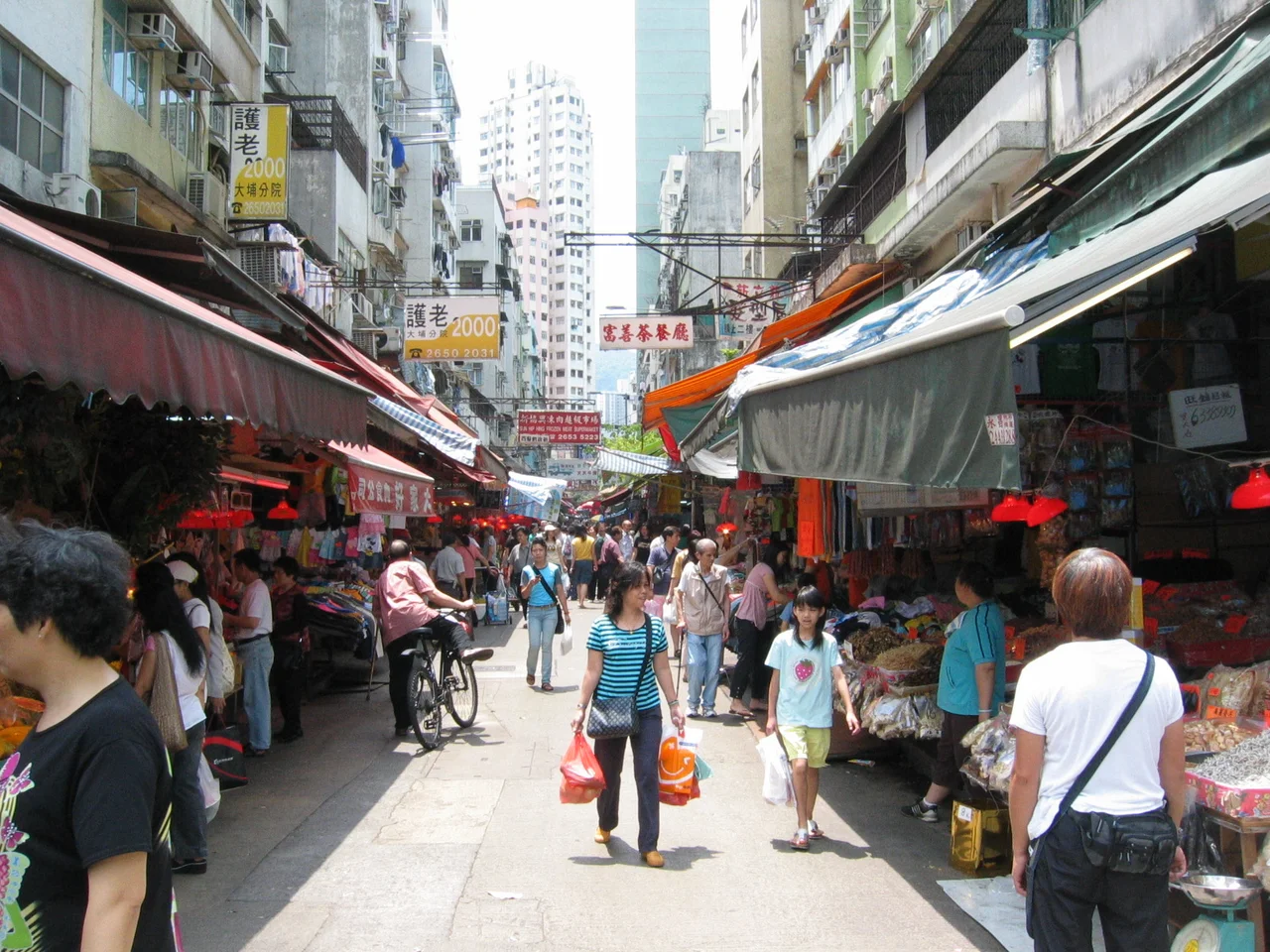

Tai Po Market
A market town that can't agree on where it is — or what it's called — is either confused or adaptable. Tai Po Market, known in Cantonese as Tai Po Hui, has been both. Its location has migrated across the northern shore of the Lam Tsuen River and back again. Its name has been claimed by at least three distinct places at different points in time. And the confusion has been genuine enough that when the government opened an indoor wet market in 2004, it managed to add yet another point of contention to an already complicated geography. None of this instability is random. It reflects the political and social history of the New Territories, where land, commerce, and clan loyalty were inseparable for centuries.
The Tang Clan and the Original Market
The first Tai Po Hui was established by the Tang clan — specifically the Tai Po Tau branch — during the Qing dynasty. The Tang family's dominance was not merely commercial; it was political. Under Qing rule, the Tang clan's market town was legally reserved for Tang traders: non-Tang villagers were explicitly forbidden to set up shops within it. This arrangement, documented in the Kangxi and Jiaqing editions of the Xin'an County Gazetteer, held for long enough to generate a countermovement. The other villages of the area organized themselves into an alliance called Tai Po Tsat Yeuk — the Tai Po Seven Alliances — and established their own rival market on the south bank of the Lam Tsuen River. They called it Tai Wo Shi: Tai Wo Market. In 1896, the alliance built a bridge connecting the two market towns. Competition, eventually, became a form of coexistence.
The Market That Became the Market
The arrival of the Kowloon–Canton Railway in 1910 shifted the balance decisively. The railway opened a flag station near the Tai Wo Shi side of the river — its station named Tai Po Market — and the new connection to Kowloon and the urban south gave the newer market a commercial advantage the original Tang market could not match. Tai Wo Shi took the name Tai Po Hui. The original Tang clan market became Tai Po Kau Hui — Old Tai Po Market. It is now known as Tai Po Old Market, or Tai Po Kau, and the area around it is a residential and commercial neighbourhood rather than an active market. The railway station itself moved further east in the 1980s, following the modernization and electrification of the line. The Four Lanes of Tai Po Market — Kwong Fuk Lane, Tai Wing Lane, Tai Kwong Lane, and Tai Ming Lane — survive in the area dating to the 1960s redevelopment.
A New Town Absorbs the Old
In 1979, the Hong Kong government designated Tai Po as a site for one of its new towns — planned satellite communities designed to relieve pressure on the densely packed urban core. The process involved reclaiming land from the Lam Tsuen River mouth and from Tolo Harbour, transforming what had been seashore and tidal flats into building plots. The first public housing estate in Tai Po New Town, Tai Yuen Estate, was completed in 1980. Today the population of Tai Po has grown to around 320,000, spread across new residential blocks and the older market area that originally gave the whole place its name. The new town was explicitly designed to incorporate the existing market rather than erase it, and that design intention shows: the older lanes of Tai Po Market still carry a different texture from the planned residential precincts around them, though the difference is narrowing.
The Name Problem, Revisited
Today "Tai Po Market" can refer to at least three things: the historic commercial area around the original Tai Po Hui; the indoor Tai Po Hui Market and Cooked Food Centre opened in 2004 on a new site (its former location redeveloped as Po Heung Estate); and the MTR station serving the area. None of these three things occupies quite the same location, and none of the boundaries — for the market, the new town, the district, the election constituency — aligns neatly with the others. This layering of names and places that don't quite correspond is not a failure of planning. It is what happens when a place grows from a Qing dynasty market dispute through colonial railways and postwar urbanization into a contemporary Hong Kong neighbourhood. Identity accumulates. It rarely simplifies.
From the Air
Tai Po Market (Tai Po Hui) sits at approximately 22.45°N, 114.16°E on the south bank of the Lam Tsuen River where it meets Tolo Harbour, in the New Territories of Hong Kong. From the air at 3,000 to 5,000 feet, the broad Tolo Harbour dominates the eastern view, with the urban grid of Tai Po New Town visible on the reclaimed land at its western head. The Lam Tsuen River valley runs south. The nearest major airport is Hong Kong International Airport (VHHH), approximately 32 kilometres to the west-southwest. Tai Po Market MTR station on the East Rail Line provides a useful ground reference.
Nearby Stories
- Chapel of St. Francis Xavier 3.5 km away
- Cuiheng 4.1 km away
- 2015 Shenzhen Landslide 16 km away
- Shunde 31 km away
- Wanshan Archipelago 37 km away
- Nanxiong Formation 96 km away
- Heyuan 149 km away
- Checheng Fu'an Temple 629 km away