
Tai Wai Village
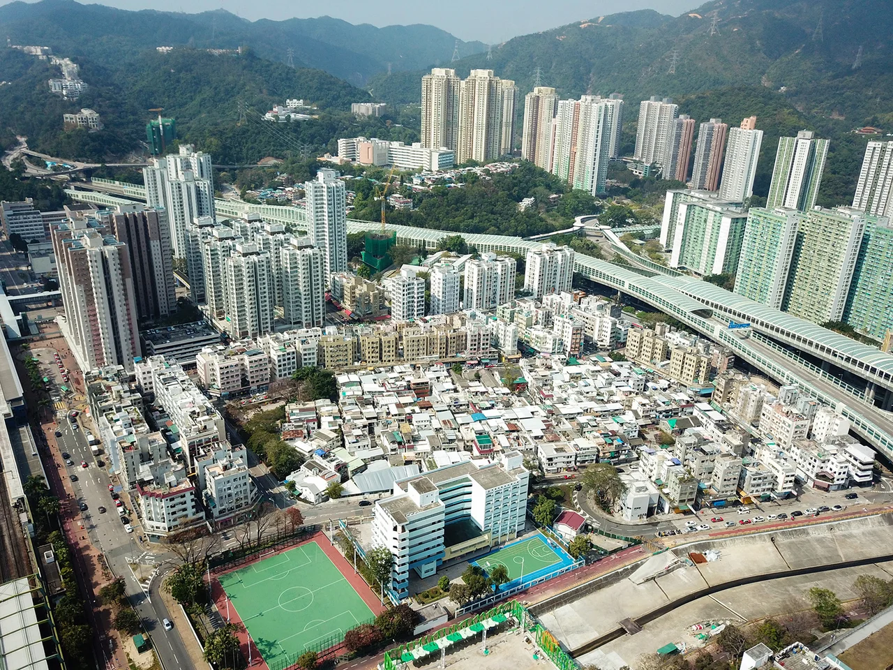
The name of the whole district comes from here. Tai Wai — "Great Enclosure" — began in this compact walled settlement in 1574, when sixteen families agreed to build their homes behind shared walls and call the place Chik Chuen Wai. As Sha Tin grew into a modern New Territories hub of railways and tower blocks, the village at its southwestern edge held its shape: the entrance gate still stands, the old houses still crowd together in rows inside, and the families whose surnames appear on founding documents still maintain their ancestral hall.
Sixteen Families Behind One Wall
When construction finished in 1574 during the Ming dynasty, Chik Chuen Wai sheltered sixteen founding clans: Wai, Chan, Ng, Yeung, Wong, Lee, Hui, Cheng, Tong, Yuen, Yau, Lam, Lok, Tam, Mok, and Choy. The settlement was rectangular, reinforced at each corner by a watch tower, and enclosed behind walls thick enough to discourage bandits and pirates who frequented the valley. By the 1911 census, 350 people lived here — 164 of them male — a figure that captures a village both old and intimate. The towers and most of the walls have since been demolished, but the entrance gate survives, now listed as a Grade II historic building by Hong Kong authorities.
A Surname Rewritten to Survive
Of the sixteen founding clans, the Wai family grew largest and claimed the most extraordinary lineage. According to tradition passed within the clan, they are descended from Han Xin, the brilliant Han dynasty general who helped Emperor Gao of Han unify China in the early second century BCE. Han Xin fell out of imperial favour when Empress Lü Zhi ordered his execution. His descendants, the story goes, fled south to escape the purge and eventually settled in what would become Sha Tin. To conceal their identity, they split the Chinese character for Han (韓) down the middle and took the right half, producing the character Wai (韋) — a new surname that literally encoded a secret history.
Origins Written in Starlight and Poetry
The village's Cheng family carried an equally storied past. Their ancestral roots traced to Xingyang in Zhengzhou, Henan — the same city from which, in Chinese legend, the Moon goddess Chang'e is said to have made her flight to the lunar palace. Xingyang was also the birthplace of Li Shangyin, one of the most celebrated poets of the late Tang dynasty, renowned for his dense and allusive verse. These Cheng ancestors who settled in Tai Wai brought that heritage — of myth, of poetry, of a particular corner of central China — into a walled village in a Hong Kong valley.
Cartography and Community Memory
The village appeared in writing at least as early as the 1688 Xinan Gazetteer, which documented settlements across the administrative district covering much of what is now the Hong Kong region. In 1866, Italian missionary Simeone Volonteri published his "Map of the San-On District," and Tai Wai appears on it — a village already old enough to anchor its section of the map. Inside the walls, the community built more than houses. A Hau Wong Temple — dedicated to a loyalist official of the Song dynasty revered across the New Territories — was originally sited outside the village walls but moved inside during the Xianfeng Emperor's reign, between 1850 and 1861. The Wai Ancestral Hall, raised sometime in the eighteenth or nineteenth century just outside the walls, remains a place of clan remembrance.
The Village in the City
Walk out of Tai Wai MTR station today and the village is almost immediately to your right, tucked against the commercial streets that have grown up around it. High-rise estates loom beyond the rooflines. But the low-slung interior of Chik Chuen Wai — houses in their historic rows, lanes between them still narrow — maintains a different scale and pace from everything surrounding it. The houses at numbers 1, 2, and 3 First Street are listed as Grade III historic buildings. This is not a village preserved under glass: people live here, ancestral halls are still visited, and the Hau Wong Temple still draws worshippers. Tai Wai Village gave its name to the district and outlasted everything that name became.
From the Air
Tai Wai Village sits at approximately 22.376°N, 114.179°E in the southwestern Sha Tin Valley, just southeast of Lion Rock. From the air, the compact rectangular footprint of the old walled settlement is visible against the surrounding high-density housing estates. The nearest major airport is Hong Kong International Airport (VHHH) on Lantau Island, roughly 30 km to the southwest. Approaching from the west at around 2,000 feet, Lion Rock's distinctive profile forms a clear landmark to the south; the Shing Mun River glints to the northeast. Sha Tin Racecourse and the elevated MTR viaduct of the Tuen Ma line are visible orientation points nearby.
Nearby Stories
- Chapel of St. Francis Xavier 3.5 km away
- Cuiheng 4.1 km away
- 2015 Shenzhen Landslide 16 km away
- Shunde 31 km away
- Wanshan Archipelago 37 km away
- Nanxiong Formation 96 km away
- Heyuan 149 km away
- Checheng Fu'an Temple 629 km away