.jpg)
Taif
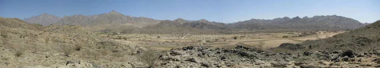
When summer temperatures on the Red Sea coast push past forty degrees Celsius, Taif is running fifteen cooler. The city sits at 1,879 meters on the slopes of the Hijaz Mountains, part of the Sarawat range, and since long before it was called the unofficial summer capital of Saudi Arabia, it was called the Garden of the Hejaz. Wheat, vines, and fruit orchards once ringed the old walled town. The goddess al-Lat was worshipped here, the lady of Taif, before Islam reached this high plateau. Today 563,282 people live in the city, and every spring three hundred million roses bloom, and 500 kilometers of Highway 15 connect the mountain to the kingdom that rose up around it.
Wajj and the Wall
Before Taif was Taif, it was Wajj. The older name survives in the Valley of Wajj, a feature of Arabian and Islamic geography that sits within the governorate. Taif literally means the circulated or encircled, after a wall the Banu Thaqif built around the pre-Islamic town. The Thaqif still live in and around the city today. In the sixth century CE the walled city held the idol of al-Lat, one of the three principal deities of pre-Islamic Arabia. Climate gave Taif an unusual role in the Hejaz economy, enough rain for wheat and orchards when nearby areas closer to the Red Sea were dry and barren. Taif and Mecca were both pilgrimage destinations, and their people traded closely. The agriculture that made Taif different has never stopped.
Ottoman and Egyptian Hands
On 17 July 1517, the Sharif of Mecca surrendered the keys of Mecca and Medina to the Ottoman Sultan Selim I. Taif went with them. The city stayed Ottoman for nearly three centuries until 1802, when forces allied with the House of Saud retook it and went on to take Mecca and Medina. The Ottoman Empire, which saw itself as the protector of the holy cities, felt the loss keenly. Sultan Mahmud II called on Muhammad Ali, the Wali of Egypt, whose forces reconquered Taif in 1813. Ottoman builders repaired the castle and military barracks in 1843, built a hükûmet mansion for government business in 1869, and later opened a post office. The fabric of Ottoman administration remained until World War I, when the Hashemite-led Arab Revolt unseated it.
The Ta'if Massacre
In July 1916 Abdullah, eldest son of Sharif Husayn ibn Ali, arrived at Ta'if with seventy men. Ghalib Pasha, the Ottoman governor of the Hejaz, dismissed him as too small a force to worry about. Abdullah secretly built his army to 5,000, cut the telegraph wires, and took the offensive. Ottoman mountain guns repelled Hashemite assaults and the two sides settled into siege. The city surrendered on 22 September 1916. But Hashemite rule did not last. In September 1924 the Saudi-sponsored Ikhwan militia under Sultan bin Bajad and Khaled bin Luwai attacked Ta'if. The defense collapsed. The king's son Ali fled with his troops, and the Ikhwan killed three hundred of his men in what became known as the Ta'if massacre. These were not abstract casualties. Three hundred soldiers, local men with families, died in a single action that a generation of Saudi history would mark as the beginning of the House of Saud's consolidation of the Hejaz.
Becoming Modern Saudi
Saudi Arabia's first public power generator was set up in Ta'if in the late 1940s. The city had been medieval when the Saudis took it. It became one of their showcases. In 1965 King Faisal inaugurated the 54-mile mountain highway between Mecca and Ta'if, the famously steep and scenic Taif-Al-Hada Road now part of Highway 15. In 1974 the Ta'if-Abha-Jizan highway, approximately 650 kilometers, opened as another part of Highway 15. By the 1991 Gulf War, Ta'if was modern enough to host the Rendon Group's broadcast network used to communicate with Kuwait during the Iraqi occupation. The Hashemite King Husayn died in the city in 1953, and King Khalid died there in 1982. Ta'if had become a place where the country's rulers summered, legislated, and eventually died.
Roses, Attar, Souq Okaz
The agricultural identity has held. Ta'if cultivates grapes, pomegranates, figs, roses, and honey, and the rose oil produced here has earned UNESCO recognition as intangible cultural heritage. The historic Souq Okaz, the pre-Islamic poetry market that was once one of Arabia's most important cultural gatherings, has been revived as a modern festival. Jebel Daka, the highest point in the governorate, is the fifth highest peak in Saudi Arabia. The surrounding mountains separating Ta'if from resort villages like Al-Hada and Ash-Shafa rise to over 2,000 meters. The climate is classified as hot desert under Köppen, with some rain in every month, more in spring and late autumn than in summer. For the governorate's fifteen municipalities and the five that administer the city itself, the future points toward a larger international airport planned for 2030 and the continued role of being where Saudis go when the rest of the country is too hot.
From the Air
Located at 21.27 N, 40.42 E in Mecca Province, Saudi Arabia. Taif sits on a raised plateau at 1,879 m, ringed by the Hijaz Mountains (part of the Sarawat range) to the west and south. Visible from altitude as an urban area on an elevated plateau, noticeably more vegetated than the surrounding Hejaz. Nearest airport: Taif International Airport (OETF). Highway 15 threads through the mountains toward Mecca (about 90 km west).
Nearby Stories
- Treaty of al-Hudaybiya 16 km away
- Jabal al-Nour 41 km away
- Al-Balad, Jeddah 64 km away
- Battle of Turubah 85 km away
- Al-Baha 124 km away
- Al-Baha Province 165 km away
- Hejaz 229 km away
- Operation Moses 283 km away