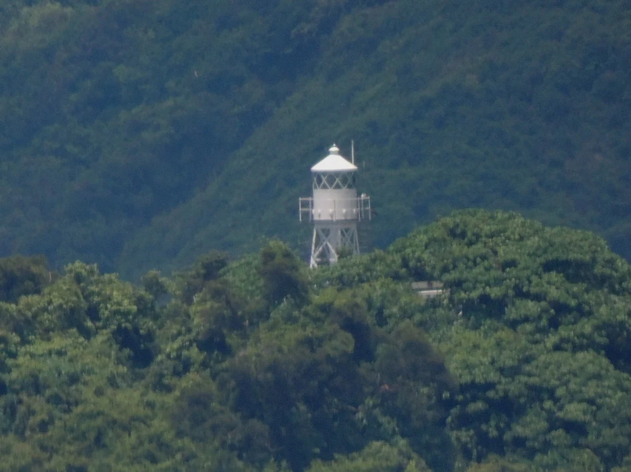

Tang Lung Chau
Ships approaching Hong Kong from the west have been threading the Kap Shui Mun strait for centuries, squeezing between Ma Wan island and the Tsing Yi shore with the currents pushing hard and the channel narrowing to less than a kilometre. On the southern tip of Ma Wan sits a small islet called Tang Lung Chau, and on Tang Lung Chau there has been a lighthouse since 29 April 1912. The light is still there. The islet is uninhabited. The lighthouse is automated now, unmanned, managed by the Hong Kong Marine Department — but the steel skeleton and its white lantern continue to mark the channel just as they did when the first keeper climbed the tower more than a century ago.
The Kap Sing Light
The lighthouse goes by two names. Officially it is the Tang Lung Chau Lighthouse; locally it is often called the Kap Sing Lighthouse, after the Cantonese name for the area. It is a skeletal steel tower, 11.8 metres high, with a white lantern mounted at the top. The steel structure and its light apparatus were manufactured in England and shipped to Hong Kong for installation — a common arrangement in the colonial-era lighthouse network, when British engineering firms supplied navigational equipment to ports across the empire.
The structure belongs to a small group of survivors. Of Hong Kong's pre-war lighthouses, only five remain standing. Tang Lung Chau's lighthouse is one of them — 1912, metal framed, still functioning after more than a century of typhoons, shipping traffic, and the upheavals of war and occupation. Its declaration as a monument in December 2000 recognised not just the building but what it represents: the persistent human effort to mark safe passage through difficult water.
An Islet Between Two Bridges
Tang Lung Chau sits within Tsuen Wan District, administered as part of the New Territories despite its position closer to Hong Kong Island than to Kowloon. The islet is wedged in a stretch of water that has become one of the most engineered maritime corridors in Asia. The Tsing Ma Bridge — one of the world's longest suspension bridges carrying both road and rail — spans the Ma Wan channel just to the north. The Kap Shui Mun Bridge connects Ma Wan to Lantau to the west. Together, they form the western gateway to Hong Kong International Airport at Chek Lap Kok.
The lighthouse predates all of this infrastructure by decades. In 1912, this passage was simply open water, with junks and steamships navigating by dead reckoning and the small reassurance of a light on the islet's rocky southern tip. The bridges came much later. The light was here first.
What Remains on the Rock
The former lightkeeper's house still stands on Tang Lung Chau alongside the tower. Together they were declared monuments by Hong Kong's Antiquities and Monuments Office on 29 December 2000, which means the site is legally protected from alteration or demolition. The house is no longer occupied — automation ended the need for a resident keeper — but it remains part of the declared ensemble, preserved alongside the tower it once supported.
The islet itself is uninhabited. No ferry stops here, no trails are publicised, and there are no visitor facilities. What Tang Lung Chau offers instead is a certain clarity: a small piece of rock in a busy strait, holding a tower that has kept its light burning through more than a century of change, tended now by circuits rather than hands, but still doing the same essential work.
A Network of Lights
Hong Kong's lighthouses were not built in isolation. They form a network laid out by colonial maritime authorities to cover the territory's complex web of channels, headlands, and approaches. Tang Lung Chau's lighthouse guards the western approach through the Kap Shui Mun. Other lighthouses cover the eastern and southern reaches: Cape D'Aguilar at the southeastern tip of Hong Kong Island, Waglan on the outermost islet of the eastern approaches, and the Green Island Lighthouse Compound at the northern entrance to the harbour.
Of these, the pre-war survivors are the rarest. Most lighthouse infrastructure in Hong Kong was damaged or destroyed during the Japanese occupation from 1941 to 1945, or replaced by modern automated equipment in the postwar decades. That five pre-war structures remain, with Tang Lung Chau's steel tower among them, is a quiet kind of luck — the right combination of structural durability, geographic isolation, and eventual recognition that what was old was also worth keeping.
From the Air
Tang Lung Chau sits at approximately 22.3401°N, 114.0624°E, at the southern tip of Ma Wan island in Hong Kong's Tsuen Wan District. The islet is clearly visible from the air, especially approaching from the west — look for the small rocky outcrop just south of Ma Wan, flanked by the Tsing Ma Bridge to the north and the Kap Shui Mun Bridge to the west. The skeletal lighthouse tower is visible at low altitude. Recommended viewing altitude is 1,000–2,000 feet in clear conditions. Nearest airport is Hong Kong International (VHHH) on Lantau, approximately 8 km to the southwest — this airspace is directly within the VHHH approach corridor, so coordinate with ATC and check NOTAMs before any low-altitude observation. The Tsing Ma Bridge at 206 metres is a significant vertical obstacle nearby.
Nearby Stories
- Chapel of St. Francis Xavier 3.5 km away
- Cuiheng 4.1 km away
- 2015 Shenzhen Landslide 16 km away
- Shunde 31 km away
- Wanshan Archipelago 37 km away
- Nanxiong Formation 96 km away
- Heyuan 149 km away
- Checheng Fu'an Temple 629 km away