
Tarskavaig
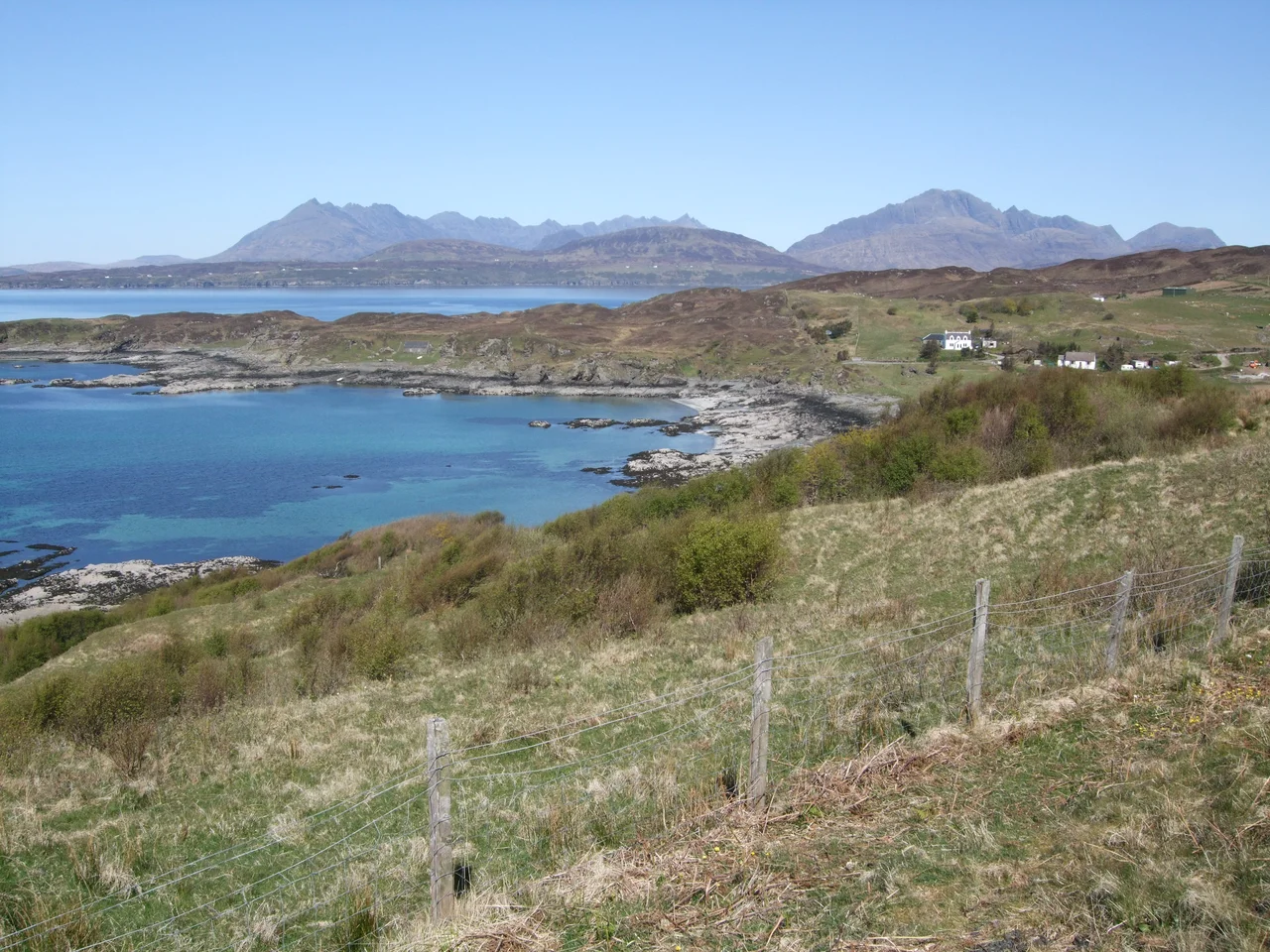
The village is called Cod Bay. Translate the Old Norse name - thorska-vagr - and that is what you get, a working description left behind by the Vikings who arrived on Skye around 875 AD and stayed long enough to leave a vocabulary. The word for cod entered Gaelic as tarsk, a loan word that bound the two languages together in the same way the people bound themselves through marriage. Twelve centuries later the village still sits in the same glen on the west coast of the Sleat peninsula, looking out across the sound at Rum, Eigg and Canna, and across the bay at what is widely held to be the finest view of the Black Cuillin from anywhere on the island.
A Village Planned for Failure
Tarskavaig as a village proper dates from 1811. Lord MacDonald, the local landowner, laid it out in thirty-one small crofts to exploit the resources of the sea and the marginal coastal land that nobody else was using. The plots were never large enough to feed a family. Tenants had to earn cash from kelping and fishing just to pay the rent. The economy depended on five activities - black cattle, potatoes, fishing, kelping, sheep - and during the 19th century all five failed or declined, one after another. The 'Year of Destitution' in 1837 was the turning point. The population had peaked at 250 that year; from then it fell steadily. When the potato blight reached Skye in 1846, a year after Ireland's catastrophe, more than 80% of the local diet came from the failing crop. Families survived only by finding work in the south.
The Last Stronghold of Gaelic
Gaelic held on in Tarskavaig long after it had faded elsewhere on Skye. In 1891, 97.6% of the village spoke Gaelic; in 1901, 95.2%, with about 19% of inhabitants speaking only Gaelic and no English. The parish averages of around 89% looked feeble by comparison. Even at the 2001 census, 54% of Tarskavaig spoke the language - against an island average of 31%. Part of the credit goes to Sabhal Mor Ostaig, the Gaelic college founded at Ostaig in 1973 just along the peninsula, which has anchored a renaissance of teaching, broadcasting and publishing in Gaelic across the Highlands. The first school in the village had opened in 1815 in croft 11 - a small building with a rusty red tin roof that still stands in the middle of the village.
The Viking Connection
Just thirteen miles north of Tarskavaig, on a peninsula called Rubha an Dunain, archaeologists recovered a clinker-built faering timber from a small loch in 2000. Carbon dating put it around AD 1100. Subsequent excavations revealed stone-built quays, a system of sluices to maintain the water level, and an artificial canal to the sea - a complete medieval harbour complex. The discovery suggests the Vikings used the coast in front of Tarskavaig as a maritime corridor for centuries, repairing and outfitting galleys in sheltered inland waters before slipping out at high tide. The connection is not just etymological. The same boats that gave Cod Bay its name probably moored within sight of the glen on their way around the Cuillin.
The View
From Tarskavaig Point on a clear evening, the Black Cuillin lift across the water in a saw-toothed line that geologists call the Cuillin Ridge and climbers call something less polite. The ridge is the eroded remains of a Tertiary volcanic complex, the most concentrated mountain wilderness in Britain, and it is at its best from this angle - across enough sea to give it scale, with the lower red granite hills setting off the dark gabbro behind. South across Gauscavaig Bay the ruins of Dunscaith Castle catch the light. It was the principal seat of the MacDonalds of Sleat in the 15th century, before the chief moved to Armadale. Now there is mostly just grass and stone and the long wash of the tide against rock that has watched the same view for a very long time.
From the Air
Tarskavaig sits at 57.11 N, 5.99 W on the west coast of Sleat, Skye's southernmost peninsula. Recommended viewing altitude 1,500-2,500 ft AGL. The village faces west across the sound to the Small Isles (Rum visible 15 nm to the southwest, Eigg slightly further south); the Black Cuillin ridge dominates the view northeast across Loch Eishort. Nearest airports: Inverness (EGPE, ~85 nm east), Oban (EGEO, ~50 nm south), Glasgow (EGPF, ~145 nm south). The terrain west of the Cuillin generates strong rotor in westerlies; cloud caps the ridge frequently. The Sleat peninsula itself is comparatively low and easier flying than the Cuillin to the north.
Nearby Stories
- Isle of Raasay Distillery 7 km away
- Ardnamurchan Lighthouse 7.2 km away
- Strome Castle 7.3 km away
- Strontian 10 km away
- Neist Point 14 km away
- Dun Telve 17 km away
- German submarine U-722 19 km away
- Tiree 33 km away