.jpg)
Tate's Cairn
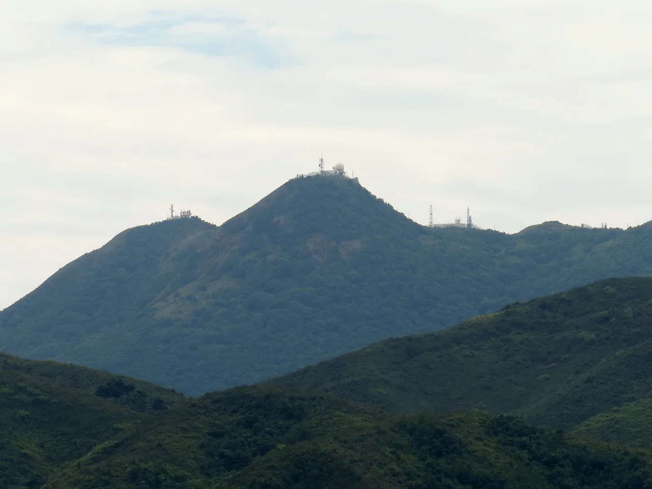
Nobody knows for certain who Tate was. The peak's English name appeared on maps in the early 20th century, but the origin is uncertain — it may trace back to George Passman Tate, an Assistant Superintendent in the Indian Survey Department who worked on government maps of Hong Kong and the New Territories in 1899 and 1900. The Cantonese name is clearer: Tai Lo Shan, meaning 'big ridge mountain,' which says what the place actually is. The mountain is 583 metres high, sits within Ma On Shan Country Park, and forms one of the Eight Mountains of Kowloon — the ridge that defines the northern skyline of the peninsula. Tate's Cairn has appeared on colonial maps since the 1860s. The English name came later. The mountain was always there.
The Ridge Above the City
The Kowloon Ridge runs northeast of the city, a chain of peaks that separates Kowloon from the New Territories. Tate's Cairn is one of eight named summits along this ridge, grouped together in Hong Kong's traditional geographic reckoning as the Eight Mountains of Kowloon. From the summit, on a clear day, the logic of Hong Kong's geography becomes visible: the densely packed urban grid of Kowloon compressed between the harbour and the hills, the New Territories opening out to the north, and Sha Tin's valley threading eastward between ridgelines.
The peak falls within Ma On Shan Country Park, which protects a broad swathe of the northeastern New Territories from development. Hiking trails cross the area, and the MacLehose Trail — Hong Kong's most famous long-distance route, running 100 kilometres from Sai Kung to Tuen Mun — passes beneath Tate's Cairn at the Stage 4 to Stage 5 transition. The mountain is a landmark for serious hikers and a familiar horizon feature for anyone who has spent time in Kowloon.
A Tunnel Beneath the Mountain
In 1991, the mountain gained a second identity. Tate's Cairn Tunnel opened that year at a cost of HK$2 billion — a twin-tube vehicular tunnel 3.9 kilometres long running north to south beneath the peak, linking Kowloon with the Sha Tin valley. The tunnel became immediately significant to Hong Kong's infrastructure: it provided a direct road connection between the Kowloon peninsula and the Sha Tin New Town that bypassed the congested Lion Rock Tunnel to the west.
The tunnel's existence beneath the mountain creates an odd double life for Tate's Cairn. On the surface, hikers walk trails through country park. Below, vehicles stream through one of the busiest road tunnels in the territory. The mountain sits on top of the modern city without being part of it — or rather, the modern city has simply extended beneath it, treating the ridgeline as a barrier to be drilled through rather than a boundary to respect.
Eyes on the Storm: Weather Radar Since 1959
Before the tunnel, before most of Hong Kong's modern infrastructure, Tate's Cairn had already been put to technical use. In 1959, the Hong Kong Observatory installed its first weather radar on the summit at approximately 580 metres above sea level. It was a Decca 41 X-band radar, with its antenna exposed to the elements — which turned out to be a problem. During heavy rain or high winds, exactly the conditions when a weather radar is most needed, the exposed antenna's effectiveness was significantly reduced.
In 1966, a second radar was added: a Plessey 43S, installed next to the original Decca unit but protected by a radome. The radome made a meaningful difference. This second radar could detect storms up to 450 kilometres away, giving Hong Kong's meteorologists the range they needed to track approaching typhoons across the South China Sea. In 1983, the original Decca 41 was replaced by a digital weather radar capable of image archival and colour-coded rainfall intensity display. In 1994, a Doppler radar — the first in Hong Kong — was installed at Tate's Cairn, providing significantly improved storm-structure resolution. The system was expanded in 1999 when a second Doppler radar was installed at Tai Mo Shan to work in tandem with the Tate's Cairn installation. The result is a layered weather monitoring network that has evolved continuously since 1959 — still anchored, in part, to this peak.
The Name and the Mountain
The uncertainty about Tate's identity is not unusual for colonial-era Hong Kong placenames. The British administration named peaks, bays, roads, and settlements after surveyors, administrators, and naval officers, often without formal documentation of the reasons. George Passman Tate, if he is the source, was a working surveyor — not a celebrated official or famous explorer, but the kind of specialist whose practical work produced the maps that made colonial governance possible. That a mountain bears his name, if it does, is a modest recognition of the sort of systematic, unspectacular technical effort that surveys of new territory require.
The mountain itself cares nothing about any of this. The ridge runs where geology put it. The peak rises to 583 metres because that is how high the rock reaches. Typhoons track toward Hong Kong because of oceanic conditions that existed long before any radar was installed to track them. Tate's Cairn is older than every name it has ever been given, and will outlast them all.
From the Air
Tate's Cairn rises to 583 metres at approximately 22.358°N, 114.218°E, forming part of the Kowloon Ridge northeast of central Kowloon. It is one of the most prominent terrain features visible from the air when approaching Hong Kong from the northeast. The weather radar installations on the summit are visible in clear conditions. The twin portals of the Tate's Cairn Tunnel are visible on the southern (Kowloon) and northern (Sha Tin) faces of the ridge. Viewing altitude of 4,000–6,000 feet puts the peak safely below while providing excellent ridgeline context. Nearest airport is Hong Kong International (VHHH), approximately 35 km to the southwest. The Kowloon ridge is a significant terrain obstacle — minimum safe altitude in this area is well above the 583-metre summit, and the summit is equipped with aviation obstruction lighting. Pilots should be aware of the multiple radio and radar installations at the peak.
Nearby Stories
- Chapel of St. Francis Xavier 3.5 km away
- Cuiheng 4.1 km away
- 2015 Shenzhen Landslide 16 km away
- Shunde 31 km away
- Wanshan Archipelago 37 km away
- Nanxiong Formation 96 km away
- Heyuan 149 km away
- Checheng Fu'an Temple 629 km away