Terborg, Germany
Terborg has a population of 105 and a name that historians cannot agree on. In a region where every place name is an etymology problem, this one is unusually fun. Was Terborg simply ter borg, East Frisian shorthand for to the castle? Or was it tri borgi, the medieval scholar Ubbo Emmius's reading, meaning three castles, because the road from Oldersum to Neermoor once threaded past three keeps: Terborg, Mittelsterborg, and Woltersterborg? Or was it Ferstenborg, the foremost castle, the way the place was listed in 1787? The honest answer is that nobody is certain. The castles are gone. The village remains, smaller than the linguistic puzzle that surrounds it, sitting on a low warft on the north bank of the Ems about 8 kilometers northwest of Leer.
Six Names and a Map
Terborg first surfaces in writing in 1357 as Burchum. By 1564 a topographic map renames it Neyeborg. Then it shows up as Torborch in 1684, Ter-Borg in 1735, and as both Terborg and Ferstenborg in 1787. That is six distinct spellings inside a few hundred years, which is unusual even by the standards of East Frisian Low Saxon, a language that has historically treated written form as a suggestion. The linguist Petra Spekker has noted that the syllable -borg can mean castle but can also mean place of refuge — a sensible double meaning in a country where the riverbanks regularly flood and a piece of higher ground might be worth defending for either reason. On a warft above the Ems, Terborg was both.
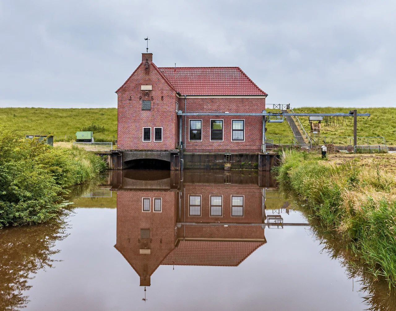
A Farming and Fishing Warft
The village probably crystallized around 1000 AD as a farming and fishing settlement perched on one of the artificial mounds the East Frisians call warften, or terps in the Dutch part of the same coastal world. These are mounds that local people built up over generations to keep their longhouses and livestock dry when storm tides pushed inland up the Ems. Surrounding Terborg, the villages of Oldersum and Neermoor took similar precautions and went on to become real waypoints on the river trade. Terborg, by contrast, never did. It stayed small, stayed agricultural, and stayed exactly where it was. The Diana Terborg, a traditional working boat that still bears the village's name, is a finer ambassador than most towns ten times the size can claim.
Belonging Without Becoming
The political history of Terborg is mostly a history of which administrative parent it belonged to that decade. In the Middle Ages it lay within the Emsgau, then under the rule of the Cirksena chieftain dynasty, then inside the Moormerland district under the Leerort jurisdiction. When Leerort dissolved in 1817, Terborg passed to the Leer district. When that district was reorganized in 1885, the new Leer district inherited it. Today it is an Ortsteil — a constituent locality — of the municipality of Moormerland. None of these reshufflings noticeably changed what life looked like in Terborg. The village stayed a row of farmhouses, a church, a pumping station to manage the Ems water, and a stream gauge that still measures river levels.
Why Small Places Reward Slowing Down
A traveler in East Frisia notices, eventually, that the region has more named villages than the map can comfortably display. They line up along the Ems and the Jümme and the Leda, along the long, straight peat canals of the moor colonies, on every patch of ground that someone two centuries ago decided was high enough to live on. Most of these places have populations in the low hundreds. They look almost identical from a passing car: brick houses, a windmill if you are lucky, a churchyard, a pumping station, a few hectares of grazing cattle. The reason East Frisians do not blur them together is that each one has been somewhere for a thousand years, with a thousand years of names and floods and family histories pinned to it. Terborg is one of those places. The most interesting thing about it is that there is nothing dramatic to report, and that this is its truth.
From the Air
Terborg sits at 53.299 N, 7.388 E on the north bank of the river Ems, about 8 km northwest of Leer and roughly halfway between Leer and the Emden estuary. From altitude the village is small — look for the cluster of buildings just north of an Ems bend, with the larger neighboring village of Oldersum about 3 km northwest. The Ems itself is the dominant visual feature, a broad meandering river leading north to the Dollart bay and the North Sea. Nearest airports: Leer-Papenburg (EDWF) about 10 km south, Emden (EDWE) about 20 km northwest, Groningen Eelde (EHGG) about 50 km west across the Dutch border. River fog along the Ems is common in autumn and early winter mornings.
Nearby Stories
- Wilhelmshaven LNG Terminal 3.5 km away
- Veenkoloniën 6.1 km away
- Varel 6.2 km away
- Juist 7.6 km away
- Delfzijl 7.8 km away
- Dornumersiel 9 km away
- Papenburg 11 km away
- Hatten 19 km away