Hatten
Most of the drinking water in greater Oldenburg comes from a low ridge of glacial sand outside a place called Hatten. The Osenberge - 'donkey hills,' a name half-affectionate, half-mocking - rise just enough above the surrounding plain to filter rainwater through metre after metre of clean Pleistocene sand. The result, *Hatter Sprudel*, is so pure that the local utility adds no chlorine. It supplies roughly 60 per cent of the greater Oldenburg area. The municipality of Hatten itself is not a town so much as a scatter - fifteen named hamlets and divisions sprawled across 10,344 hectares of forest, field and moorland on the northwest edge of the Wildeshausen Geest Nature Park.
The Fortunate Warrior
The name *Hatten* shows up in the written record in 860, attached to the settlement that became Kirchhatten - 'Church Hatten,' the place with the parish. It comes from the Old Germanic root *Hathus* or *Hadu*, which carries a cluster of meanings around war: 'War,' 'God of War,' 'Fortunate Warrior.' The reality on the ground was far more peaceful. Hunters had worked the area since the Stone Age - flint tools and traces of camps survive - and later Germanic and Saxon farmers settled in because the soils, though sandy, supported reliable agriculture. Today more than 6,000 of the municipality's hectares are still farmed, and another 2,500 are forested. The countryside has not changed shape much; what has changed is who passes through it.
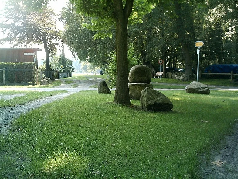
Megaliths in Sandhatten
Out in the hamlet of Sandhatten, among the pine plantations and farmsteads, sit stone graves that are roughly six thousand years old - megalithic tombs built by the same Funnelbeaker farmers who left the more famous Visbek Bride and Bridegroom an hour to the south. They are quieter, smaller, easy to miss if you do not know to look. Sandhatten is also, in a less ancient register, the workshop of Martin McWilliam, a contemporary European ceramicist whose vessels and sculptures are exhibited internationally. The combination is the Geest in miniature - Neolithic farmers and a working potter sharing the same patch of sand, four kilometres from a swimming pool.
Canoes, Cessnas and Country Buses
Modern Hatten is built around quiet leisure. The Hunte river loops through the southern part of the municipality, and on summer weekends canoeists drift past Dingstede and Kirchhatten through banks of alder and willow. The Flugplatz Oldenburg-Hatten, a small grass-and-asphalt airfield, runs a flight school and offers sightseeing flights over the geest. The NordWestBahn regional trains and a thick bus network connect the hamlets to Oldenburg and the wider region. In Sandkrug a Blacksmith Museum and a Printing Museum keep the older crafts visible. Kirchhatten centres a large recreation complex with a swimming pool and exhibition halls. There is no historic centre, no medieval market square - Hatten is a municipality of suburbs, farms and woods, knit together by a coat of arms whose twin fir trees stand for the forest and whose stylised rose traces back to the oldest arms of Oldenburg-Wildeshausen.
Peter Suhrkamp's Birthplace
Hatten has produced one figure whose name still echoes in German culture. Peter Suhrkamp was born here in 1891 and went on to found Suhrkamp Verlag in 1950, one of the most influential publishing houses in postwar German literature - the imprint of Hesse, Brecht, Adorno, Habermas, Walser, and the long backbone of the German intellectual twentieth century. Suhrkamp himself had been imprisoned by the Gestapo during the war for opposing the regime; he never fully recovered his health. The publishing house he started in defiance of that experience went on to shape how the new Germany read itself. The boy who left the sandy hamlets of Hatten ended up curating a national conversation. The hamlets, meanwhile, kept doing what they do - growing crops, filtering water, watching small aircraft circle the airfield on Sunday afternoons.
From the Air
Hatten lies at roughly 53.02 degrees north, 8.35 degrees east, 16 km southeast of Oldenburg in Lower Saxony, on the northwest edge of the Wildeshausen Geest Nature Park. The terrain is flat to gently rolling at elevations of 5 to 30 metres, mostly cultivated fields, pine plantations and patches of moor. The Hunte river loops through the southern half of the municipality. Flugplatz Oldenburg-Hatten (EDWH), a small general-aviation airfield, sits south of Sandkrug and is suitable for light aircraft and sightseeing flights. Bremen (EDDW) lies about 35 km northeast; Oldenburg's main centre is the nearest larger city. From the air the Osenberge ridge shows as a low band of sandy soil and pine that supplies most of the region's drinking water.
Nearby Stories
- Vechta 1.9 km away
- Saterland Frisian language 4.1 km away
- Vossbarg 14 km away
- Varel 17 km away
- Emsland Railway 30 km away
- Gardelegen Massacre 179 km away
- Ludwigslust Palace 180 km away
- Wöbbelin Concentration Camp 185 km away