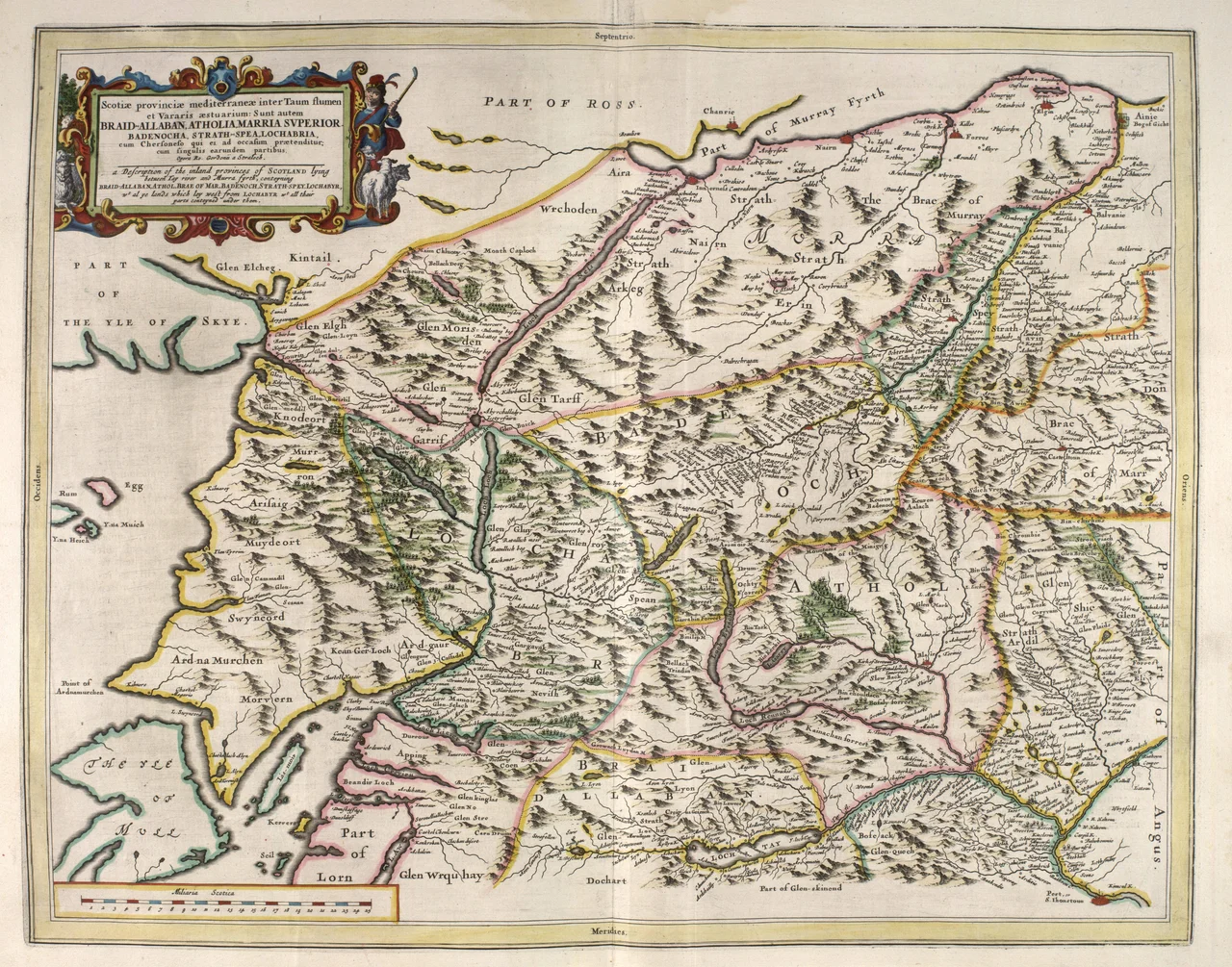

The Rough Bounds
An anonymous writer in 1750 set down a description that still fits: "all these countries viz. Knoydart, the Two Morrirs, Moydart, and Arisaig, are the most Rough Mountainous and impassible parts in all the Highlands of Scotland, and are commonly called by the Inhabitants of the Neighbouring countries the highlands of the Highlands." Bounded by Loch Hourn, Loch Shiel, and Loch Moidart, the area has no official name today; cartographers from Blaeu's 1654 atlas onward have simply marked it as the territory west from Lochaber. It is one of the emptiest stretches of mainland Britain, and the last place on Scottish soil where Bonnie Prince Charlie stood before fleeing into exile.
Bronze Age Continuity
The Rough Bounds have been used, in their fashion, for a very long time. When archaeologists from the University of Edinburgh and Headland Archaeology surveyed a six-kilometre realignment of the A830 road near Arisaig in 2000-2001, they found a Bronze Age kerb cairn, turf buildings, and shieling huts that had been reused continuously from medieval to post-medieval times. The shieling huts sat directly on top of Bronze Age remains - the same patches of ground favoured by herders three thousand years apart. Peat cores told a longer story: a slow, continuous decline in woodland from about 3200 BC to the present, the land thinning out under wind, salt, and grazing across five thousand years.
The Lordship of Garmoran
After the Vikings, this area belonged to the Norse Kingdom of the Isles, and then through the Norse-Gaelic figure Somerled to a kingdom of his own making. After Somerled's death the territory that became the Rough Bounds, along with Uist, Eigg, and Rum, formed Garmoran, ruled by the MacRory faction of Somerled's descendants. The 1266 Treaty of Perth made Garmoran a Scottish crown dependency. The Lordship survived under MacRory and Clan Ranald until 1427, when violent feuding between Clan Ranald and the Siol Gorrie - both descended from Ranald MacDonald - prompted King James I to execute the Siol Gorrie's leader at Inverness and declare the Lordship forfeit. By the late 16th century the name Garmoran had quietly dropped out of use. The land remained, but it was no longer anyone's named possession.
Catholic, Jacobite, Hidden
When the Statutes of Iona attempted to enforce the Scottish Reformation across the highlands in 1609, the Rough Bounds simply refused. The area remained resolutely Roman Catholic and sided with the Royalists in the Civil War. In the following century, Jacobite sympathy ran so deep that the locals burned down Tioram Castle themselves to keep it out of anti-Jacobite hands. After the failed Jacobite rising of 1745, the Rough Bounds gave Bonnie Prince Charlie his last sanctuary on Scottish soil. He left from this country into exile in France on 20 September 1746, and the men who went with him are commemorated by the Seven Men of Moidart - seven beech trees planted in a line near Kinlochmoidart, of which only a few survive.
Trained in Secret, Spoken in Gaelic
Moidart did not get its road - the A861 - until 1966; before that, you walked in or sailed in. That remoteness made it perfect for secret things. During the Second World War, the Special Operations Executive established its Scottish headquarters just outside Arisaig, building paramilitary training bases throughout the Rough Bounds. Resistance fighters from across occupied Europe came here to learn small-arms warfare, demolition, and survival in a landscape of bog, mountain, and sea loch. At Moidart, HMS Dorlin trained Royal Navy Beach Signals and Royal Signals operators. The same remoteness preserved the language: the 1881 census showed around 90% of the population speaking Gaelic and over a third unable to speak English. By 2001 the Gaelic share had fallen below 15%. The country is still rough, still mostly empty - but the languages that filled it have grown quieter.
From the Air
Centre coordinates 57.0583°N, 5.66667°W. The Rough Bounds covers Knoydart, North Morar, Arisaig, and Moidart - bounded by Loch Hourn (north), Loch Shiel and Loch Moidart (south), with Loch Nevis cutting through the middle. From 4,000-6,000 ft AGL the landscape reveals itself: a tangle of sea lochs, sharp ridges, and almost no roads except the A830 (Mallaig) and A861 (Moidart). Nearest fields: Plockton (EGPO) 25 nm north, Oban (EGEO) 50 nm south. Severely turbulent in westerlies; weather changes rapidly. Castle Tioram on its tidal island near Loch Moidart is a useful visual reference.
Nearby Stories
- Rùm 4.7 km away
- Eden (2016 TV Series) 6.2 km away
- Plockton 9.7 km away
- Wiay, Inner Hebrides 11 km away
- Ballachulish 14 km away
- Stand-off at the Fords of Arkaig 19 km away
- Coll 22 km away
- Affric-Beauly hydro-electric power scheme 29 km away