Torres Strait
Jules Verne stranded Captain Nemo's Nautilus here in 1870, which tells you something about the Torres Strait's reputation. The 150-kilometre-wide passage between Cape York Peninsula and Papua New Guinea contains 274 islands, 580 coral reefs covering 2,400 square kilometres, and some of the most extensive seagrass beds in the world. Its waters are shallow, its tidal currents fierce, its channels maze-like. In 1823, Captain John Lihou became the first to navigate a ship through from west to east, an achievement the Sydney Gazette noted was 'accomplished after the loss of four anchors and the rudder.' The strait has been testing sailors, connecting cultures, and confounding mapmakers for centuries.
The Namesake Who Never Saw Australia
Luis Vaz de Torres sailed along the south coast of New Guinea in 1606 as second-in-command of a Spanish expedition that had set out from Peru the previous year. He discovered the passage that now bears his name, but the evidence suggests he never realized a continent lay to his south. Early Spanish maps show New Guinea correctly while omitting Australia entirely. Torres's records gathered dust in Manila archives until 1769, when Scottish geographer Alexander Dalrymple, translating captured Spanish documents, found the testimony proving a navigable passage south of New Guinea. Dalrymple named the strait, published his findings, and spent the rest of his life bitter that James Cook, not he, was chosen to command the expedition that reached Australia's east coast in 1770. Cook himself rounded Cape York and landed on Possession Island, where he may have hastily reimagined a signalling drill as a possession ceremony after learning that the French had preceded him across the Pacific.
Islands of Every Origin
The strait's 274 islands are not one landscape but many. The western islands are hilly and steep, formed of granite, the northernmost peaks of the Great Dividing Range that became islands when sea levels rose at the end of the last ice age. The central islands are predominantly coral cays, low and flat. The eastern islands are volcanic. Those nearest the New Guinea coast are low-lying formations built from alluvial sediment carried by river outflows. Only 17 of these islands have permanent settlements today. Between them, submarine sand dunes migrate across the seafloor, pushed by tidal currents that surge through narrow channels between reefs. Navigation requires pilotage through specific routes: the Endeavour Strait for small vessels, the Prince of Wales Channel for larger ships, and the Great North East Channel linking out to the Coral Sea and the northern entrance to the Great Barrier Reef.
A Culture Between Continents
The Torres Strait Islands have been inhabited for at least 2,500 years, possibly much longer. The Islander communities are neither Papuan nor Aboriginal Australian but a distinct people related to both, shaped by millennia of maritime trade and cultural exchange. Two indigenous languages survive: Kala Lagaw Ya in the western and central islands, and Meriam Mir in the east, alongside Torres Strait Creole. In 1898, Cambridge University ethnographer Alfred Haddon led an expedition to study these cultures. Decades later, Margaret Lawrie spent the 1950s through 1970s recording stories, genealogies, art, and music that Islanders entrusted to her. Her collection became the basis for Myths and Legends of Torres Strait and Tales from Torres Strait, and in 2008 it was inscribed on UNESCO's Memory of the World Register. The 2016 census recorded 4,514 people living on the islands, though many more Torres Strait Islanders live elsewhere in Australia.
Pearls, Politics, and a Shared Sea
From the 1860s through about 1970, pearling defined the Torres Strait economy. The industry drew experienced divers from across the Pacific and as far as Japan, transforming the islands into a multicultural workplace long before the rest of Australia grappled with immigration. When the London Missionary Society arrived on Erub (Darnley Island) in 1871, their arrival became such a defining moment that Torres Strait Islanders still celebrate it annually as the Coming of the Light. Queensland annexed the islands in 1879, despite some lying just off the New Guinea coast. A 1978 agreement between Australia and Papua New Guinea settled the maritime border, and the 1985 Torres Strait Treaty established a protected zone where both nations manage fisheries access while protecting the traditional way of life. Today, the strait faces new pressures: mining waste from the Fly River in Papua New Guinea, rising sea levels, and the challenge of sustaining both natural resources and the culture that depends on them.
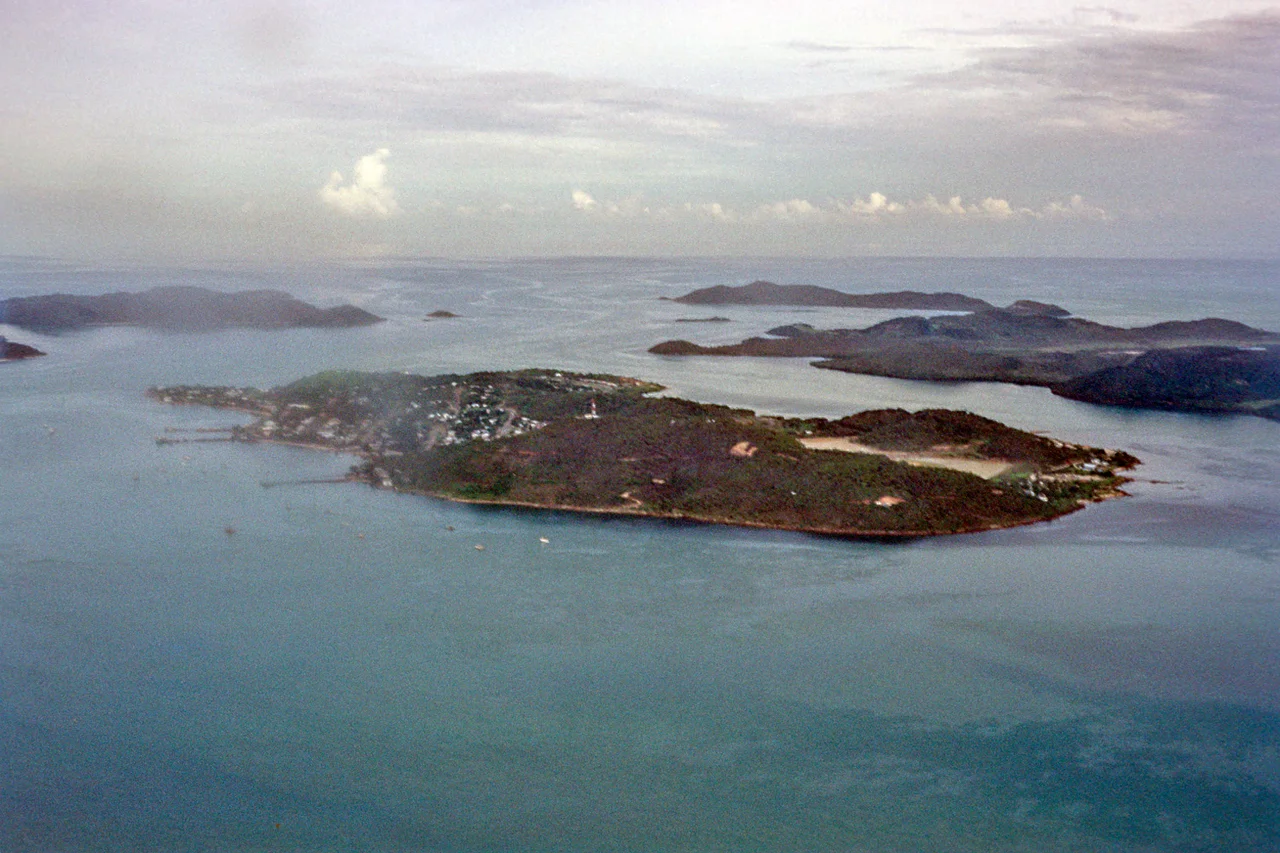
From the Air
The Torres Strait (9.83S, 142.50E) stretches 150 km between Cape York Peninsula and Papua New Guinea, dotted with 274 islands and 580 coral reefs. The western islands appear hilly and green, the central cays low and sandy, the eastern islands volcanic. Major shipping channels are visible as breaks in the reef patterns. Horn Island Airport (YHID) near Thursday Island is the primary gateway. Approach from the south for a dramatic view of the island chain stretching toward Papua New Guinea, or from the east to follow the Great North East Channel past Bramble Cay and into the strait.
Nearby Stories
- Holy Trinity Church, Saibai Island 14 km away
- Asia (1818 ship) 24 km away
- Daru 47 km away
- Booby Island (Queensland) 66 km away
- All Saints Anglican Church, Darnley Island 76 km away
- Booby Island Light 95 km away
- Wasur National Park 165 km away
- HMS Pandora (1779) 179 km away