
Tri-Mountain National Scenic Area
Three separate landscapes, none of them touching, each with its own character — and one administrative umbrella to hold them together. The Tri-Mountain National Scenic Area did not begin as a unified place. It became one on March 16, 2001, when the central government merged three former province-level scenic zones after the Taiwan Provincial Government wound down. The merger was bureaucratic in origin, but the result is a scenic designation that spans five counties, stretches from the western foothills into the high Central Mountains, and encompasses Buddhist cliff temples, Atayal highland orchards, a giant Buddha visible for kilometers, and more tea than any one person could drink in a season.
Baguashan: The Buddha and the Plateau
Baguashan sits in Changhua County, where a long basalt plateau runs parallel to the western coast. The name means Eight Trigrams Mountain, a reference to the Daoist cosmological symbol. The plateau's most visible landmark is the Great Buddha of Baguashan, a 22-meter statue completed in 1961 that was long known as the largest Buddha statue in Asia. It remains the spiritual and visual anchor of Changhua City — visible from the plain below and lit at night so that it can be seen from a distance across the flat farmland. The Baguashan Skywalk, stretching from the Great Buddha toward the National Changhua Living Art Center, is now the longest skywalk in Taiwan, threading past a martyrs' shrine, lotus ponds, and an ecological park. Each spring around the equinox, the plateau becomes a staging ground for grey-faced buzzards migrating northward — a seasonal spectacle that draws birders from across Taiwan. The plateau's gentler terrain also produces pineapple, turmeric, and dragon fruit in the surrounding agricultural land.
Shitoushan: Temples in the Cliff
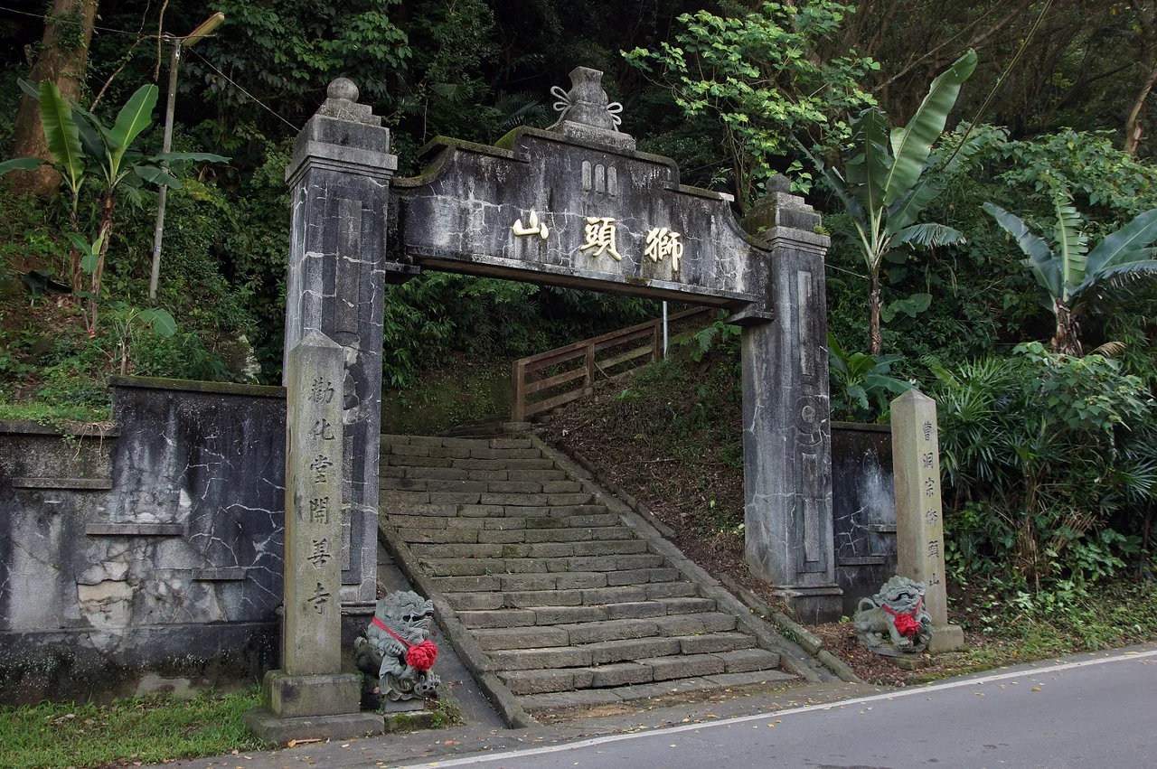
The name means Lion's Head Mountain, and the profile of the sandstone ridge above Miaoli County does suggest a resting lion when seen from the right angle. What makes Shitoushan unusual is not its shape but what human hands have done with it: eleven Buddhist and Daoist temples built directly into the cliff face, connected by a five-kilometer historic hiking trail called the Shishan Path. Walking the trail moves through incense and shadow, past shrines tucked into rock overhangs, monastery guesthouses, and the particular atmosphere of a mountain that has been a pilgrimage destination for more than a century. At the base of the mountain, Nanzhuang Old Street preserves the market-town character of the Hakka communities that settled this part of Miaoli. The Atayal and Saisiyat peoples have also called this landscape home — their presence acknowledged in the cultural programs now maintained in the area alongside the temple complex.
Lishan: Orchards at Altitude
Lishan is the most remote of the three zones, sitting entirely within Heping District in Taichung at elevations where the growing season runs cool and long. The Atayal people have inhabited these high mountains since long before anyone wrote the landscape into an administrative category, and their presence shapes the character of the communities here. The plateau is best known for its agricultural output: peaches, Asian pears, apples, and vegetables grown at altitudes that give them a sweetness unavailable in the lowlands. Guguan, a hot spring town on the road into Lishan, offers a warmer welcome before the climb — its geothermal pools sitting in a river gorge where the water runs clear over boulders. The approach road is its own experience, a mountain highway that switches back through forest and cloud.
One Name, Three Worlds
The management office for the entire Tri-Mountain National Scenic Area sits not inside any of the three zones but in Wufeng District, Taichung — a practical choice that places administration near the population center of the region. The three areas remain non-contiguous: you cannot walk from one to another. Traveling between them means descending to the lowlands and climbing again, which in practice means most visitors experience them as separate destinations rather than a unified park. What the designation offers is coordination: shared branding, pooled resources, and a framework that treats these three distinct landscapes as a coherent expression of central Taiwan's geographic and cultural range. From Lion's Head Mountain in the northwest to Lishan's apple orchards in the high northeast, the area spans an extraordinary variety of terrain, and the Shoutian Temple in the Baguashan zone, dedicated to Xuantian Shangdi, draws one of the largest pilgrimage crowds on the island during festival seasons.
From the Air
The Tri-Mountain National Scenic Area's three zones are spread across central Taiwan. The approximate center of the designation is near 24.06°N, 120.70°E, but the three areas are spread over a wide arc. Baguashan lies to the southwest near Changhua City (24.07°N, 120.55°E); Shitoushan is to the north near the Hsinchu-Miaoli border; Lishan is to the northeast deep in the Central Range at roughly 24.26°N, 121.22°E. From cruising altitude, the contrast between the flat Changhua coastal plain (where Baguashan's plateau is visible as a long dark ridge) and the sharp mountain topography of Lishan is dramatic. The nearest major airport to the management office and Baguashan zone is RCMQ (Taichung International), approximately 20 km west of Wufeng. Approach Lishan from the east over the Central Range at 12,000+ feet to appreciate the full relief.
Nearby Stories
- Shigang Dam 2.7 km away
- Taixi, Yunlin 4.9 km away
- Xitou Nature Education Area 7.2 km away
- Lintianshan Forestry Culture Park 11 km away
- Taroko National Park 20 km away
- Smangus 36 km away
- China Airlines Flight 611 56 km away
- Taiwan Strait 69 km away