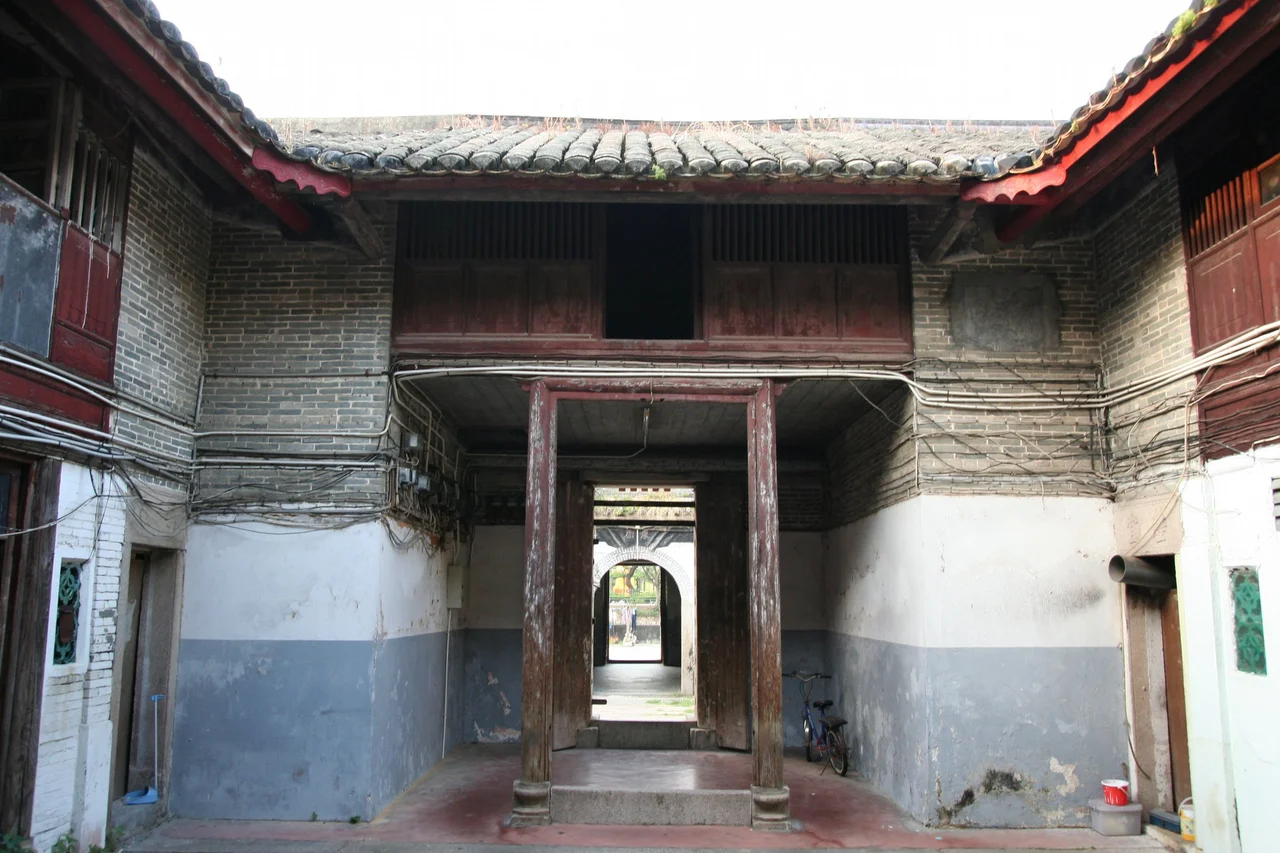

Tsang Tai Uk
Tsang Koon-Man had money, granite, and a clear-eyed sense of what late-imperial China required of a man with both. In 1847 he began building Shan Ha Wai — later renamed Tsang Tai Uk — in the Sha Tin valley, positioning it close enough to his business ventures in the city to remain convenient, while making it strong enough to resist the bandits and political instability that plagued the region in the final decades of Qing rule. The construction took roughly twenty years. The result was a rectangular complex of grey brick walls, three rows of houses, and four three-storey guard towers at the corners, each with firing apertures cut into the stone. The original granite, brick, and timber are still largely intact. What Tsang Koon-Man built as a stronghold survived to become one of Hong Kong's most significant historical sites.
A Merchant's Fortress
Hakka walled villages in Hong Kong were not uncommon in the nineteenth century, but few were built with the resources Tsang Koon-Man could bring to bear. As a successful granite merchant and stonemason, he had both the material and the expertise. The walls he specified were high and fortified; the main gate was defensive; the four corner guard towers were designed for actual use, not merely for show. The compound was rectangular — a form that maximised internal space while minimising the perimeter that needed to be defended. He also acquired the best agricultural land in the surrounding valley, ensuring that the clan inside the walls would have a stable income even when economic conditions deteriorated. What emerged was less a village than a planned settlement, designed from the outset to be self-sufficient and resilient. That intentionality is part of what distinguishes Tsang Tai Uk from many of the walled villages that developed more organically over generations.
The People Inside
By the time of the 1911 census, the population of Shan Ha Wai was 56 — a small number for a compound of this scale, suggesting that some of the original families had moved on while others held their ground. After the Second World War, the village took on its current name, Tsang Tai Uk, from the displaced families who sought refuge within its walls. By 1979 the population had grown to approximately 700 residents, of whom around 300 belonged to the Tsang clan. The village had become something different from what Tsang Koon-Man had designed: not a clan stronghold but a community of extended relationships, still centred on the founding family but no longer exclusively theirs. Visitors today can enter the first courtyard and the ancestral hall; the inner courtyards and remaining buildings remain private, still home to residents who live inside walls that were built to keep danger out.
Flood, Typhoon, and Reclamation
The Sha Tin valley that surrounded Tsang Tai Uk changed beyond recognition in the twentieth century. The Sha Tin New Town, developed from the 1970s onwards, was built on land reclaimed from Tide Cove — the shallow arm of Tolo Harbour that had lapped at the edge of the valley for centuries. That reclaimed land was raised to an average of five or six metres above sea level. Tsang Tai Uk, however, sits only 2.5 to three metres above sea level, and it flooded. Typhoon Wanda in 1962 inundated the compound entirely, water covering the ground level completely. For a village whose walls were built to stop people, not water, this was a different kind of siege. In the late 1970s, the government designed a drainage improvement plan to address the chronic flooding. When the new town rose around the village, Tsang Tai Uk was preserved — unusual in an era when villages were sometimes relocated to make way for development — because its historical significance was already recognised.
Grades of Survival
Tsang Tai Uk holds Grade I status as a historic building, the highest classification in Hong Kong's heritage system, placing it alongside only a small number of structures that represent the most significant built heritage on the territory. Restoration work on the ancestral hall began in 2009, funded in part by a HK$1 million government grant for the maintenance of privately owned graded historic buildings. The scale of that grant relative to the cost of genuine restoration gives some sense of the challenge: maintaining a century-and-a-half-old compound of this size requires ongoing commitment from the people who still live there. The closest MTR stations are Che Kung Temple and Sha Tin Wai, both a short walk away — which means that one of Hong Kong's most intact historical settlements is also one of its most accessible, a grey-brick enclosure in the middle of a modern suburb that most commuters ride past without knowing it exists.
From the Air
Tsang Tai Uk sits at approximately 22.374°N, 114.191°E in the Sha Tin district of Hong Kong, surrounded by the dense urban development of Sha Tin New Town. From the air at 1,500–3,000 feet, it appears as a compact rectangular compound — noticeably older and lower in profile than the high-rise estates immediately around it. The Lion Rock ridge to the west provides the clearest geographic reference; the Lion Rock Tunnel cuts through the base of this ridge connecting Sha Tin to Kowloon. Tolo Harbour is visible to the northeast. The nearest airport is Hong Kong International Airport (VHHH), approximately 22 nautical miles to the southwest on Lantau Island. The Shing Mun River channel runs to the west of the site.
Nearby Stories
- Chapel of St. Francis Xavier 3.5 km away
- Cuiheng 4.1 km away
- 2015 Shenzhen Landslide 16 km away
- Shunde 31 km away
- Wanshan Archipelago 37 km away
- Nanxiong Formation 96 km away
- Heyuan 149 km away
- Checheng Fu'an Temple 629 km away