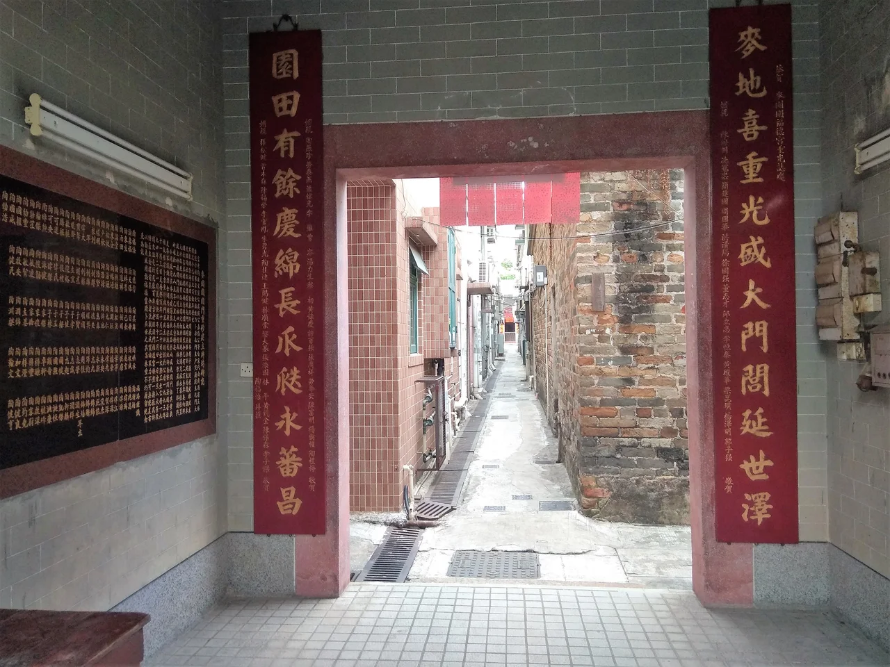

Tsing Chuen Wai
A clan that moved across half of southern China — from Jiangxi or Guangxi, depending on who you ask — eventually settled on the flat land of Lam Tei in what is now Tuen Mun District. When the population grew too large for a single settlement, they didn't disperse into the wider countryside. Instead, the To Clan built walls. Tsing Chuen Wai is one of five fortified villages that the clan established in the Lam Tei area, each enclosed by a boundary wall thick enough to hold the world at bay. The 'wai' in the name says it plainly: this was a place that protected itself.
A Clan That Built Walls
The origins of the To Clan in the New Territories are documented, if not perfectly clear. Historical records variously place their ancestral home in Poyang County in Jiangxi province, or in Watlam in Guangxi — two different places, suggesting either that different branches tracked their lineage to different regions, or that the memory of migration blurred over centuries. What is clear is the pattern of movement: from that distant inland origin, the clan arrived at Ngau Tam Mei, then moved to Tuen Mun Tai Tsuen, and as families multiplied, spread outward. Tsing Chuen Wai, Nai Wai, Tuen Tsz Wai, Lam Tei Tsuen, and Tuen Mun San Tsuen — five communities, all fortified, all clan. In a period when the New Territories offered little in the way of formal protection, building your own walls was not paranoia. It was prudent.
On the Map Before Britain Arrived
In 1866, the Italian missionary Simeone Volonteri published a detailed map of the San-On District — the administrative region that then encompassed most of what is now Hong Kong. On that map, Tsing Chuen Wai is already marked. Britain would not acquire the New Territories until the Convention of Peking in 1898, more than three decades later. That Volonteri bothered to record the village at all is telling: these walled settlements were significant enough features on the landscape that a careful cartographer could not omit them. The map is a minor miracle of documentation, capturing a world that was about to be remade, and Tsing Chuen Wai appears in it as an established fact rather than a footnote.
What the Green Bricks Remember
Most of the original boundary wall is gone. Time, storms, and the particular indifference of urbanisation have done their work. But at the main entrance to the village, a surviving section of green-brick wall still stands — the original material, the original scale, communicating something about what the full enclosure once looked like. Green brick, fired at temperatures that produce a distinctive grey-green finish, was the construction material of choice for substantial buildings in Guangdong and the Pearl River Delta region during the Qing dynasty. To see it in place at the gateway is to see the wall as its builders intended. The Antiquities Advisory Board has documented the remains, including the ruins of a watchtower, recognising their value as evidence of a building tradition that has largely vanished from the territory.
The Shrine at the Centre
Step through the entrance today and the village shrine holds three figures: Tin Hau, goddess of the sea and protector of fishermen and sailors; Kwan Tai, the deified general who embodies loyalty and righteousness; and a Qing official, unnamed but present. The combination is characteristic of Hong Kong's walled villages, where the spiritual life of a community is not confined to a single tradition but draws on whichever figures have proven their usefulness over generations. Tin Hau watches over those who live near water. Kwan Tai steadies those who deal with conflict or commerce. The Qing official — perhaps a local magistrate remembered for fair dealing, perhaps a more distant figure — represents the weight of administrative authority. Together, they map the concerns of a community that needed protection from the sea, from rivals, and from the state.
Recognition Under the Small House Policy
Tsing Chuen Wai retains a formal status that connects it to a much older set of rights. Under the New Territories Small House Policy, the village is a recognised settlement, meaning that male indigenous inhabitants of the To Clan descent retain the right to apply to build a small house on land within the village's defined area. The policy, introduced in 1972, codified customary rights that predate British administration. It is one of the mechanisms by which the clan's connection to this particular piece of ground — the connection that brought their ancestors here from Jiangxi or Guangxi, and that prompted them to build walls around what they had settled — persists into the present. The village is represented in the Tuen Mun Rural Committee, one of 36 villages with a voice in that body.
From the Air
Tsing Chuen Wai sits at approximately 22.42°N, 113.98°E in the Lam Tei area of Tuen Mun District, in the northwestern New Territories. From the air, the area appears as a low-density residential zone between the town of Tuen Mun to the south and the Yuen Long plain to the north. Castle Peak (elevation 583 m) rises to the southwest and provides a useful visual reference. The nearest major airport is Hong Kong International Airport (VHHH) on Lantau Island, approximately 18 km to the southeast. Recommended viewing altitude for the walled village area is 1,500–3,000 feet, where the contrast between older village layouts and newer development is most legible. The absence of high-rise buildings in this part of Tuen Mun makes the village footprint easier to distinguish from the air than in denser urban areas.
Nearby Stories
- Chapel of St. Francis Xavier 3.5 km away
- Cuiheng 4.1 km away
- 2015 Shenzhen Landslide 16 km away
- Shunde 31 km away
- Wanshan Archipelago 37 km away
- Nanxiong Formation 96 km away
- Heyuan 149 km away
- Checheng Fu'an Temple 629 km away