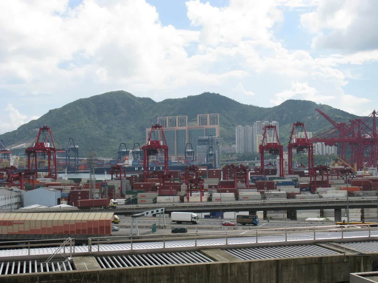

Tsing Yi Peak
The Cantonese name says it plainly: Sam Chi Heung, three sticks of incense. From across Victoria Harbour, Tsing Yi Peak's three summits do resemble joss sticks pointing skyward — a coincidence of geology that gave a densely industrial island an unexpectedly spiritual silhouette. The three peaks align along a north-south axis, each slightly higher than the one before, culminating in the south peak at 334 metres — the highest point on Tsing Yi Island. Two road tunnels burrow beneath it: the Cheung Tsing Tunnel through the north peak, the Nam Wan Tunnel cutting diagonally beneath all three. No road reaches the tops. The only way up is on foot, along paved trails that connect all three summits, passing through burial grounds, past agricultural terraces, and across slopes where a plant once thought extinct was rediscovered.
Three Peaks, Three Characters
The north peak is the most accessible and the most historically layered. Its lower slopes hold the main burial ground for Tsing Yi Island's indigenous inhabitants — families who farmed and fished here long before the industrial age arrived. The burial ground occupies the northeast quadrant of the peak, and the paved trail to the summit threads through it, past a covered service reservoir and two football pitches that serve the nearby estates of Cheung Ching and Cheung Hong. Reach the top and there is a pavilion and a trigonometrical station, and a view that opens out over most of Tsing Yi's new town, across Rambler Channel to Tsuen Wan and Kwai Chung, with Tsing Ma Bridge and the hills of northeast Lantau visible to the west.
The middle peak is cone-shaped and rockier, with great stones gathered at its highest points. The Civil Aviation Department has placed an obstacle light near the summit, designated Hill No. 6, a reminder that the three peaks sit within the approach corridors of one of the world's busiest airports. Agricultural terraces occupy the mid-level slopes, watered by a stream that runs through the valley between the north and middle peaks — a fragment of the farming life that predates the industrial transformation by generations.
The High Point and Its Hidden Plant
The south peak, at 334 metres, is the highest ground on the island. Its summit is relatively flat, marked by a trigonometrical station and another aviation obstacle light, designated Hill No. 5. From here, on a clear day, the view south is surrounded by water on every side: the Kowloon Peninsula, Stonecutters Island, Hong Kong Island, Green Island, Kau Yi Chau, Peng Chau, Lantau Island, Tang Lung Chau, and Ma Wan. Nearly a hundred ships anchor or move through those waters at any given time. Container Terminal 9 sits directly below on the reclaimed southwest shore of the island.
Below the summit, on the southeast slope, lies something smaller and rarer than any of those landmarks. The Hong Kong Croton — a plant endemic to Hong Kong and once believed lost — was found here in 1997, growing in the woodland beneath the peak. The southeast slope is now designated a Site of Special Scientific Interest to protect the species. Between the aviation lights and the container ships below and the rare plant on the slope, this summit manages to compress an unusual range of the city's concerns into a single small area.
Barrier and Witness
Tsing Yi Peak is not just scenery. It performs a structural role in the island's geography. The granite ridge separates the industrial southwest — petroleum storage depots, a 1520-megawatt power station site, container terminals — from the 200,000 residents who live in the northeast quarter. Without the ridge, the proximity of fuel storage and residential towers would be considerably more alarming than it already is. The two tunnels that pass beneath the peaks carry the highway traffic that keeps Tsing Yi connected to the wider road network: Route 3 through the Cheung Tsing Tunnel, Route 8 through the Nam Wan Tunnel. Above them, the trails on the surface offer a different kind of transit: slow, on foot, through a landscape that has remained largely green while the shorelines all around it were remade in concrete and reclaimed land.
Walking the Ridge
The trail system links all three peaks with paved paths — an unusual amenity for a hill that sits in the middle of one of the world's most densely built cities. Walkers can begin near Cheung Ching Bus Terminus on the north side, or from Mayfair Gardens along Ching Hong Road, or from the direction of Hong Kong Institute of Vocational Education on the middle peak's southern approach. The path on that southern route includes paved ladders, and the burial ground of the Chan family serves as a navigation landmark partway up. These burial grounds are a common feature of Hong Kong's hillsides, where the traditional preference for south-facing slopes on elevated ground means that the dead and the living share the same geography, and the hills hold both.
From the Air
Tsing Yi Peak's three summits are a significant terrain feature at approximately 22.337°N, 114.100°E, rising to 334 metres (1,096 feet). The peak sits directly beneath the approach path to Hong Kong International Airport (VHHH), approximately 9 nautical miles to the southwest at Chek Lap Kok. Civil Aviation Department obstacle lights mark both the middle peak (Hill No. 6) and south peak (Hill No. 5). Pilots should maintain the standard instrument approach altitudes; the peak is notably visible from aircraft on the ILS approach to runway 07L/R. From cruising altitude, the ridge is clearly distinguishable as the green spine dividing Tsing Yi's industrial southwest from its residential northeast. Tsing Ma Bridge is visible immediately southwest of the island.
Nearby Stories
- Chapel of St. Francis Xavier 3.5 km away
- Cuiheng 4.1 km away
- 2015 Shenzhen Landslide 16 km away
- Shunde 31 km away
- Wanshan Archipelago 37 km away
- Nanxiong Formation 96 km away
- Heyuan 149 km away
- Checheng Fu'an Temple 629 km away