
Tsing Yi
The island got its name from a fish. Tsing Yi — literally 'green-black clothes' in Cantonese — was also the name of the blackspot tuskfish, once abundant in the nearby waters of Victoria Harbour's western approaches. Fishermen named the island after the fish they caught around it, which is a more honest kind of place-naming than most. Ming Dynasty maps show the island as Chun Fa Lok, 'the fall of spring flowers,' and the waters beside it as Chun Fa Yeung, 'the ocean of spring flowers' — where the Ming navy once defeated pirate fleets. By the time the British took the New Territories in 1898, the island held about 4,000 people farming rice, vegetables, and pineapples and fishing the same waters their ancestors had named. Over the following century, that population grew nearly fifty times. The harbours were filled in, the fishing villages relocated, eight bridges and two tunnels were built, and Tsing Yi became the industrial and transport backbone of the Hong Kong container port. The fish the island was named for is no longer abundant in those waters.
Four Quarters, Four Worlds
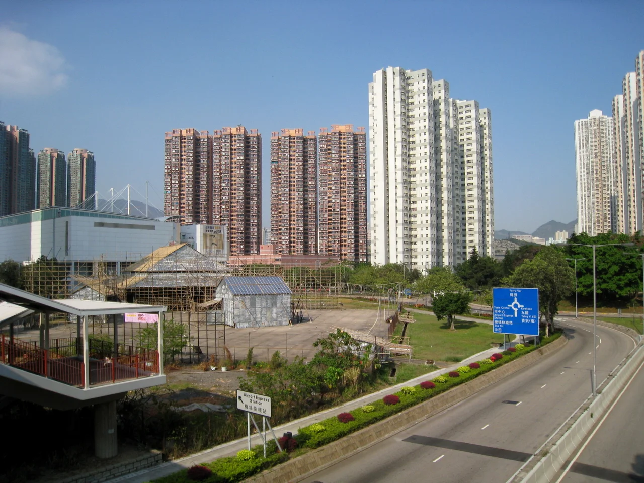
Stand on Tsing Yi Peak at 334 metres and the island's internal logic becomes visible. The northeast quarter is residential — the high-rise estates of Tsing Yi Town, home to most of the island's roughly 170,000 residents, with a promenade along the Rambler Channel waterfront. The southeast quarter contains more residential development, Tsing Yi Town proper, and the island's only MTR station, served by the Tung Chung line and the Airport Express. The southwest quarter holds Hong Kong's heavy industrial presence: petroleum storage depots, the site of the former 1,520-megawatt Tsing Yi Power Station, and Container Terminal 9, which was built on reclaimed land between 2000 and 2004. The northwest quarter mixes dockyards, shipbuilding facilities, and a recreation trail. Tsing Yi Peak's granite ridge separates the industrial west from the residential east — a natural boundary that the planners incorporated into the island's zoning.
From Stilt Houses to High-rises
As late as the 1970s, the harbour of Tsing Yi Tong in the island's northeast resembled Tai O on Lantau, with characteristic stilt houses connected by plank walkways and junks moored at every available point. Fishermen worshipped at the Tin Hau Temple on the shore — Tin Hau, goddess of the sea, whose birthday brought fishermen from across the nearby waters for celebrations at what islanders called Pak Miu, the white temple. When the harbours were reclaimed, the temple was moved. The fishermen were relocated to land housing in Cheung Ching Estate. The plank walkways disappeared under concrete. In their place came Tsing Yi Estate, Cheung On Estate, Cheung Fat Estate, Cheung Hang Estate, and a succession of private developments — Greenfield Garden, Serene Garden, Broadview Garden, Tivoli Garden, Grand Horizon, Villa Esplanada, Tierra Verde — a catalogue of aspirational names covering ground that had once been mudflat and typhoon shelter.
The Bridge They Built Themselves
The story of how Tsing Yi got its first road connection to the mainland is unexpectedly cooperative. Before the Tsing Yi Bridge opened, the island could only be reached by ferry — hovercraft ran between Tsuen Wan, Tsing Yi, and Central, operated first by Hongkong and Yaumati Ferry, then by Hong Kong and Kowloon Ferry. In the 1970s, six large companies operating on the island collectively funded the construction of the Tsing Yi Bridge across the Rambler Channel. Once built, they transferred it to the Hong Kong Government. It was the sole road connection for more than a decade. Traffic congestion became severe enough to generate sustained public protest. Eventually the Tsing Yi North Bridge was added, connecting to Tsuen Wan, and then a cascade of infrastructure projects followed the decision to relocate Hong Kong's international airport to Chek Lap Kok: the Airport Express, the Tsing Ma Bridge to Ma Wan and Lantau, the Ting Kau Bridge north to the New Territories, the Cheung Tsing Bridge south to Kowloon and Hong Kong Island. Eight bridges now connect Tsing Yi to the rest of Hong Kong.
What the Rocks Remember
The granite of Tsing Yi Peak is old in a way the rest of the island is not. The island's edges have been redrawn so many times by reclamation — three major bays filled in, neighbouring islets Nga Ying Chau and Chau Tsai annexed — that the original natural shoreline barely exists. But the hills themselves remain. The hilly interior is designated green belt and administered as part of a country park zone, which is why most of it is still covered with trees and scrub rather than towers. In 1997, botanists found the Hong Kong Croton growing on the slopes beneath the south peak — a plant endemic to Hong Kong and thought to have been lost. The industrial southwest of the island, by contrast, is a different kind of record: oil tanks, cement works, and container infrastructure that chart the economic history of a city that spent the second half of the twentieth century becoming indispensable to global trade. Both histories are true. The island holds them at the same time.
Daily Life on the Island
For the people who live here — around 170,000 of them, mostly in the northeast quarter — Tsing Yi is a place of shopping centres, MTR connections, and morning tai chi on the Promenade by Rambler Channel. Maritime Square, the main shopping centre, anchors the town. Three hotels face the channel views. The Tsing Yi Promenade, completed in 2004, runs along a stretch of shore that had sat as reclaimed wasteland for nearly a decade before that. In the evenings, groups gather in playgrounds near Cheung Ching Estate to practice Chinese dancing and music, or exercise in the traditional ways that persist in Hong Kong's older residential areas regardless of what the neighbourhood looks like from above. Since 2018, the island has its own craft brewery, H.K. Lovecraft, producing lager. The fishing village that gave the island its name is mostly memory now, but the island that replaced it has a texture of its own.
From the Air
Tsing Yi Island sits at approximately 22.346°N, 114.100°E, clearly visible as a distinct landmass from the air. The island measures roughly 7 km north-to-south and is easily identified by the green Tsing Yi Peak ridge running through its southern half, with the dense residential towers of the northeast quarter to one side and the tank farms and container terminals of the industrial southwest to the other. Hong Kong International Airport (VHHH) at Chek Lap Kok on northern Lantau is approximately 9 nautical miles to the southwest. The Tsing Ma Bridge, connecting Tsing Yi to Ma Wan and Lantau, is a prominent landmark to the southwest — its twin towers are visible from considerable distance. The Rambler Channel separates Tsing Yi from Tsuen Wan to the north. At 2,000–3,000 feet, the island's four-zone character — residential northeast, residential southeast, industrial southwest, mixed northwest — is clearly legible.
Nearby Stories
- Chapel of St. Francis Xavier 3.5 km away
- Cuiheng 4.1 km away
- 2015 Shenzhen Landslide 16 km away
- Shunde 31 km away
- Wanshan Archipelago 37 km away
- Nanxiong Formation 96 km away
- Heyuan 149 km away
- Checheng Fu'an Temple 629 km away