
Tsuen Wan
Pirates once collected three hundred coins from anyone passing through Rambler Channel. That was the toll — Sam Pak Tsin, three hundred coins — and the waters off Tsuen Wan were sufficiently lawless that the levy stuck as a place name. The town was already old by then. Archaeological evidence puts human settlement here at least two thousand years back, and the earliest recorded name, Tsin Wan, means simply "shallow bay" in Cantonese. The pirate name came later, then a slower transformation: incense sticks, preserved fruit, and farmland gave way to textile mills, and a fishing bay gave way to one of Hong Kong's defining experiments in urban planning.
From Shallow Bay to Factory Floor
In 1911, roughly three thousand people lived in Tsuen Wan. When Castle Peak Road was completed in 1917, motor vehicles could reach the town for the first time; before that, it was accessible only on foot or by sea. Regular bus services arrived in 1933. The real acceleration came after the Second World War, when postwar industries — metal wares and textiles especially — flooded into the area. By the 1950s, Tsuen Wan had become the centre of Hong Kong's textile industry, drawing workers from across the mainland, including a large Shanghainese community concentrated in the Fuk Loi area. The town's population jumped from thousands to hundreds of thousands within a generation. The bay itself could not contain it: land reclamation extended the coastline outward, burying the three natural streams — the nullahs that once flowed to the shore — under roads and buildings.
Hong Kong's First New Town
In the 1950s, the Hong Kong government designated Tsuen Wan a satellite town, one of only two in the territory at the time. By 1961 the experiment had been upgraded and renamed Tsuen Wan New Town — the first formal new town in Hong Kong — covering not just Tsuen Wan but the neighbouring areas of Kwai Chung and Tsing Yi. Housing estates rose quickly. The Fuk Loi Estate was completed in 1967, the first of many. The idea was to relieve pressure on Kowloon and Hong Kong Island by creating a self-sufficient urban centre in the New Territories. It worked. Today the MTR's Tsuen Wan line — one of the original metro routes — ends here, and three stations serve the town. Tsuen Wan's example became the template for the other new towns that followed across the New Territories.
The Village Inside the City
In the middle of all this density, one structure refused to disappear. The Sam Tung Uk walled village is roughly two hundred years old — a Hakka clan settlement that survived decades of demolition around it. When MTR construction began in the 1970s, the village was carefully restored. It opened as a public museum in 1987, after being declared a historic monument in 1981. Walk through its narrow lanes and you step into a domestic scale that the surrounding towers have entirely abandoned: the clan hall, the communal granary, the residential rows where extended families lived in close formation. The Sam Tung Uk Museum is one of the most honest things in Tsuen Wan — a reminder of the settlement that the new town was built over, rather than beside.
Hills, Towers, and the Space Between
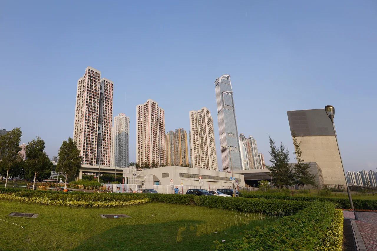
Tsuen Wan presses against the hills on two sides. Behind the town, Shing Mun Country Park and Tai Mo Shan Country Park begin almost immediately — the transition from tower block to woodland takes minutes. At 957 metres, Tai Mo Shan is Hong Kong's highest point, its summit often shrouded in cloud. The Nina Towers, an 80-storey complex rising from Tsuen Wan's commercial core, mark the town's own ambition in the other direction. Route Twisk, a road originally built by the Royal Engineers as a military supply route and opened to the public in 1961, winds through the country parks and links Tsuen Wan to the interior. It is the seam between city and mountain, and on clear days the views from it are worth the detour.
A Town That Keeps Connecting
The Tsuen Wan Transport Complex once served as the interchange point between ferries and buses. Land reclamation moved the ferry pier; the MTR absorbed much of the passenger demand; the complex lost its function. But Tsuen Wan kept building. Citywalk and Citywalk 2 rose from an urban renewal project. Discovery Park — one of Hong Kong's largest shopping centres — anchors the town centre. The Tsuen Wan Pier still connects to Park Island on Ma Wan, a private residential enclave that is technically part of a different district but reachable by water from here. That kind of layered, slightly improbable connectivity is characteristic of the town. Tsuen Wan grew up solving the problem of how to link a shallow bay to the rest of the world, and it has never quite stopped.
From the Air
Tsuen Wan sits at 22.37°N, 114.11°E on the western New Territories coastline, directly across Rambler Channel from Tsing Yi Island. At 2,500 feet, the contrast between reclaimed industrial waterfront and the abrupt green rise of Shing Mun Country Park is striking. The Nina Towers — at 80 storeys the tallest structure in the immediate area — provide a clear vertical fix. Tai Mo Shan (957m) dominates the ridge to the northeast. Hong Kong International Airport (VHHH) lies approximately 14 nautical miles southwest on Lantau Island. The Tsing Ma Bridge, connecting Lantau to the mainland across Ma Wan, is visible from most approach angles into this part of the New Territories.
Nearby Stories
- Chapel of St. Francis Xavier 3.5 km away
- Cuiheng 4.1 km away
- 2015 Shenzhen Landslide 16 km away
- Shunde 31 km away
- Wanshan Archipelago 37 km away
- Nanxiong Formation 96 km away
- Heyuan 149 km away
- Checheng Fu'an Temple 629 km away