
Tu-Endie-Wei State Park
Tu-Endie-Wei is Wyandot for the point between two waters, and the park sits exactly there - a triangle of land where the Kanawha River pours into the Ohio in downtown Point Pleasant, West Virginia. The Wyandot people, allies of the Shawnee who fought here in 1774, gave the place a name in their own language. The park keeps that name. It marks the Battle of Point Pleasant, holds the grave of Shawnee Chief Cornstalk, and quietly invites the visitor to remember that the conflict commemorated here had two sides, and that the Wyandot phrase honors both the geography and a way of describing it that predates everything else in the park.
The Two Waters
The Kanawha River drains a substantial portion of central West Virginia, flowing northwest from the Allegheny Mountains until it meets the Ohio at Point Pleasant. The Ohio at this point is already a major river, draining western Pennsylvania, eastern Ohio, and the northern panhandle of West Virginia. The two waters merge in a wide confluence visible for miles in every direction. The Tu-Endie-Wei point sits at the apex of the triangle where the rivers meet, with the Kanawha on one side, the Ohio on the other, and downtown Point Pleasant behind. The geography is the kind of natural waypoint that humans have used for at least 10,000 years - the Adena and Hopewell before the Shawnee, the Shawnee before the European settlers, the river boatmen before the highway engineers.
The Battle Monument
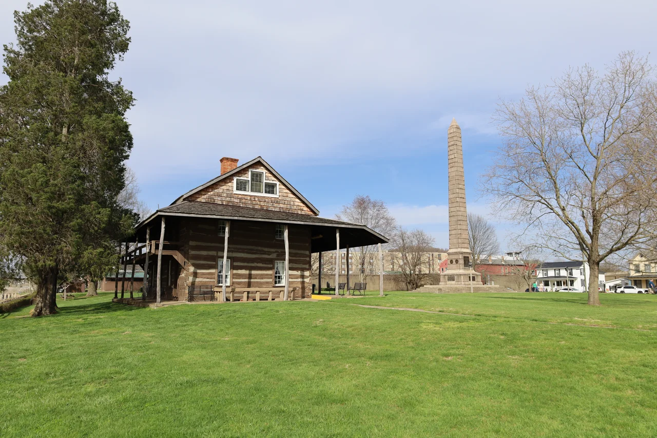
An 84-foot granite obelisk rises from the center of the park, a Civil War-era monument to the Virginia militia who fought at the October 10, 1774 Battle of Point Pleasant. About 75 of Colonel Andrew Lewis's men died here. Their names are on the monument. The base of the obelisk includes panels describing the battle. Other markers and statues throughout the park honor specific militia commanders and frontier figures - Andrew Lewis, Charles Lewis, the surgeon John Field. The park was formally established in 1901 and has been maintained as a state park ever since, one of the smallest in the West Virginia system but among the most historically dense.
Cornstalk's Grave
On the opposite side of the park from the militia monument stands a much simpler marker - a granite slab and bronze plaque marking the grave of Shawnee Chief Cornstalk, murdered in his cell at nearby Fort Randolph in November 1777. Cornstalk's remains have been moved more than once over the centuries, but the current marker stands within sight of the obelisk that commemorates the men who fought him at the 1774 battle. The proximity is meaningful. Few American battlefield parks honor both armies. Few sit on ground where the survivor of one battle was later murdered while imprisoned by the other side. Tu-Endie-Wei does, and the park's name in Wyandot quietly insists that the Native American voice remains part of how this place is remembered.
The Mansion House and the First Battle Debate
Also in the park stands the 1796 Mansion House, originally built as a frontier tavern and now operated as a historic house museum by the Colonel Charles Lewis Chapter of the Daughters of the American Revolution. Its rooms preserve early frontier furniture, period weapons, and documents related to the battle. The DAR has long argued that the Battle of Point Pleasant should be considered the first battle of the American Revolutionary War, an argument based partly on the political relationship between Dunmore's War and the simmering colonial crisis. Female descendants of the battle veterans are eligible to join the DAR on that basis. Mainstream historians remain skeptical, but the claim has shaped how the park presents the battle to visitors. Whether or not Point Pleasant was strictly part of the Revolution, the militia who fought here would soon become Revolutionary soldiers, and many of them did.
From the Air
Located at 38.84 N, 82.14 W at the confluence of the Ohio and Kanawha rivers in downtown Point Pleasant, West Virginia. The 84-foot battle monument obelisk is a visual landmark from the air. Yeager Airport (KCRW) is about 50 miles southeast. Best viewed at 2,500-4,000 feet on clear days, with the river confluence and historic park clearly visible.
Nearby Stories
- Ashland, Kentucky 2.7 km away
- Salt Reservations 3.1 km away
- Wayne National Forest 4.5 km away
- Morris Memorial Hospital for Crippled Children 8.5 km away
- Mount Zion Baptist Church 17 km away
- Robey Theatre 19 km away
- Malden, West Virginia 22 km away
- Jesse Stuart Memorial Bridge 25 km away