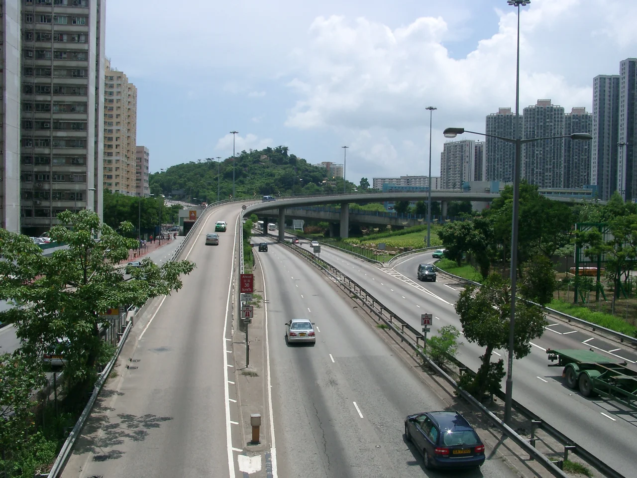

Tuen Mun Road
Governor Murray MacLehose stood at the ribbon on 5 May 1978 and officially opened Hong Kong's first expressway. The engineers who built it knew the road had problems. To save construction costs, the carriageways had been made narrow and the geometry substandard — tight bends, limited sightlines, steep grades that the terrain of the Tai Lam hills demanded. The decision was practical. It was also a debt that would take decades to repay.
Built Along the Coastline
Tuen Mun Road runs roughly 21 kilometres between Tuen Mun in the northwest New Territories and Tsuen Wan, forming part of Hong Kong's Route 9 — a circuit that loops the entire New Territories. The alignment is never simple. From Lam Tei Interchange, where the road meets Yuen Long Highway, it works eastward through Tuen Mun town before climbing the hillside above Sam Shing Hui, descending into So Kwun Wat, rising again to cross the mouth of Tai Lam Chung, and then threading through the split-level terraces carved into the Tai Lam hillside. The two carriageways separate and rejoin repeatedly, one tracking above the other on embankments and viaducts. Near Ting Kau, the road reaches its widest point — five lanes in one direction, three in the other — before the final tight-bend descent into Tsuen Wan. Building all of this along a winding coastline and through steep terrain required numerous viaducts, culverts, and deep cuttings. The construction was phased: Phase 1 opened in 1978 as the Tsuen Wan-bound carriageway; Phase 2, between Sham Tseng and Tsuen Wan, followed in 1981; the remaining Tuen Mun-bound section was completed in 1983.
The Weight of Heavy Use
For years after it opened, Tuen Mun Road was simply the road — the main artery linking the rapidly developing northwest New Territories to urban Kowloon. Container trucks rolled toward the River Trade Terminal in Tuen Mun. Commuters who wanted to avoid the tolls of Tai Lam Tunnel took this road instead. Buses ran constant circuits. The narrow lanes and substandard curves caused frequent accidents, and speeds had to be reduced. From 2008 to 2015, the Highways Department undertook major reconstruction: lane widening, curvature improvements, new noise barriers, better sightlines. The work transformed the road's worst sections without fundamentally changing its character. Tuen Mun Road is still a road that asks something of the people who drive it.
Ting Kau, 10 July 2003
Early on the morning of 10 July 2003, a Neoplan Centroliner double-decker bus operated by Kowloon Motor Bus was running route 265M toward Tin Shui Wai. Near the junction with Tsing Long Highway — the viaduct section above Ting Kau — a lorry in the middle lane lost control. The collision knocked the bus sideways, toward the edge of the viaduct. The bus broke through the parapet and fell 35 metres onto Ting Kau Village below. Twenty-one people died, including the driver. Twenty more were injured. Rescue teams described the operation as the most challenging they had faced since the 1996 Garley Building fire: the village sat on a steep hillside with no direct road access, and the number of severely injured survivors was overwhelming. The Chief Executive of Hong Kong, Tung Chee Hwa, visited the scene and pledged a full investigation. The lorry driver was initially found guilty of causing death by dangerous driving and sentenced to 18 months in jail; on appeal, after evidence emerged that the lorry had a mechanical defect causing it to veer under braking, the conviction was reduced to careless driving and the sentence cut to five months. At the time, it was the worst road accident in Hong Kong's history. The bus itself was eventually lifted back up to the road and taken to a vehicle compound, where it was written off.
Small Disasters and Long Jams
Not all incidents on Tuen Mun Road involve catastrophe on that scale, but the road keeps finding ways to stop traffic. On 1 December 2013, a screw protruding from the road surface punctured the tyres of approximately 50 heavy vehicles — 36 of them KMB buses — near Yau Kom Tau. The cascading failures shut down lanes and produced a three-hour traffic jam that stranded hundreds of passengers. No one was injured, but the absurdity of the disruption captured something essential about the road: it does not need a dramatic cause to create a crisis. The engineering compromises of 1977 echo forward. Drivers who know the road well still respect its worst sections, and the buses that run its length every day carry the accumulated memory of what this corridor has witnessed.
A Road Still Being Fixed
The 2008–2015 reconstruction improved Tuen Mun Road significantly, and the bus-bus interchange at the road — completed in stages in 2012 and 2013 — eased transfers for commuters making their way between the New Territories and Kowloon. The road is more capable than it was when MacLehose cut the ribbon. But it remains what it always was: a piece of infrastructure that was built quickly to meet an urgent need, on difficult terrain, with the knowledge that some of the cost would come due later. Hong Kong built its northwest suburbs fast. The road that connected them learned to carry that speed, and the weight of it, for decades.
From the Air
Tuen Mun Road runs between approximately 22.41°N, 113.98°E (Lam Tei Interchange, western end) and 22.37°N, 114.10°E (Ting Kau/Tsuen Wan, eastern end). The road's viaduct sections above Tai Lam and Ting Kau are visible from the air as elevated ribbons crossing green hillside. The Ting Kau Bridge (visible nearby) provides a useful navigation reference. Hong Kong International Airport (VHHH) lies approximately 10 km to the west-southwest of the road's western terminus. Recommended viewing altitude: 2,000–3,500 feet to appreciate the road's winding route through the Tai Lam hills and its relationship to the bay and surrounding terrain.
Nearby Stories
- Chapel of St. Francis Xavier 3.5 km away
- Cuiheng 4.1 km away
- 2015 Shenzhen Landslide 16 km away
- Shunde 31 km away
- Wanshan Archipelago 37 km away
- Nanxiong Formation 96 km away
- Heyuan 149 km away
- Checheng Fu'an Temple 629 km away