
Tuen Mun
The name came first, and then the town came to fit it. The To clan — migrants from Jiangxi on the Chinese mainland — arrived late in the Yuan dynasty (1272–1368) and established a village they called Tuen Mun Tsuen. More clans followed, more villages clustered around, and the settlement grew through its own gravity. It became Tuen Mun Tai Tsuen — 'large village.' More growth, and it became Tuen Mun Hui, a market town. Today that original market site is called Tuen Mun Kau Hui: 'old market,' because there is now a San Hui, a new market, beside it. The place kept outgrowing its own names. Nothing in its recent history suggests it has stopped.
A Coast Worth Defending
Long before the To clan arrived, Tuen Mun mattered for reasons of strategy. During the Tang dynasty (618–907), a navy town — Tuen Mun Tsan — was established across Deep Bay in what is now Nantou, Shenzhen, and the broader area including Hong Kong fell under its protection. The location made sense: Tuen Mun sits at the mouth of the Tuen Mun River where it opens into Castle Peak Bay, commanding access to a stretch of coast that any serious power needed to control. The settlement continued to serve coastal defence purposes right up to 1898, when Britain extended its lease from the Qing government and took over the New Territories. The new administration renamed the area Castle Peak and renamed the market Tsing Shan Hui. Locals kept calling it Tuen Mun. The original name outlasted the empire that tried to replace it.
Tanka Fishermen and Castle Peak Bay
For generations before the new town, the most visible community at Castle Peak Bay was the Tanka — a boat-dwelling people who fished the South China Sea and made their home on the water. They gathered at the bay in significant numbers, a floating economy of nets and vessels that represented a way of life stretching back centuries. The Tanka world was largely invisible to administrators in the city: they lived apart, they married apart, they moved with the seasons and the fish. When Hong Kong began planning in earnest, the bay they depended on became something else entirely. The reclamation that followed turned water into land, and that land became the platform for a city of towers.
A New Town on Reclaimed Ground
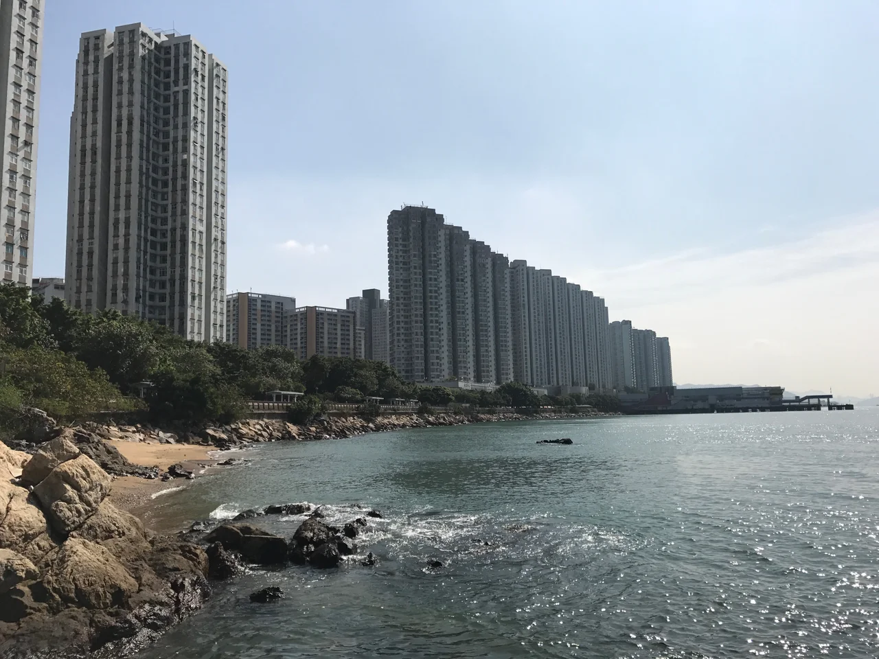
In 1965, planners designated the area 'Castle Peak New Town.' Construction began from 1970, and many of the new buildings rose directly on land reclaimed from Castle Peak Bay itself. The name reverted to Tuen Mun in 1972 — a quiet acknowledgment that the original name had never really left. The first public housing estate, Castle Peak Estate, opened in 1971. What followed was decades of building at a pace that compressed multiple generations of urban development into a single lifetime. By the time the Light Rail system opened in September 1988, the town already needed mass transit. By the time the KCR West Rail connected Tuen Mun to Kowloon in December 2003 — becoming part of the Tuen Ma line in June 2021 — around half a million people were living here, sandwiched between Castle Peak (583 m) to the west and Kau Keng Shan (507 m) to the east.
The Town That Everything Runs Through
Tuen Mun is not a quiet backwater. Hong Kong's largest electricity generation facilities — Castle Peak Power Station and Black Point Power Station — are located in the western part of the district. The town has 36 primary schools and 38 secondary schools; three universities, including Lingnan University, are based here. Three traditional-style wet markets still operate: Kau Hui, San Hui, and Sam Shing Hui. The Tuen Mun Town Hall hosts concerts and theatrical performances. The River Trade Terminal in the south handles container freight. Cross-border ferries depart from the pier for Macau and Shenzhen. Hong Kong International Airport is across the bay, visible from the hills. The Tuen Mun Trail, in two segments, climbs through those hills above the town and connects to the end of the MacLehose Trail — offering, from the ridgeline, a panoramic view of everything this particular stretch of coast has become.
Between Two Mountains
Tuen Mun's geography is its defining constraint and its most striking feature. The town cannot spread west past Castle Peak, cannot climb east over Kau Keng Shan. It fills the valley between them, pressing against the bay on one side and the country parks on the other. The Tuen Mun River runs through it, now channelled and managed. The hills above remain green, the country park boundary holding the city at a clear line. From the lookout points on the Tuen Mun Trail, the view makes the relationship between the ancient settlement and the modern city suddenly legible: the bay where the navy once anchored, the reclaimed ground where towers now stand, and the hills that have always been there, unchanged, watching all of it.
From the Air
Tuen Mun is located at approximately 22.39°N, 113.97°E at the northwestern edge of Hong Kong's New Territories, fronting Castle Peak Bay. From the air, the town's new town grid of housing estates is clearly visible between two ridgelines — Castle Peak (583 m) to the west and Kau Keng Shan (507 m) to the east. Hong Kong International Airport (VHHH) sits approximately 7 km to the southwest across the water. The Tuen Mun River channel cutting through the town and the curved shoreline of Castle Peak Bay are useful navigation landmarks. Recommended viewing altitude: 2,000–4,000 feet for the full valley view.
Nearby Stories
- Chapel of St. Francis Xavier 3.5 km away
- Cuiheng 4.1 km away
- 2015 Shenzhen Landslide 16 km away
- Shunde 31 km away
- Wanshan Archipelago 37 km away
- Nanxiong Formation 96 km away
- Heyuan 149 km away
- Checheng Fu'an Temple 629 km away