Valle de Cocora
The trees should not be this tall. Palms are tropical things, squat and coconut-heavy, belonging to beaches. But in a cloud forest 2,400 meters up in the Colombian Andes, the Quindío wax palm grows to sixty meters - a pencil-thin column of pale trunk topped by a small crown of fronds, standing alone in cow pasture like a misplaced exclamation point. When the mist rolls through the Valle de Cocora and only the upper canopies show, the palms look less like trees than like the masts of some lost ghost fleet drifting above the valley floor.
The World's Tallest Palm
Ceroxylon quindiuense is a contradiction. Its girth matches any ordinary palm at the base - thick enough to hug - but its trunk shoots upward for nearly twenty stories before the fronds unfurl. Nothing else in the botanical world balances quite like this. The tree nearly vanished. For centuries farmers felled wax palms for building timber and candle wax, but the killing custom was Palm Sunday: each year the fronds were cut for Catholic processions, and each year the trees were weakened further. By the early 1980s the species teetered on the edge. Colombia responded in 1985 by designating Valle de Cocora a protected area and, two years later, naming the wax palm the national tree. The cutting stopped. The population is still rare, still recovering, but no longer staring at extinction.
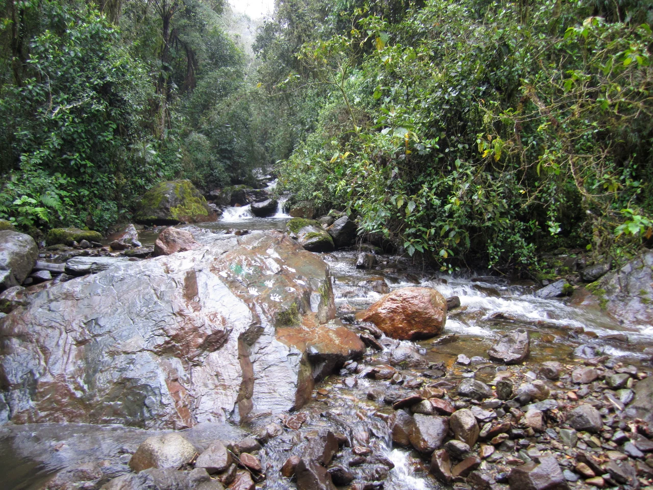
A Cloud Forest Between Andes
The valley sits in Quindío department, an hour from the coffee-country town of Salento, cradled between flanks of the Cordillera Central. The Quindío River threads through the bottom, pastures climb the lower slopes, and above them the cloud forest takes over - dense, dripping, stitched together with ferns, bromeliads, and the moss that gives every branch its fuzzy outline. Altitude runs from roughly 1,800 to 2,400 meters, which keeps the air cool and the clouds low. Most days begin clear and end wet. Visitors who rode up in the back of a willys jeep from Salento's plaza at dawn tend to learn the same lesson by early afternoon: hike early, because by three the rain usually finds you.
Parrots That Live in Palms
The charismatic mammals here - spectacled bears, mountain tapirs, pumas - keep well out of sight, as they should. The signature animal you actually meet is a bird. The yellow-eared parrot, Ognorhynchus icterotis, nests only in hollow wax-palm trunks. As the palms vanished, so did the parrots; by the late 1990s fewer than a hundred remained. A coordinated rescue operation through the organization ProAves, protecting both the birds and the trees they depend on, pulled the species back. By 2012 the census counted more than 1,500. Fly through the valley now and you may hear their raucous calls before you see the green flash of a flock banking between palm crowns. Andean condors ride the thermals higher up; hummingbirds crowd the feeders at the Acaime sanctuary, needles of color hovering an arm's length away.
The Long Loop
There is really only one thing to do in Cocora, and that is walk. The classic six-hour loop climbs slowly through pasture, enters the cloud forest, crosses the Quindío River a half-dozen times on log bridges, and emerges at the Finca La Montaña - a small farm perched on a steep shoulder with views that make the climb feel justified. From there the trail drops back down into the wax-palm valley itself, the stand most people came to see. Experienced hikers argue for running the loop backwards, reaching the palms in the bright morning before the afternoon clouds close in. Either way, bring boots. The trail, churned by horses and soaked by nightly rain, becomes a shallow river of mud. The reward is walking under trees that look impossible and finding, beyond them, a valley that opens into the high passes of Los Nevados - the back door to the glaciers and volcanoes above.
From the Air
From a cockpit above the Colombian Cordillera Central, Valle de Cocora reads as a bright green trough pointing northeast toward the snow-capped peaks of Los Nevados National Park, with the tiny white grid of Salento on its western approach. The wax palms themselves are too slender to pick out individually from altitude, but the pasture-forest mosaic shows clearly, and on cloud-free mornings the contrast between the valley floor and the dark forested ridges above is unmistakable.
From the Air
Coordinates 4.63°N, 75.46°W. Valle de Cocora sits in Quindío department at 1,800-2,400 m elevation, oriented roughly east-west between ridges of the Cordillera Central. Nearest paved airport is El Edén (SKAR) at Armenia, about 25 km southwest; Matecaña International (SKPE) at Pereira is 35 km northwest. Cloud formation typically builds after midday - best aerial views are early morning. The glaciated peaks of Los Nevados National Park (Nevado del Tolima, Nevado del Ruiz) rise to the northeast above 5,000 m.
Nearby Stories
- Manizales 20 km away
- Tolima Department 42 km away
- San José del Palmar 42 km away
- San Francisco, Cundinamarca 66 km away
- Sabana Formation 74 km away
- Valle del Cauca Department 82 km away
- Tutunendo 113 km away
- Villavicencio 142 km away