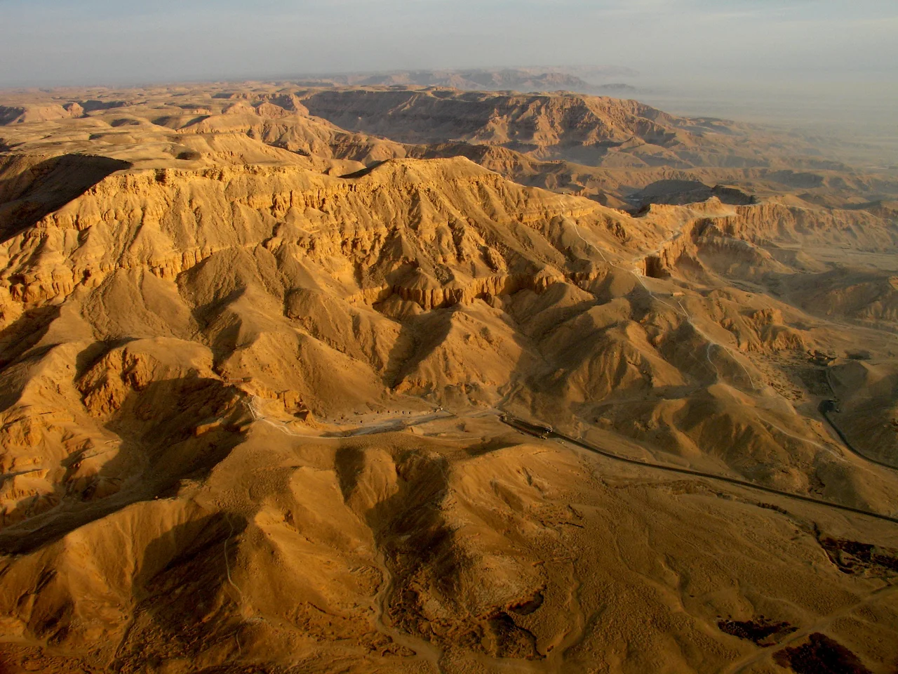

Valley of the Queens
The ancient Egyptians called this place Ta-Set-Neferu, a name that meant both "the Place of Beauty" and "the Place of the Royal Children" - and they meant both. Tucked into a parched fold of the Theban hills, a short walk from where the pharaohs themselves lay in the Valley of the Kings, this narrow desert basin became a cemetery for the women and children of Egypt's royal house. For roughly four centuries, queens, princesses, and young princes were carried here to be sealed into the rock. The valley holds more than a hundred tombs in all. One of them is among the most beautiful paintings to survive from the ancient world.
Why Here
No surviving text explains the choice, and Egyptologists are left to read the landscape itself. The valley sits close to Deir el-Medina, the walled village of the artisans who cut and decorated the royal tombs - the same skilled hands worked both sides of the ridge. It lies a short distance from the Valley of the Kings, keeping the dead of one family within reach of each other. And at the valley's entrance, a sacred grotto dedicated to the goddess Hathor may have made the ground holy. Hathor was a goddess of the western mountain and the welcoming of the dead, and her grotto was likely tied to ideas of rejuvenation - the hope that those buried here would be reborn. For a people who built their whole civilization around the journey past death, a valley watched over by Hathor was no accident.
Nefertari's Rooms
The valley's masterpiece belongs to Nefertari, the beloved great wife of Ramesses II, the pharaoh who ruled for sixty-six years and called himself the Great. Her tomb, designated QV66, was found in 1904 by the Italian Egyptologist Ernesto Schiaparelli, who held the excavation rights here and worked the site methodically with his collaborator Francesco Ballerini. Robbers had long since stripped the burial of its treasure. But what they could not carry off were the walls. Across roughly 520 square meters of plaster, Nefertari is shown moving through the afterlife - playing the board game senet, greeted by gods, her gown white and translucent, the ceiling a field of golden stars on deep blue. The colors are so vivid and the drawing so assured that the tomb is often called the Sistine Chapel of ancient Egypt.
The Salt and the Slumping Hills
Beauty this fragile does not survive on its own. The valley is cut into a treacherous mix of limestone, clay, and shale, faulted and tilted over millions of years. The clays swell and shrink with every rare flash flood, cracking tomb walls; groundwater seeps in and leaves crystallized salt that pushes paint off plaster from behind. By the twentieth century, Nefertari's reliefs were in danger of being lost entirely. Between 1986 and 1992, the Getty Conservation Institute worked with Egyptian authorities to stabilize them - drawing out salts, consolidating the plaster, monitoring the air. The tomb reopened in 1995 under tight limits on how many visitors may enter and for how long. A few tombs here have been left to a different kind of guest: bat colonies now roost in QV15, QV48, and QV78, protected for their ecological value.
A Family Across the Ridge
Not everyone in the royal family came to rest here. During the Eighteenth Dynasty, the valley took nobles and officials alongside royals - a head of the stables, a vizier, an early princess named Ahmose. By the Nineteenth Dynasty, under Ramesses I, Seti I, and Ramesses II, it narrowed to royal women almost exclusively. The princes went elsewhere. Across the hills in the Valley of the Kings lies KV5, a sprawling warren rediscovered to be the tomb of the sons of Ramesses II - dozens of chambers for the king's many boys. Read together, the two valleys map a dynasty's sense of where its people belonged in death: the kings in one wadi, their wives in another, their sons in a third, all within a few minutes' walk under the same desert sun.
From the Air
The Valley of the Queens sits at 25.728°N, 32.593°E, on the west bank of the Nile opposite Luxor, tucked into the southern end of the Theban necropolis below the pyramid-shaped peak of el-Qurn. From the air it reads as a pale, branching desert wadi just south of the Ramesseum and the Deir el-Medina village ruins, with the green Nile floodplain and the city of Luxor a few kilometers to the east. Best viewed at 2,000-4,000 feet AGL in the clear, dry light of early morning, before midday haze and dust build over the valley. The nearest airport is Luxor International (ICAO HELX), roughly 8 km east-northeast across the river; Cairo International (HECA) lies far to the north.
Nearby Stories
- Temple of Seti I (Abydos) 20 km away
- Dendera Temple complex 21 km away
- Esna 22 km away
- Abydos, Egypt 49 km away
- Mersa Gawasis 116 km away
- Kharga Oasis 147 km away
- Hurghada 184 km away
- Wadi El Gemal National Park 238 km away