
Vastas
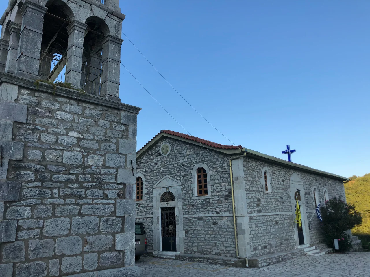
Seventeen trees grow from the roof of the Chapel of Saint Theodora, and no one who sees them can quite believe it. They are not small trees. Most rise more than 30 meters. Their roots are invisible — not beneath the floor, not visible in the walls, not detectable outside the building. For centuries this was simply called a miracle. Then researchers from the University of Patras arrived with ground-penetrating radar.
A Woman Who Refused the Rules
The chapel stands because of a woman who lived — and died — in defiance of the expectations placed on her. Saint Theodora of Vasta was an 11th-century Byzantine woman living in what is now a mountainside village 850 meters above sea level, near the border of Arcadia and Messenia. When bandits raided the area and the men of the village organized to defend it, Theodora joined them. The only way she could do so was in disguise, dressed as a male soldier.
She did not survive the fight. As she lay dying, she uttered what became her dying prayer — words recorded in Orthodox tradition, asking that her body become a church, her blood a river, and her hair the trees around her. The villagers buried her and, moved by what she had done and what she had asked, built a chapel at the site of her grave. Tradition holds that a local river shifted course to pass directly beneath the building. Then the trees began to grow — from the roof itself.
What the Radar Revealed
The mystery of the trees is real, but it does have an explanation — one that, if anything, makes the chapel more remarkable rather than less. Researchers from the University of Patras used high-frequency ground-penetrating radar and electrical tomography to map what was happening inside the stone walls without disturbing the building or alarming the clergymen who, as the research report notes with some warmth, served as "sleepless guardians" throughout the survey.
What they found: the roots descend through gaps in the stonework of the walls, threading invisibly through the masonry. They reach the ground this way, forming a web of roots that — almost paradoxically — reinforces the structure's resistance to its own roof load while simultaneously creating stresses that threaten the walls. The building is being held up and slowly destroyed by the same living system. The south wall, they found, has significantly more voids than the north. The roots are real. The engineering problem is real. The miracle of survival, centuries-long, remains.
The Three Wonders of Vasta
The chapel is only the beginning of what Vastas offers to careful attention. Beneath the church itself lie large, largely unexplored ancient caverns. About four decades ago, a local landowner named Mitsios Papakostantinou discovered three small statues in those caverns; the Archaeological Museum of Sparta claimed them. What else might be underground remains unknown.
On the village's northwestern edge, a large limestone bears what older residents identify as the fossilized footprint of Theodoros Kolokotronis, the central figure of the Greek War of Independence of 1821. The story holds that Kolokotronis and his riders used the spot as a lookout for Ottoman forces, and that when he dismounted one day, the weight of the moment — or the man — left its mark in the rock.
At the summit of Mount Tetrazion, the village's highest point, a spring produces water so cold that it is, according to local testimony, very difficult to keep a hand submerged for more than 40 seconds. The legend attributes this spring to Apollo, whose temple is reportedly visible from the mountain's western slope below.
The Village Above the Valley
Vastas itself is a small place, 14 km west of Megalopolis, perched on a mountainside at roughly 850 meters. The terrain here is typical of interior Arcadia: steep, forested, the kind of landscape that preserved ancient customs and isolated small communities through Ottoman centuries and Byzantine ones before that. The village sits near a border — geographically between Arcadia and Messenia — and that borderland quality gives it an in-between feeling, a place just outside the main currents of regional history that somehow accumulated a remarkable density of layers.
The chapel of Saint Theodora draws religious pilgrims as well as visitors drawn by curiosity. It is a protected monument under the Directorate for the Restoration of Byzantine and Post-Byzantine Monuments. The trees have survived without any obvious means of survival for long enough that they have become simply part of the place — part of what Vastas is.
Vastas from the Air
Vastas lies at approximately 37.37°N, 21.98°E in the mountainous interior of the Peloponnese, on a forested ridge that is easily identifiable from altitude as one of the more pronounced hillside settlements in the area. Kalamata International Airport (LGKL) is roughly 55 km to the southwest. Approaching from that direction at 5,000–7,000 feet, the terrain rises sharply from the coastal plains of Messenia into the Arcadian highlands, and the village of Vastas appears as a cluster of white buildings against dark green hillside. The chapel itself is small enough that it won't catch the eye from altitude, but the dense tree cover over a roofline in the lower part of the village marks its location unmistakably once you know what to look for.
From the Air
Vastas: 37.37°N, 21.98°E. Nearest major airport: LGKL (Kalamata International), ~55 km southwest. Recommended viewing altitude: 5,000–7,000 ft. The village appears as a hillside settlement on a forested ridge; the chapel is in the lower village. Terrain rises significantly from coastal Messenia; clear days provide wide views across the interior.
Nearby Stories
- International Flight Training Center, Kalamata 5.3 km away
- Karyes 6.8 km away
- Barony of Akova 11 km away
- Agios Andreas, Katakolo 13 km away
- Diocese of Amyclae 14 km away
- Larisa (Argos) 19 km away
- 2023 Messenia Migrant Boat Disaster 26 km away
- Panagia Skafidia Monastery 40 km away