Warsingsfehn
By 1816, a peat-cutting village that had been founded eighty years earlier on a 225-hectare moor lease owned twelve seagoing ships. By the end of the nineteenth century it owned eighty-two. None of this was supposed to happen. Warsingsfehn started as a Fehn colony — one of the rectangular peat-canal villages that dot East Frisia — and was meant to spend its life supplying fuel to Emden and Leer by barge. The men who dug the peat noticed something the planners did not: the canals their families had cut to ship peat connected, eventually, to the North Sea. So a great many of them stopped digging and went to sea, and a moor colony quietly turned into a port. Today Warsingsfehn is the capital of the municipality of Moormerland, the largest village in it, with nearly 8,000 people. The peat is long gone. The seagoing reflex remains.
Born After the Christmas Flood
Warsingsfehn carries the memory of a disaster inside its origin story. The Christmas Flood of 1717 — the catastrophic North Sea storm surge that drowned an estimated 14,000 people across the Frisian coast in a single night — swept through the original settlement and forced its survivors to move to higher ground. The village we now call Warsingsfehn dates its real founding to 16 November 1736, when the Prussian state granted landowner Gerhard Warsing a leasehold of 225 hectares of raised moor. His son Hermann expanded the territory in steady increments: 50 more hectares in 1769, 62 in 1776, ten more in 1779. The Warsings then sublet plots along a central canal and a fan of side canals branching off at right angles, the precise geometry that gives Fehn colonies their distinctive aerial fingerprint.
How to Cut a Moor
The peat-cutting method was exacting. Crews first stripped the upper layer of white peat — younger, lower-quality material — and set it aside. Then they dug the black peat underneath, dried it, and barged it to the cities as heating fuel. After the black layer was excavated, they spread the saved white peat back over the underlying soil to create something that could, with help, grow crops. White peat alone yields almost nothing, so the settlers mixed it with marsh dung from the surrounding East Frisian wetlands. The resulting fields kept families fed, but barely. Most moor settlers in Warsingsfehn made a hard, modest living, and the village's first decades were dominated by the rhythm of cutting, drying, and shipping the bog itself away one barge at a time.
From Peat Barges to North Sea Sails
Then the math changed. In 1751 the canals around Warsingsfehn carried five small peat ships and four other inland boats. By 1816 the peat fleet had grown to 31, and twelve seagoing ships had appeared alongside. Captains who had grown up moving fuel to Emden began moving cargo between North Sea ports, picking up freight wherever the next harbor offered it. By the end of the nineteenth century the seagoing fleet had reached 82 vessels. Many ordinary villagers signed on as sailors. The captains and shipowners built solid brick houses lining the canal — many still standing — and the village's prosperity outgrew anything peat alone could have funded. Then steam shipping arrived. Small sailing vessels could not compete with steel-hulled steamers, and Warsingsfehn's blue-water trade collapsed within a generation.
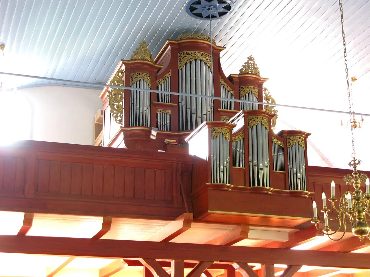
The Quiet Win
The collapse did not end the village. It just changed it. When Moormerland was assembled in the 1970s out of several surrounding settlements, the question of which town would host the new municipal administration came down to Warsingsfehn versus Neermoor. Warsingsfehn won on size. Despite being one of the youngest places in the new municipality, it had already grown into by far the largest, and the seat of government came with it. Walk the village today and the peat era survives in the canal geometry and in the windmill that still turns at the village edge. The seagoing era survives in the captains' houses and in the organ of St. James' Church. The current era — a small administrative capital with a population around 8,000 — is what eighty years of peat and a hundred years of sailing built, almost by accident.
From the Air
Warsingsfehn lies at 53.314 N, 7.486 E, the central village of Moormerland municipality, about 9 km north of Leer and just north of Veenhusen. From altitude the Fehn geometry is unmistakable: a straight central canal with side canals branching at right angles, narrow strips of farmland between, and a regular row of houses along the canal banks. The Ems estuary lies about 5 km west. Nearest airports: Leer-Papenburg (EDWF) about 10 km south, Emden (EDWE) about 18 km northwest, Groningen Eelde (EHGG) about 55 km west across the Dutch border. Bremen (EDDW) is about 90 km southeast. Morning fog over the Ems delta is common in autumn; clear summer afternoons give the best look at the Fehn canal pattern.
Nearby Stories
- Wilhelmshaven LNG Terminal 3.5 km away
- Veenkoloniën 6.1 km away
- Varel 6.2 km away
- Juist 7.6 km away
- Delfzijl 7.8 km away
- Dornumersiel 9 km away
- Papenburg 11 km away
- Hatten 19 km away