
Whalley Abbey
Whalley Abbey is the kind of place that took longer to build than most empires last. The first stone went down in June 1296. The church wasn't finished until 1380. The rest of the monastery dragged on until the 1440s. The North East Gatehouse, the one most visitors notice first, was the final touch, completed in 1480. Nearly two centuries from groundbreaking to ribbon-cutting, and then, within sixty years, Henry VIII had it all torn apart.
The Move from Stanlow
Whalley exists because Stanlow Abbey, on the bleak banks of the Mersey estuary, was a disaster. Flooded in 1279. Church tower blown down in a 1287 gale. Burned in 1289. By 1283, Henry de Lacy, tenth Baron of Halton, had agreed his Cistercian tenants could relocate inland to a quieter spot in the Ribble Valley. The move took thirteen more years to organize, and de Lacy himself laid the first stone in June 1296. Stone for the new abbey was hauled from quarries at Read and Simonstone, just a few miles up the valley. A royal licence to crenellate the boundary wall arrived in 1339, giving the abbey the defensive air of a small fortress.
The Feud with Sawley
The move did not please everyone. Sawley Abbey, seven miles north, watched its income drain south to the new house and complained bitterly. Food prices rose. Building materials grew scarce. When Whalley announced plans for a tannery, oak bark merchants raised their prices and nearly destroyed Sawley's own leather operation. The general chapter of the Cistercian order settled the dispute in 1305 with the kind of judgement only monks would devise: Whalley must offer any surplus to Sawley at market rates, and any monk who wronged the other house would be sent to that house for punishment. Imagine being marched to your enemy's gate to ask for the rod.
Country House on Sacred Ground
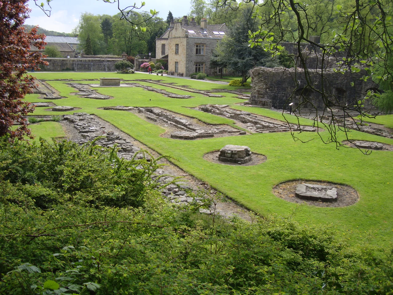
The dissolution came in 1537. By 1553, the abbey lands had been sold for just over £2,151 to John Braddyll of Brockhall and Richard Assheton of Lever near Bolton. They divided the spoils. Assheton took the monastic site, demolished the abbot's house and the infirmary, and built a large country house on the consecrated ground. Over the next century, most of what remained of the church and monastic buildings was pulled down for stone. The house passed through generations of owners, each adding their own modifications, until Sir John Travis Cragg bought it around 1900. In 1923, the Anglican Diocese of Manchester purchased the property, and when the Diocese of Blackburn was created in 1926, Whalley came with it.
What Survives
Only the foundations of the abbey church remain visible, but the monastic outbuildings have fared better. The west range, once the lay brothers' dormitory, still stands at two storeys and is roofed; it serves today as a Roman Catholic church hall, a small ecumenical irony nobody seems to mind. Parts of the kitchen, refectory, day room, parlour and vestry walls survive on the east and south sides of the cloister. The Grade II listed lodge at the entrance, built of ashlar sandstone with a stone slate roof, dates from the late 18th century. The 1480 gatehouse still stands sentinel where visitors arrive.
Retreat and Reckoning
The former house reopened in September 2005 after a major refurbishment as a retreat and conference centre. Conference rooms, a dining room, en suite accommodation, a coffee shop, an exhibition centre and a bookshop now occupy the north range. Two ground floor rooms have been converted into chapels. Guided tours of the ruins run in summer. But the abbey has not been entirely at peace. In August 2021, around 150 youths gathered in the ruins for an extended night of drinking, drug-taking, and vandalism, harassing the warden and his wife, assaulting security staff and police, and pelting neighbouring houses with stones. The Cistercians chose this valley for its silence. Most nights, it still keeps it.
From the Air
Whalley Abbey sits at 53.82°N, 2.41°W in the Ribble Valley, on the south bank of the river just south of Whalley village. Best viewed at 2,000-3,000 feet AGL; look for the surviving gatehouse and the cluster of stone buildings against the river bend. Nearest airports: Blackpool (EGNH) 25 nm west, Manchester (EGCC) 30 nm south, Leeds Bradford (EGNM) 35 nm east. Pendle Hill rises distinctively to the northeast, providing one of England's most recognizable navigation landmarks in clear weather.
Nearby Stories
- Bury Art Museum 2.6 km away
- Silverdale, Lancashire 3.1 km away
- Siege of Lathom House 4.2 km away
- Leeds Bradford Airport 6.5 km away
- Preesall 11 km away
- Jervaulx Abbey 14 km away
- Wentworth Castle 19 km away
- Yorkshire Dales 19 km away