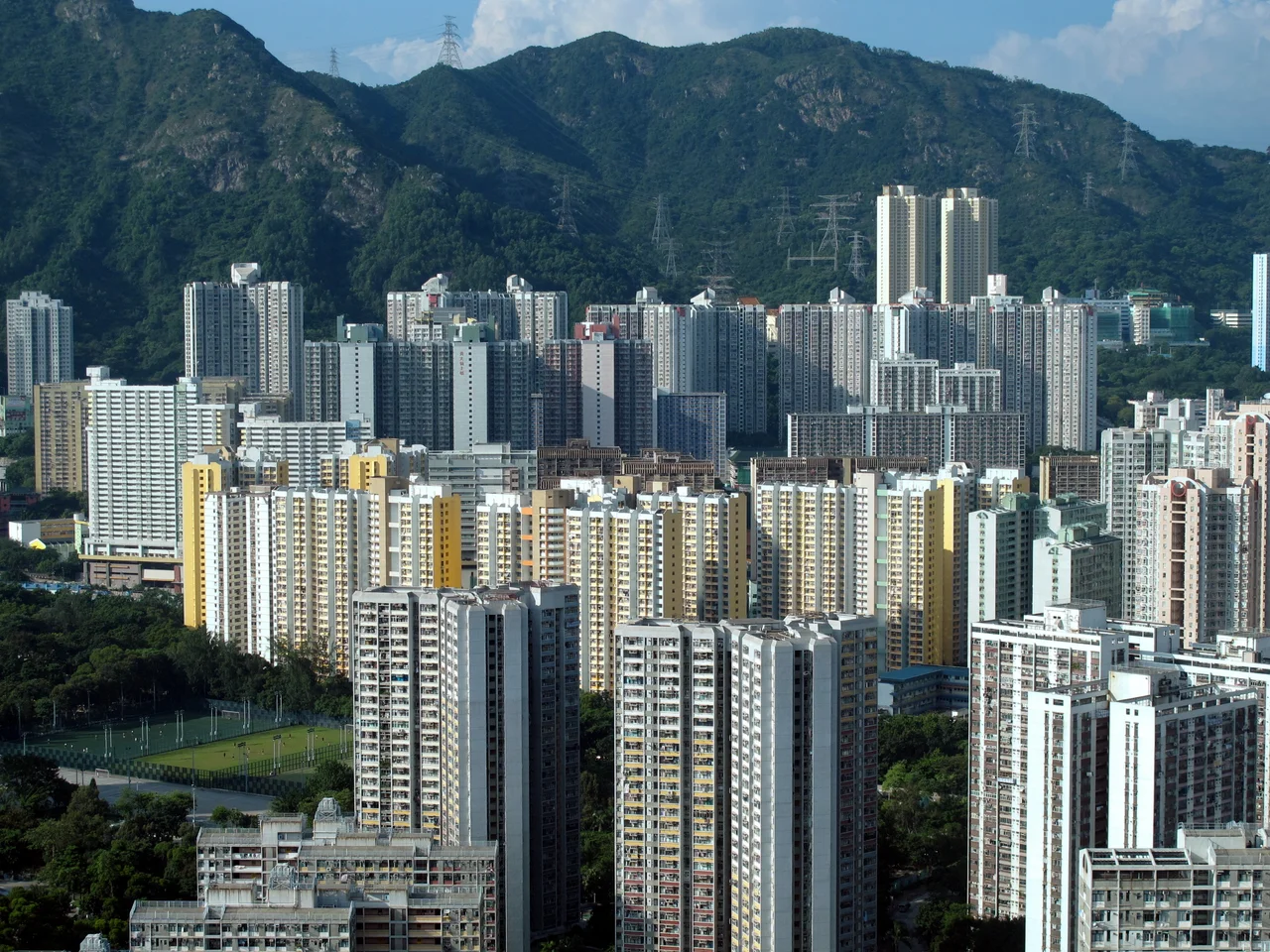

Wong Tai Sin District
Hong Kong is defined by water — the harbour, the typhoon shelters, the South China Sea at every edge. Every district touches a coastline except one. Wong Tai Sin, tucked into the northern reaches of Kowloon, is entirely landlocked, hemmed in by hills and neighbouring districts on all sides. It covers just 9.36 square kilometres, making it one of the smallest districts in the territory, yet it holds more than 400,000 residents. The density is palpable: high-rise housing estates rise close together, and the streets between them carry the full weight of a community that has been living in close quarters for generations. What binds the district together is not geography but something harder to quantify — a shared sense of place centred, more than anything else, on a temple.
A District Without a Shore
Wong Tai Sin District occupies the northernmost corner of Kowloon, bordered by Kwun Tong to the southeast, Kowloon City to the southwest, Sai Kung to the east, and Sha Tin to the north. Within those boundaries lie a string of densely settled neighbourhoods: Diamond Hill, Wang Tau Hom, Lok Fu, Chuk Yuen, Tsz Wan Shan, Ngau Chi Wan, and Choi Hung. Most residents live in public housing estates, some of them among the largest in Hong Kong. The old Kai Tak Airport — which closed in 1998 — sat just south of the district's boundary, and its redevelopment into the Kai Tak district has reshaped the southern edge of Kowloon ever since. The Kwun Tong MTR line threads through Wong Tai Sin with stops at Lok Fu, Wong Tai Sin, Diamond Hill, and Choi Hung, connecting the district to the rest of the city without a single meter of coastline to cross.
The Temple That Named the District
The district draws its name from the Wong Tai Sin Temple — a sprawling Taoist complex on the southern slopes of Lion Rock that draws millions of visitors every year. The temple and the district are inseparable: the neighbourhood grew up around the shrine, and the shrine gives the neighbourhood its identity. On Chinese New Year's Eve, thousands of worshippers queue outside before midnight to be first through the gates when the new year begins, believing that the earlier the incense is offered, the better the luck. The faith is specific, personal, and deeply local. It is not an abstract tradition; it is something the people of Wong Tai Sin do, year after year, in the same neighbourhood where they sleep and shop and raise children.
A Community Shaped by Migration
The 2016 census found that 34.9 percent of Wong Tai Sin's population was born in Mainland China, Macau, or Taiwan — a proportion that reflects decades of migration into Kowloon's public housing estates, which absorbed successive waves of newcomers from the mainland throughout the second half of the 20th century. At the same time, 61.1 percent were born in Hong Kong, and Cantonese is spoken by 94 percent of residents — the district is linguistically cohesive even if its origins are mixed. What the numbers cannot capture is the texture of that mixture: the way in which people who arrived with nothing built something durable, raising families in tower blocks and sending children to schools run by the Sik Sik Yuen, the charitable organisation that administers the temple and operates schools throughout the district.
An Aging Neighbourhood
Wong Tai Sin has one of the highest proportions of elderly residents among Hong Kong's eighteen districts. The 2021 census recorded a total population of approximately 406,802, down from 425,235 in 2016 — a decline that reflects both Hong Kong's low birth rate and an outflow of younger residents to newer districts. The challenge this poses is not abstract: aging residents in high-density housing need medical services, accessible transport, and social support. The district's second-highest population density in Hong Kong compounds the pressure. Yet Wong Tai Sin is not a place that feels in decline. The markets are busy, the temple is crowded on auspicious days, and the Chi Lin Nunnery — a Tang dynasty-style Buddhist complex built without a single nail — draws visitors of its own to the eastern edge of the district.
Between the Old and the New
Nga Tsin Wai Tsuen, a small walled village near San Po Kong, sits entirely within Wong Tai Sin District — the only remaining walled village in Kowloon, a physical remnant of a landscape that predates the high-rises by centuries. The government announced plans to redevelop it in 2007, setting off a preservation debate that has continued for years. The contrast it creates — an ancient clan enclosure surrounded by tower blocks — is pure Hong Kong: time compressed rather than erased, the old and the new occupying the same few square kilometres because there is nowhere else for either of them to go.
From the Air
Wong Tai Sin District lies at approximately 22.33°N, 114.20°E in the northern Kowloon peninsula. VHHH (Hong Kong International Airport) is about 30 km to the west-northwest on Lantau Island. On approach from the east, the dense tower clusters of Kowloon are visible across the harbour; Wong Tai Sin occupies the northern inland section, just south of the hills separating Kowloon from the New Territories. Lion Rock, the ridge that defines the northern boundary of Kowloon, provides a clear navigational landmark from the air — Wong Tai Sin District sits at its southern foot, at roughly 2,500–4,000 feet altitude on approach.
Nearby Stories
- Chapel of St. Francis Xavier 3.5 km away
- Cuiheng 4.1 km away
- 2015 Shenzhen Landslide 16 km away
- Shunde 31 km away
- Wanshan Archipelago 37 km away
- Nanxiong Formation 96 km away
- Heyuan 149 km away
- Checheng Fu'an Temple 629 km away