.jpg)
Wrightville
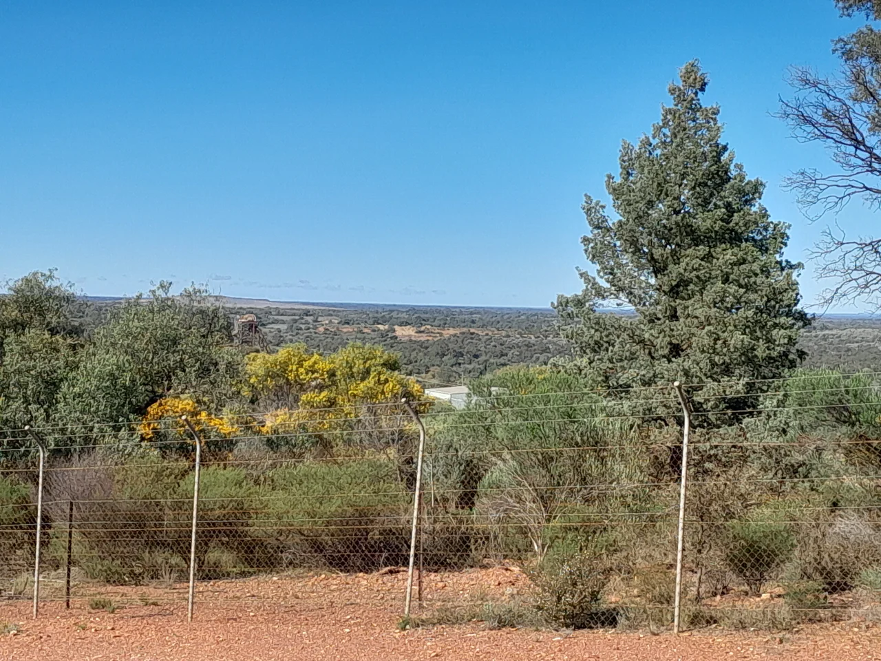
Stand on Fort Bourke Hill today and look south-west across the scrub, and there is almost nothing to see: a gravel track, the faint scar of an old railway formation, an open pit slowly filling with sky. Yet a little over a century ago this patch of semi-arid mulga held a town of two thousand people, with four hotels, two schools, a picture theatre, a town band, and a council so determined to outshine its neighbour Cobar that it picked fights with it for decades. Wrightville was that rarest of things on the dry edge of New South Wales: a community that briefly believed it could become a city. It was wrong, and the speed of its undoing is the most startling thing about it.
A Town the Shape of Its Mines
Wrightville was never planned for elegance. It grew about four kilometres south-east of Cobar, on what is now the Kidman Way, in a tangle defined entirely by the holes in the ground around it. Five mine leases hemmed it in: the Occidental and the Chesney, the largest, plus Mount Pleasant, the Young Australian, and the Great Cobar pressing from the north. The streets bent and broke to fit between them. Gold drew the first diggers here in the late 1880s, after the Chesney opened in 1887 and the Occidental followed by 1889. In the days before motor transport, a miner had to live within walking distance of the shaft, and so a settlement simply accreted around the work. The village was formally proclaimed in November 1895. By 1903 some 1,500 people called it home, and the population probably peaked near two thousand around 1907.
Water, Typhoid, and the Cost of Living Dry
Prosperity could not solve the one problem that shadowed every outback town: water. Households relied on their own rainwater tanks and a small communal dam, and in drought both failed. The mines themselves were thirsty, so when the Federation Drought bit, men lost work and families went short. Worse, the precarious supply and thin sanitation bred typhoid. By 1909 a resident wrote bitterly that the place was 'a struggling village, with little or no hope of a future return to prosperity.' There was a cruel irony in it: a stream actually ran through town year-round, fed by the Chesney Mine's pumps. But mine water was poison to drink. The town band played on, a soda fountain opened in 1909, and children crossed a footbridge over water they could not touch.
The Bushranger and the Member for Wrightville
Among the town's settlers was Patrick Daley, a reformed bushranger who had ridden with the notorious Gardiner-Hall gang in the 1860s and was one of the few of that crowd not hanged or shot dead. Sentenced to fifteen years' hard labour in 1863, he was released early, married, drifted to the Cobar district, and turned respectable. By 1904 the former outlaw was an alderman of Wrightville and the owner of the Family Hotel, and when he died in 1914 he left an estate of some six thousand pounds. The town's name, fittingly, also carried a personal story. It most likely honoured Joseph Wright, a mining entrepreneur who had pegged a claim over the future Occidental as far back as 1876.
Gone in a Generation
The collapse came fast. In March 1919 the Great Cobar shut, taking the Chesney's smelters with it. The Occidental, choked by a costly grinding plant that simply did not work, closed in 1921 with gold still in the ground. The population had been 930 at the start of 1920; by the April 1921 census it was 338. The hotels closed one by one, the convent school ended in 1922, and that same year the council, unable even to muster a quorum, was abolished by a special act of parliament. A modest revival followed the New Occidental's reopening in 1933, but the benefit flowed to Cobar, not here. When the mine closed again in 1952, the end was certain. By the late 1960s the last decaying buildings were judged an eyesore and bulldozed. A town that took thirty years to rise was erased in an afternoon.
What the Scrub Keeps
Wrightville has not quite surrendered every trace. West of the Kidman Way, the old main street survives as a gravel road still called Hunt Street, parallel to the highway. The railway formation of the Peak branch line is still legible from the air, curving toward the silent Occidental pit. In Cobar, a winder and headframe rescued from the Chesney stand in the Miner's Heritage Park, and a short street named Wrightville crosses one named Dapville, the two long-dead villages commemorating each other in a town that outlived them both. A church roll of honour, listing twenty local men who went to the First World War, hangs in the Cobar Uniting Church. Beyond that, the place that once dreamed of rivalling its neighbour has vanished completely.
From the Air
Wrightville's former site lies at 31.53°S, 145.86°E, about 4 km south-east of Cobar along the Kidman Way, in the semi-arid mulga country of the Cobar Peneplain in far-western New South Wales. The most visible landmark is the open-cut pit of the old New Occidental mine; Fort Bourke Hill, with its lookout over the former village sites, sits just to the north. Cobar Airport (ICAO YCBA), 4 km north-west, is the obvious reference point and the nearest sealed strip. The broad red plains read clearly from a circuit at 1,500-2,500 ft AGL; longer-range diversions can use Bourke (YBKE) about 130 km north or Nyngan (YNYN) roughly 130 km east. Skies here are typically clear with long visibility, though summer afternoon heat and dust can soften the horizon.
Nearby Stories
- Mount Drysdale, New South Wales 19 km away
- Nymagee 47 km away
- Louth, New South Wales 87 km away
- Paroo-Darling National Park 123 km away
- Ivanhoe 147 km away
- Roxy Theatre and Peters Greek Cafe Complex 443 km away
- Bingara 454 km away
- Lake Burley Griffin 469 km away