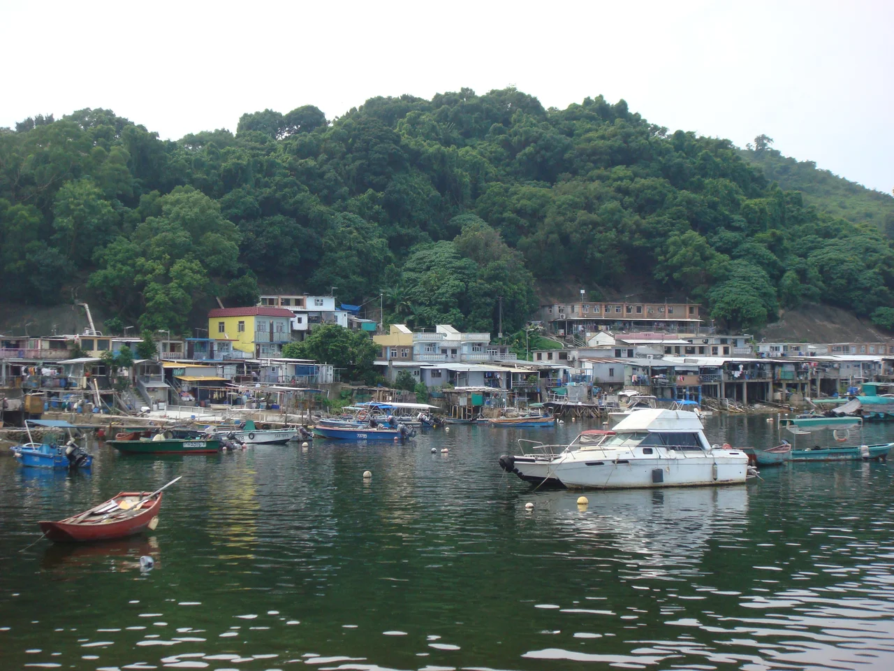

Yim Tin Tsai (Tai Po District)
Twice a day, when the tide drops far enough, a narrow strip of sand and sediment emerges between Yim Tin Tsai and the island of Ma Shi Chau to its east. This tombolo — a geological tongue connecting two landmasses through tidal rhythms — has made the crossing possible for centuries, though only for those who know the tide and are willing to wait for it. Yim Tin Tsai itself sits in Tolo Harbour in Hong Kong's Tai Po District, forming part of the southern edge of Plover Cove. It is not a famous island. But the ground beneath its villages holds evidence of 4,000 years of occupation, and its modern history involves salt fields, a Hakka clan migration from what is now Shenzhen, and a community of fishing families who were moved from boats to land when a reservoir drowned their original home.
A Harbour Full of Prehistory
Tolo Harbour has a remarkable concentration of ancient human presence. Centre Island, at the harbour's centre, has yielded evidence of occupation going back 6,000 years to the Middle Neolithic. Yuen Chau Tsai, another harbour island, has Bronze Age remains from roughly 3,000 years ago. And on Yim Tin Tsai, archaeologists have identified a Late Neolithic site dating to approximately 4,000 years ago — placing human activity here in the period when people across south China were transitioning from stone tools to early metalwork. The harbour's sheltered water, reliable fish stocks, and accessible coastlines made it an attractive place to settle across many successive cultures. Each of these islands holds a separate chapter of the same long story, and Yim Tin Tsai sits squarely in the middle of it, its prehistoric site a quiet counterpoint to the villages that occupy the land today.
Salt Pans and the Hakka Chan Clan
The historical record for Yim Tin Tsai becomes more specific in the nineteenth century. Members of the Hakka Chan clan — whose name renders into Mandarin as Chen — migrated from the area of present-day Shenzhen and settled on the island, where they operated salt fields. The name Yim Tin Tsai itself encodes this history: yim (鹽) means salt in Cantonese, tin (田) means fields, and tsai (仔) is a diminutive — Little Salt Field, or Small Salt Pan Island. The Chan clan also settled at the better-known Yim Tin Tsai in Sai Kung District and at Ping Yeung in Ta Kwu Ling's North District. This particular island in Tai Po District was one node in a wider Hakka clan geography across the eastern New Territories, linked by kinship and by the extraction of salt from coastal flats.
When the Reservoir Moved the Fishermen
The twentieth century brought a displacement that fundamentally reshaped the northern part of the island. The fishing community at the original Sam Mun Tsai lived on boats moored near Tai Kau in Luk Heung — a location that now lies at the northeastern shore of Plover Cove Reservoir. When the Plover Cove Reservoir was constructed, that water-bound community had to go somewhere. In 1966, 36 families were moved from their boats onto land, establishing Sam Mun Tsai New Village on the northern shore of Yim Tin Tsai. A neighbouring settlement, Luen Yick Fishermen Village, occupies the same northern stretch. Both villages face the Shuen Wan Typhoon Shelter. In 2006 and 2007, extensive renovation work at the Sam Mun Tsai Fishermen's Village updated the infrastructure that had served these relocated families for four decades.
Connections Across Water and Land
What makes Yim Tin Tsai's geography worth dwelling on is its pattern of connections. A road running north links the island to the mainland near The Beverly Hills residential development. A tombolo to the east — passable only at low tide — connects it to Ma Shi Chau, whose distinctive rock formations form part of a Special Area administered under Hong Kong law. A small unnamed island roughly 100 metres northeast of Yim Tin Tsai's shore falls within the Ma Shi Chau Special Area, even though Yim Tin Tsai itself does not. The island thus sits at a hinge point between different governance designations, different modes of access, and different geological ages — the old salt flats and prehistoric sites on one hand, the managed natural heritage of Ma Shi Chau on the other. At low tide, with the tombolo exposed and the two landmasses briefly joined, the distinction between island and mainland, between past and present, seems appropriately provisional.
From the Air
Yim Tin Tsai in Tai Po District lies at approximately 22.4510°N, 114.2140°E in Tolo Harbour, northeast of Tai Po town. This is the Tai Po District island — distinct from the more commonly known Yim Tin Tsai in Sai Kung District. Approach from the south over Tai Po at 1,500–2,500 feet to see the island's position at the southern edge of Plover Cove. The tombolo connecting Yim Tin Tsai to Ma Shi Chau is visible at low tide as a pale sandy strip across dark water. The nearest major airport is Hong Kong International Airport (VHHH), approximately 40 km to the southwest. The distinctive kidney-bean shape of Plover Cove Reservoir is a clear navigational landmark to the north.
Nearby Stories
- Chapel of St. Francis Xavier 3.5 km away
- Cuiheng 4.1 km away
- 2015 Shenzhen Landslide 16 km away
- Shunde 31 km away
- Wanshan Archipelago 37 km away
- Nanxiong Formation 96 km away
- Heyuan 149 km away
- Checheng Fu'an Temple 629 km away