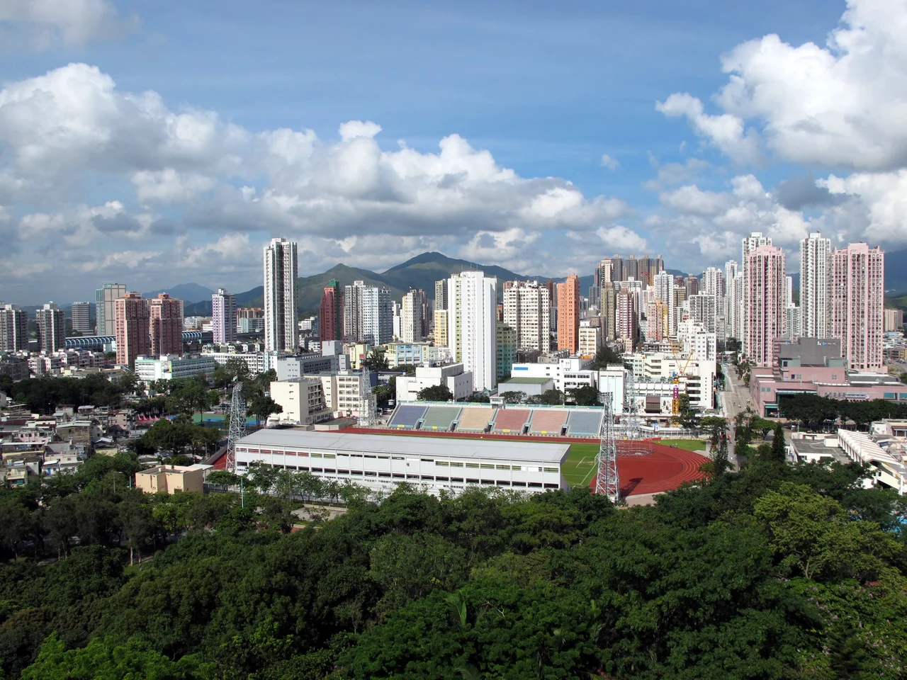

Yuen Long District
Look at a map of Hong Kong and Yuen Long District appears as a wide, flat pocket tucked against the Shenzhen border — a place that seems, from the outside, like a transit zone between the city and the mainland. Spend time there and a different picture emerges. With 144 square kilometres of land spanning rice paddies, fish ponds, mangrove wetlands, and tightly packed new towns, Yuen Long District is where Hong Kong's oldest roots run deepest. People have lived on this alluvial plain for around 3,500 years. The ruling Tang clan, one of Hong Kong's Five Great Clans, has called the area home for centuries. And the landscape — flat, broad, and threaded with rivers — still bears the shape of the ancient world beneath the modern one.
Clan Country: The Tang Legacy
In 1898, when Britain extended its lease over the New Territories, the terms seemed straightforward on paper. In practice, the villagers of Yuen Long had other ideas. A six-day conflict broke out between British forces and the Tang clan militia and their allies — an episode that left a peculiar footnote: the iron doors of Kat Hing Wai, the great Tang walled village in Kam Tin, were looted and shipped to the United Kingdom as trophies. They were eventually returned, but local legend holds that the doors were mixed up in transit and restored to the wrong villages. Walk through Kat Hing Wai today and the two sides of the entrance gate display noticeably different designs — a small, enduring reminder of that colonial encounter. Built by the Tangs some 500 years ago, the rectangular fortress measures 100 by 90 metres. Its five-metre-high blue brick walls and four corner cannon towers were added during the Qing dynasty as protection against bandits. It remains one of the few walled villages in Hong Kong where people still live.
Flat Land, Deep Time
The Yuen Long-Kam Tin plain is the largest alluvial plain in Hong Kong. It did not grow into farmland quickly; it was shaped slowly by rivers carrying silt down from the surrounding hills over millennia. The district covers traditional clan territories — Ping Shan Heung, Ha Tsuen Heung, Kam Tin Heung, Pat Heung, San Tin Heung, Shap Pat Heung — each with its own ancestral halls, walled villages, and heritage trails. The Ping Shan Heritage Trail, inaugurated in December 1993, links a kilometre of Tang clan monuments including the Tsui Sing Lau Pagoda, the only surviving ancient pagoda in Hong Kong, and the Tang Ancestral Hall. Over at San Tin, Tai Fu Tai Mansion, likely built in 1865 during the Qing dynasty, stands as one of the finest examples of scholar-gentry domestic architecture in the entire territory: green-brick walls, a large forecourt, and a rear garden laid out with the precision that wealth and status demanded.
Where the Birds Stop
Along the northern edge of the district, where the land flattens further toward Deep Bay, the natural world asserts itself with unexpected force. Mai Po Marshes, at the centre of Hong Kong's wetland zone, sit on the East Asian-Australasian Flyway — one of the great migration routes on Earth. More than 300 bird species have been recorded here, many of them rarely seen anywhere outside this corridor. The birdwatching season runs from October to May. Nearby, Nam Sang Wai — a roughly triangular wetland bounded by the Shan Pui and Kam Tin rivers — shelters Black-faced Spoonbills, Northern Pintails, and Yellow-nib Ducks among its reeds and mangroves. Hong Kong Wetland Park, at the northern edge of Tin Shui Wai, was established partly to compensate ecologically for the fish ponds lost when that new town was built. The compensation, it turned out, produced something worth visiting in its own right.
New Towns, Old Rhythms
From the late 1970s onward, Hong Kong's government transformed the market town of Yuen Long into one of the New Territories' major new towns. Tin Shui Wai followed in the 1990s, built largely on reclaimed fish-pond land. Together, these developments changed the scale of Yuen Long District dramatically — the population stood at 662,000 in 2021, spread across tower blocks, shopping malls, and the Light Rail system that threads through the flatlands connecting communities. Yet the old festivals persist alongside the new infrastructure. Each year on the 23rd day of the third lunar month, the Tin Hau Festival brings residents from multiple walled villages together. The procession moves along Fung Cheung Road, past Yuen Long Stadium, and ends at the Tai Shu Ha Tin Hau Temple, which has stood for around 300 years — celebrating the birth of the sea goddess whose name, in this inland district, is a reminder of how close the coast once was.
The Border in View
The Hong Kong–Shenzhen Western Corridor bridge, completed in 2007, runs 5.5 kilometres from Ngau Hom Shek on the northwest edge of Yuen Long to Shekou in Shenzhen. It is the fourth crossing between Hong Kong and mainland China, and from the right vantage point in the district you can watch container lorries making the crossing against a backdrop of fish ponds and migratory birds. That juxtaposition — ancient wetlands meeting a 21st-century border crossing — captures something essential about Yuen Long District. It is simultaneously one of Hong Kong's most historically layered places and one of its most actively contested frontiers, a landscape where clans, governments, nature, and the logic of the Pearl River Delta have been negotiating terms for thousands of years.
From the Air
Yuen Long District sits at approximately 22.45°N, 114.02°E in the northwest New Territories, visible as the broad flat plain stretching south from the Shenzhen border. Flying over at 3,000–5,000 feet, the alluvial plain stands out clearly from the surrounding hill ranges. The patchwork of wetlands, fish ponds, and new town towers at Tin Shui Wai is distinctive from the air. The nearest airport is VHHH (Hong Kong International), approximately 15 km to the southwest on Lantau Island. The Hong Kong–Shenzhen Western Corridor bridge is visible on the northwest edge of the district.
Nearby Stories
- Chapel of St. Francis Xavier 3.5 km away
- Cuiheng 4.1 km away
- 2015 Shenzhen Landslide 16 km away
- Shunde 31 km away
- Wanshan Archipelago 37 km away
- Nanxiong Formation 96 km away
- Heyuan 149 km away
- Checheng Fu'an Temple 629 km away